
The Latefull Eight
DH Venom WR557 on Farlam Currick,
Bristol Beaufighter
JM223 on Croglin Fell,
C-47 G-AMVC on Blotting Raise.
(Distance covered = 19.0 mile/Ascent
= +1017m)
This day was the Solway Highland Dancing Championships, held in Dumfries. I didn't have to take the girls, they had a lift there and back so I hatched a rather over ambitious plan to to and look for 8 crashsites in the Northern Peninnes.
I've been trying for a while now to beat my record of finding 3 new crashsites in one day, I failed last time I was over the Northern Peninnes when I'd also set off to look for 8 crashsites, although I found four, one of them I'd visited previously so I only managed to equal my record.
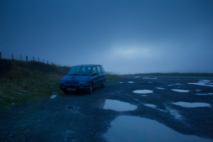
Blueberry Esmerelda Muffin II parked in the old quarry opposite The Hartside Cafe
it was a lot darker than it appears on this photo.
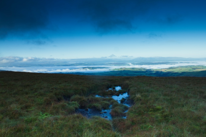
As the girls had a lift over to their competition in Dumfries I was able to set away at silly 'o' clock in the morning and it was still dark when I parked up at Hartside cafe. After hanging around for over half an hour it became just light enough so I could see where I was going so at 6:30am I set off up Hartside Heights towards Black Fell.
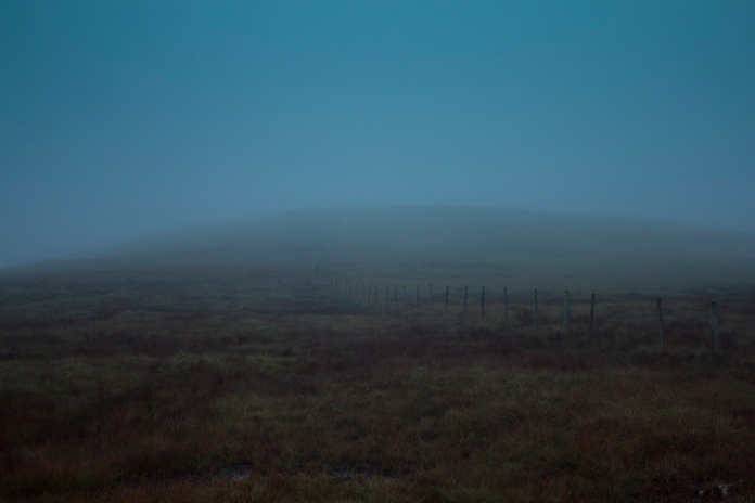
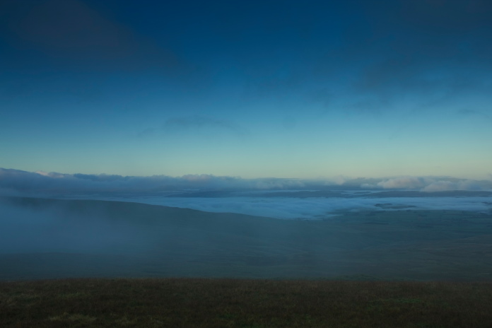
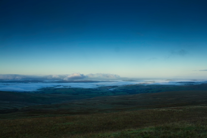
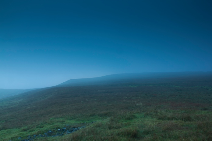
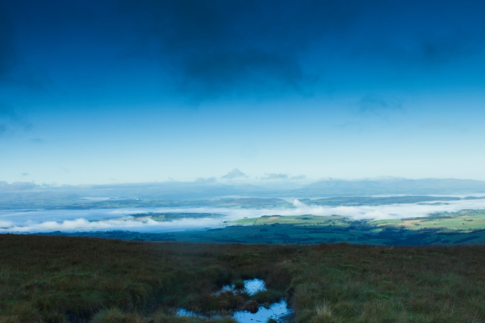
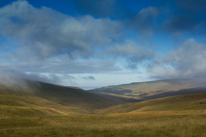
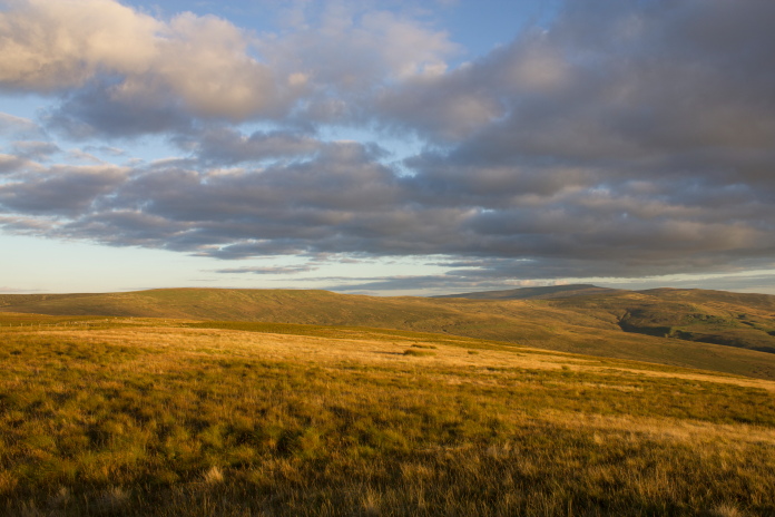
The first mile or so of the expedition was a bit gloomy thanks to low cloud and poor light as it was still so early, but as I made my way to Black Fell via Hartside Heights and Little Daffenside things slowly improved and some canny decent views opened up to the west.
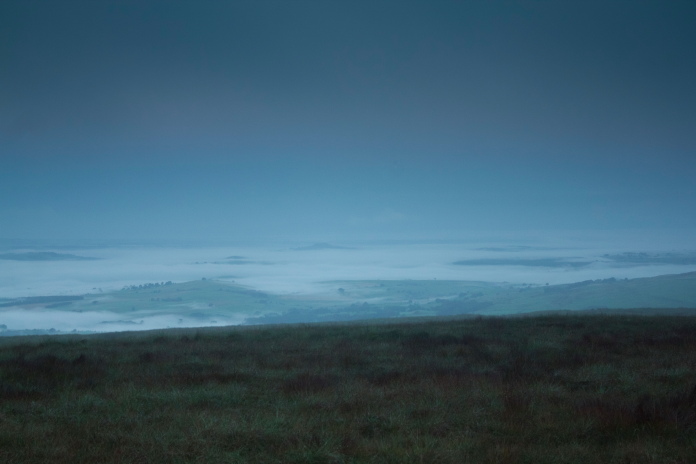
above and below:-Views over to the west, Cumbria still blanketed in fog.
Approaching Little Daffendon.
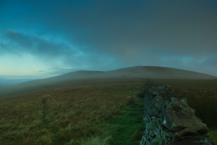
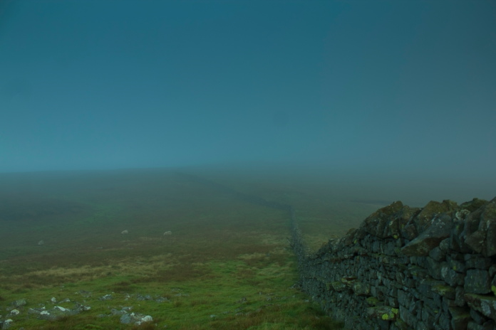
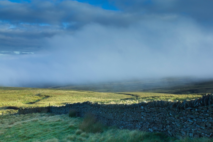
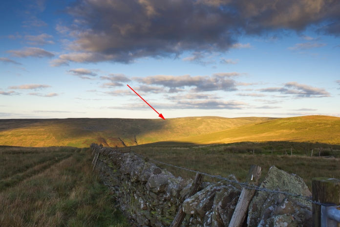
Navigating to Black Fell was made pretty easy by a stone Wall which could be followed from Hartside Heights and went up and across the top of Black Fell, this wall was going to prove more than extremely helpfull on the way back!
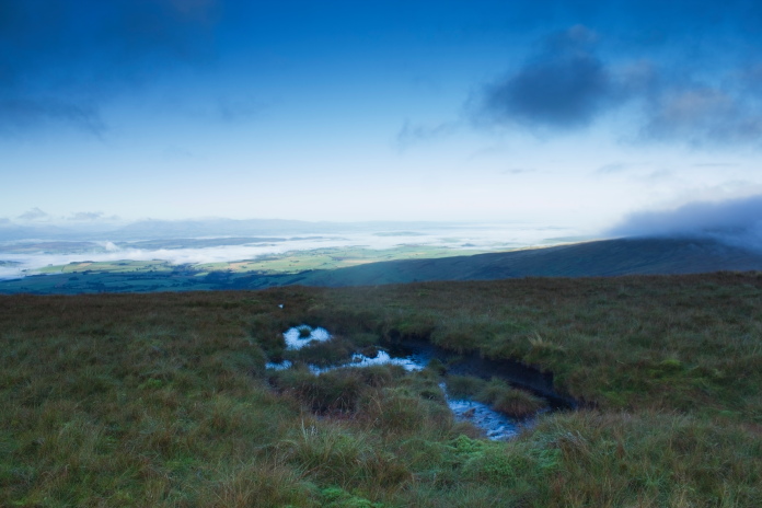
Another view, this time across to the north
west with Dumfries and Galloway hidden under the mist.
Near the top of Black Fell and back into a cloud!
Once onto the top of Black Fell I had to leave the wall and head cross country a bit to look for the first of the planned 8 crashsites of the day, a Sepecat Jaguar which crashed in the 1980's.
The top of Black Fell, I was to find out later why it was called this!
The Jaguar crashsite was on a list I have that was given to me by an Air Crash Investigation Group, they had been to the site and found fragments so I was confident the grid reference I had was correct. I had also had a look at satellite images and could clearly see a crater exactly where the grid ref put the crashsite, so I had high hopes of finding something. On arriving at the crater I was disapointed to discover all it contained was water, there may well have been some pieces buried or submerged under the water but without a metal detector I had no way of knowing and there is also the possibility that the Jaguar only struck a glancing blow here before crashing elsewhere, so unfortunatley this one didn't count!
Above and next two photos:-Crater on Black Fell caused by the Jaguar crash.
After checking around the area of the crater for any pieces of Jaguar without success I struck off again towards my next objective which was a DH Venom wreck on Farlam Currick. I returned to the Jaguar site in April 2019 and on that occasion I found some pieces including an intact cockpit instrument***.
Dropping off the northern end of Black Fell.
I'd been to the Venom crashsite on Farlam Currick twice before but on both those occasion I'd approached from the west starting out from the village of Croglin, this time I was approaching from the south.
Farlam Currick from Black Fell.
From the Jaguar site across to the Venom was about 2 mile, all of it pathless and all of it boggy.Farlam Currick was still covered in clag but I was hopefull it would have cleared by the time I got there; it didn't!
Crossing the higher reaches of Croglin Water onto Farlam Currick.
Almost there, the Venom wreckage is just the other side of the wall.
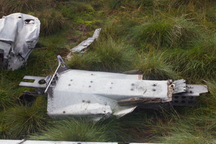
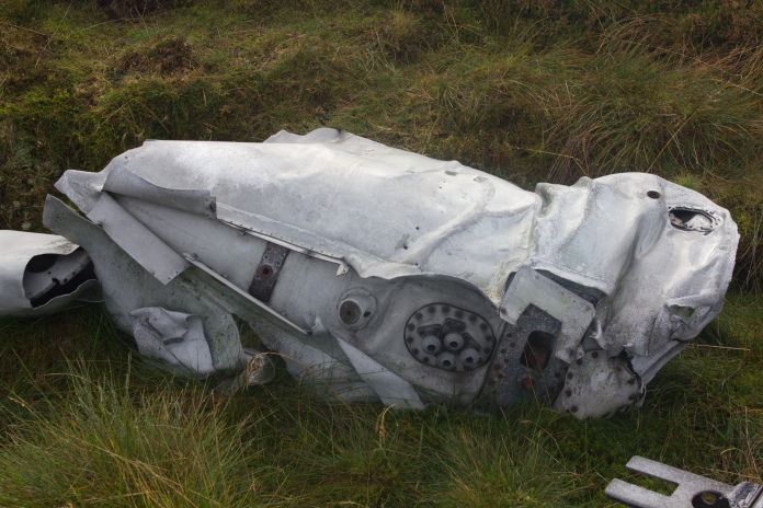
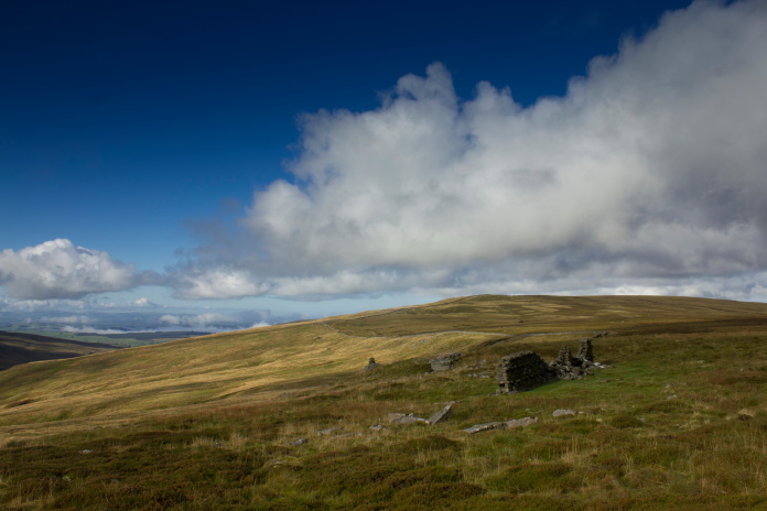
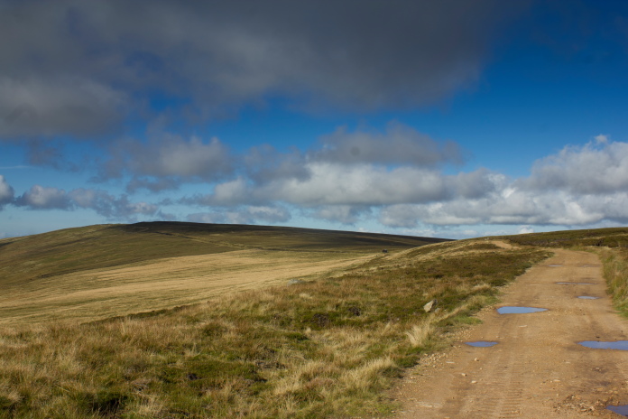
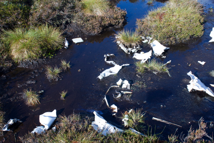
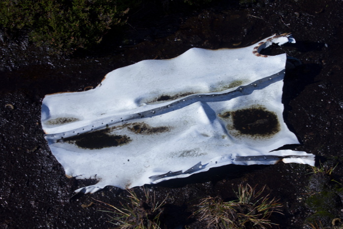
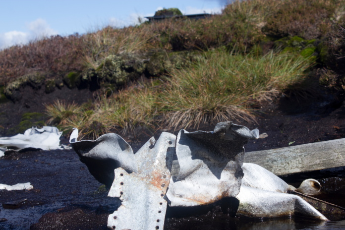
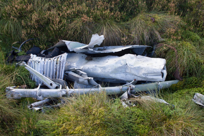
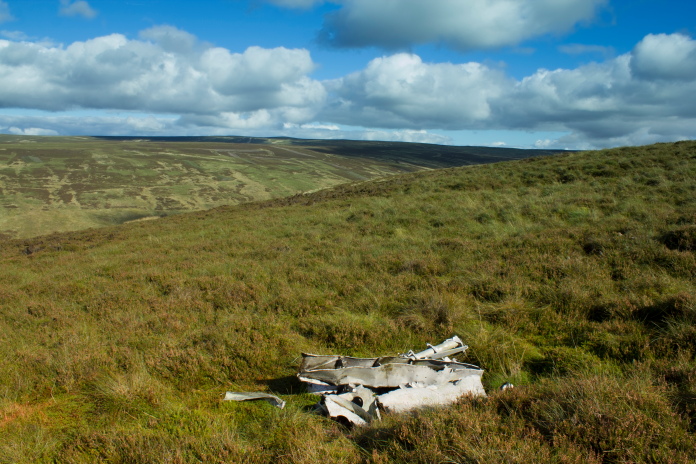
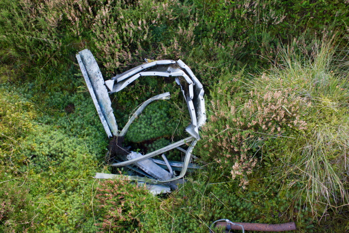
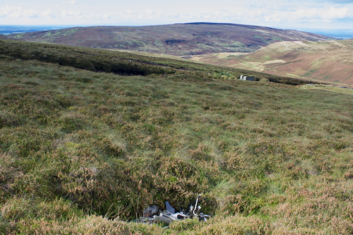
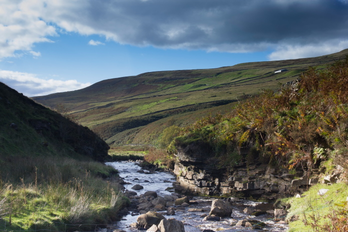
above and next 23 photos:-Wreckage of DH Venom WR557 on Farlam Currick.
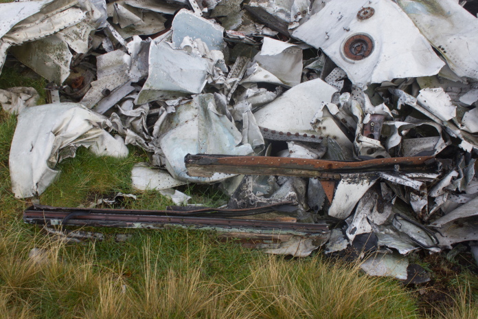
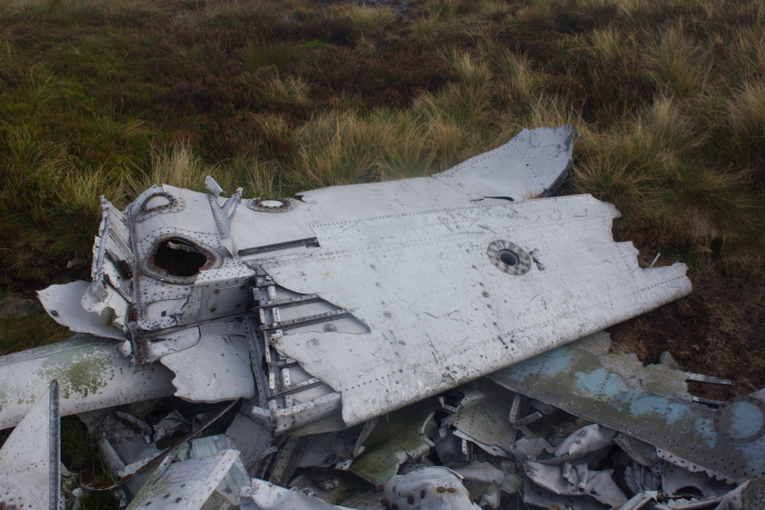
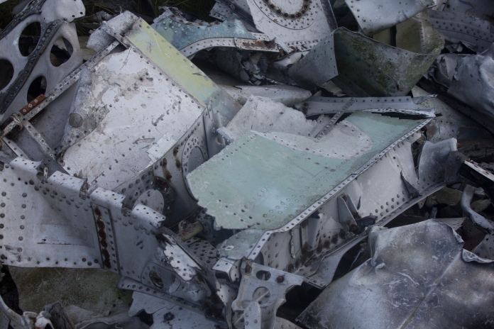
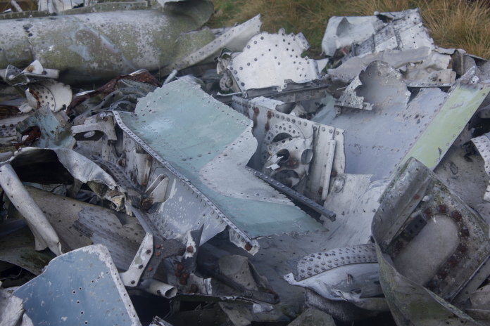
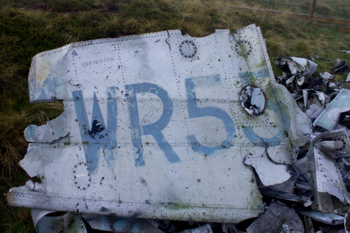
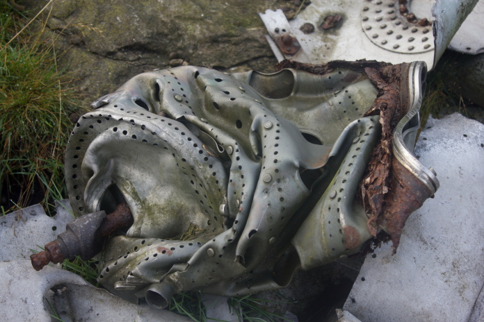
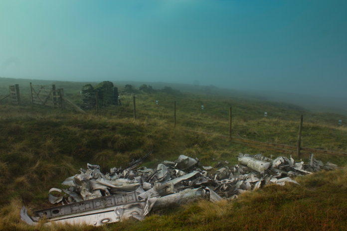
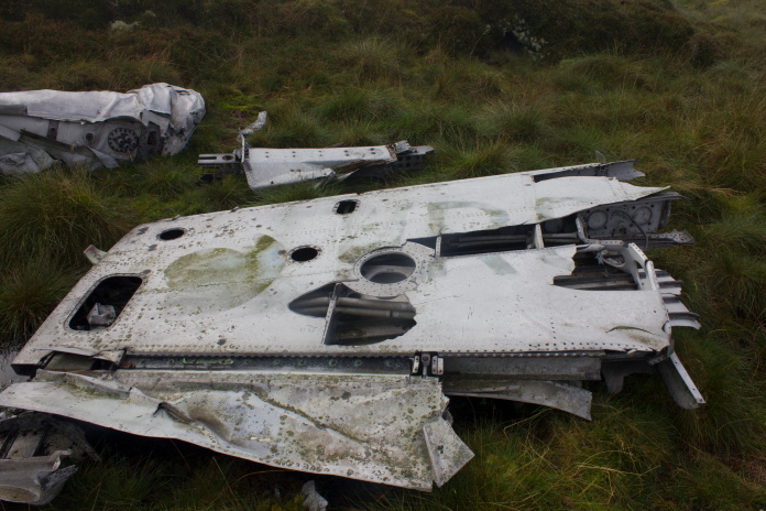
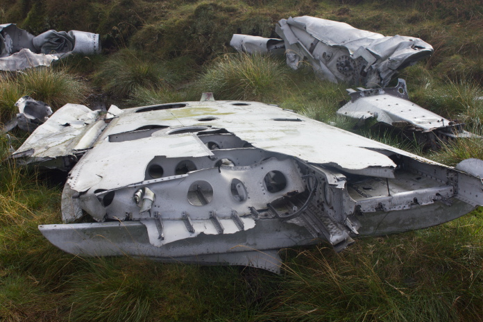
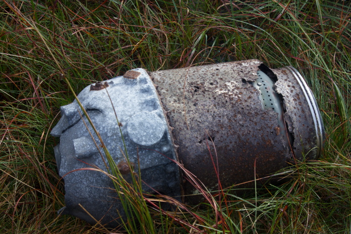
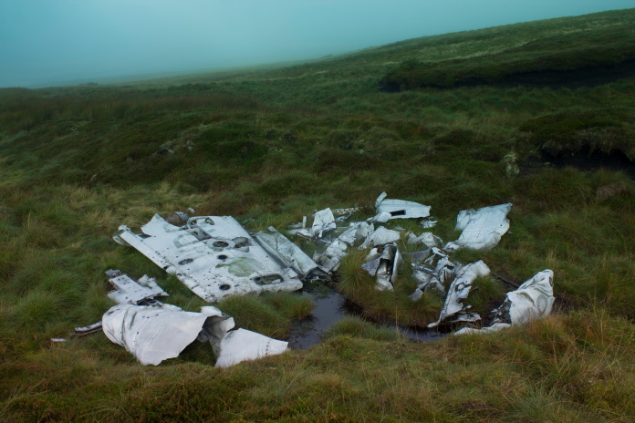

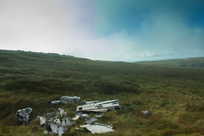
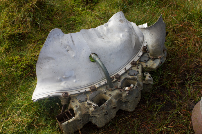
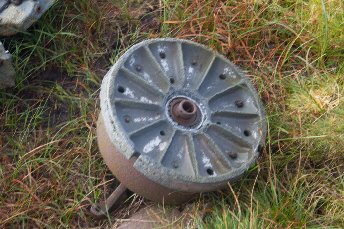
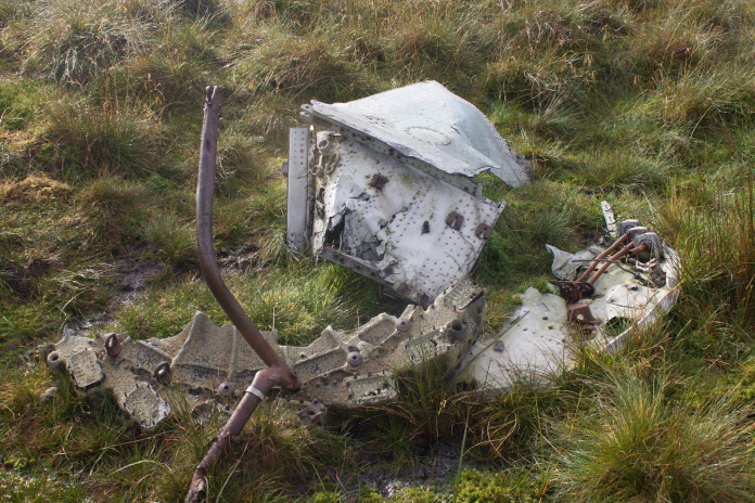
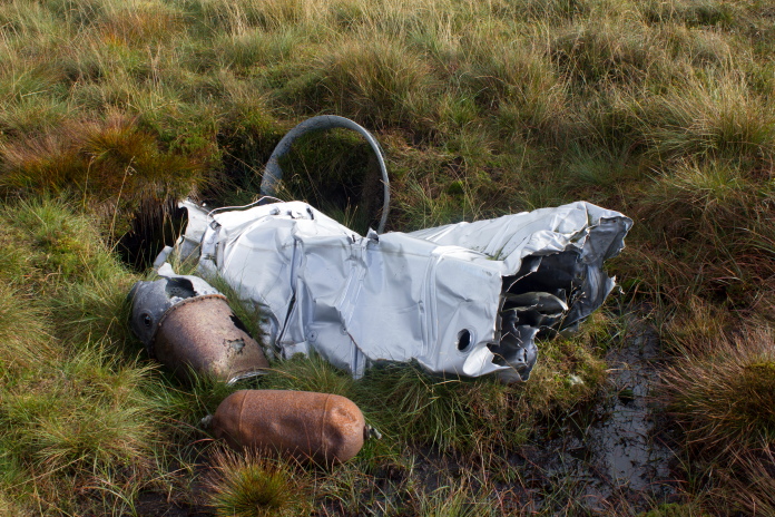
The Venom wreckage was scattered in a north westerly direction, starting off with a large crater full of wreckage beside the fence then a smaller collection including a complete wing and terminating with the remains of the engine.
View over to Thack Moor from the Venom crashsite.
From the engine I needed to be about a mile to the north west to pick up the start of a landrover track that I could follow onto Croglin Fell but first I had to make a diversion to the north to avoid Stockdale Beck.
 View down Croglin Water.
Approaching the top end of Stockdale Beck with Croglin Fell and the Landrover track dead ahead.
Stockdale Beck flowing down into Croglin Water with Thack Moor beyond.
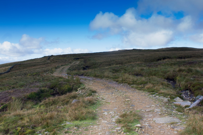
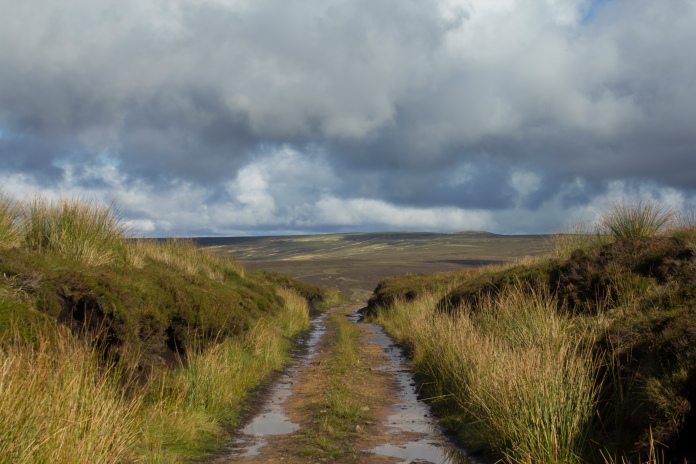
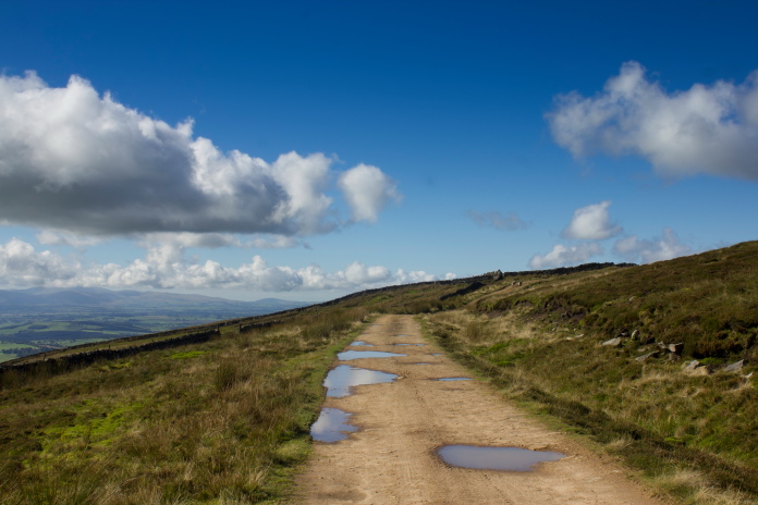
Onto the Landrover track, a bit of easy going at last.
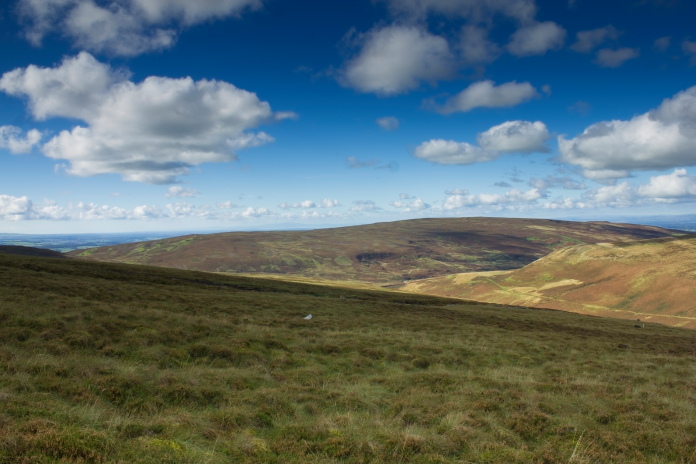
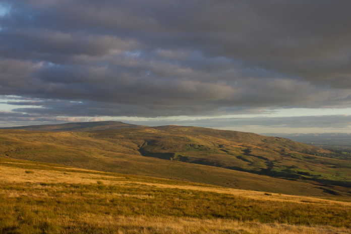
Once I hit the Landy track I found a nice boulder to sit on and have me bait, this also gave me the opportunity to check out Thack Moor and Scarrowmannick Fell with my binoculors, for any sign of the Hurricane and Phantom that crashed over there. I made a mental note of some scars that might be worth checking out but other than that, as is usually the case, I spotted nothing of interest.
 View
west from my bait stop, the fog has eventually lifted over there.
View
west from my bait stop, the fog has eventually lifted over there.
After some scran it was time to head off for crashite number 3 on my itinerary, a Bristol Beaufighter that crashed into Croglin Fell. I had also spotted a very likely scar for this one on the satelite imagery but after my earlier disapointment I was now beginning to think the 'spot the crashsite on the satelite image' method was as useless as the 'spot the crashsite with the binoculors' method.
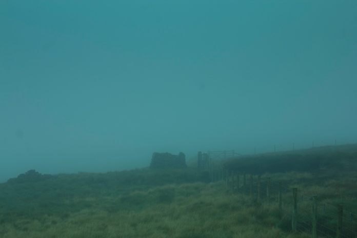
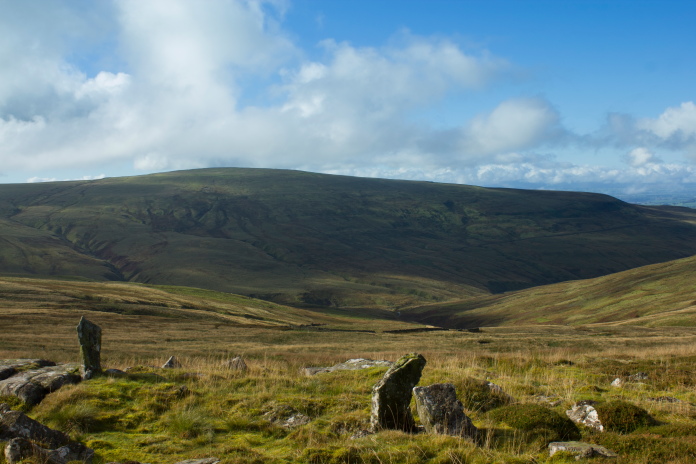
Crossing onto Croglin Fell with Blotting Raise in the distance.
Another landrover track that passed quite close to the Beaufighter crashsite.
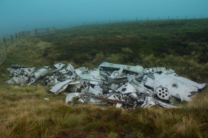
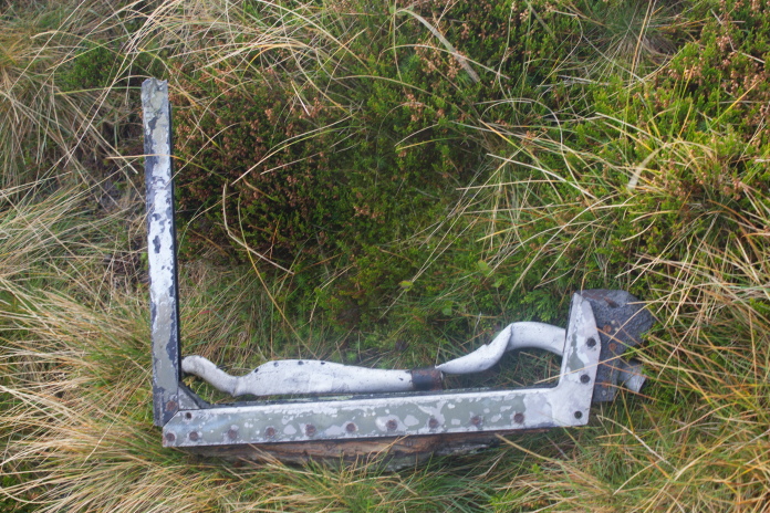
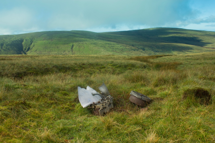
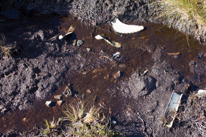
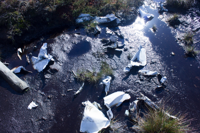
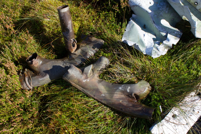
The area where the Beaufighter crashed was quite flat and very featureless and it had been heavily managed for the grouse shooting, with shooting butts and lots of drainage ditches cut in the moorland, luckily they had left the scar untouched and it still contained a few pieces of the Beaufighter.
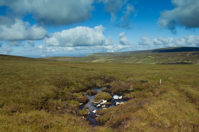
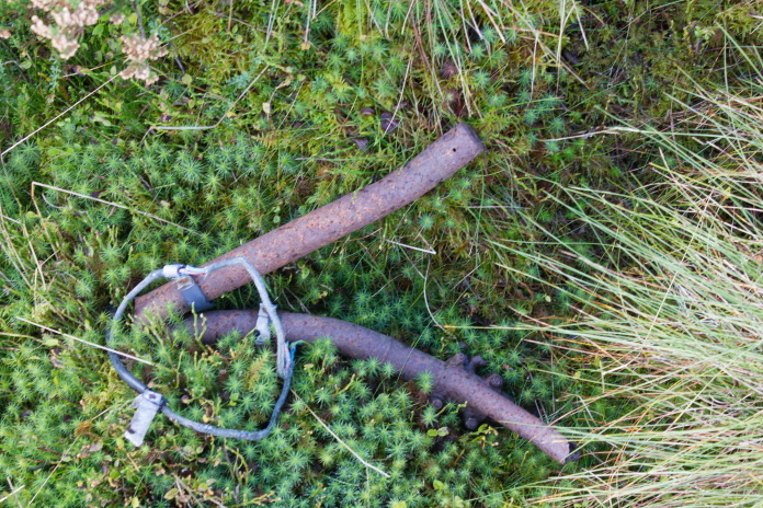
Above and next 6 photos:-Impact scar containing small pieces of Beaufighter JM223.
After the Beaufighter I began having doubts on whether I would have enough time to go and look for the Dakota on Blotting Raise and the Hurricane and Phantom on Thack Moor then get back to the car before it got dark. I definately wasn't going to have time to relocate the car twice as I'd planned to look for crashsite number 7 and 8 on my itinerary. I decided that as I'd come all this way and I was so close to where the Dakota crashed it would be daft not to continue so I set a deadline of 1:00pm for turning back for the return trip the car.
 Walking up onto Blotting Raise.
View back towards Black Fell, the car is about 9 mile away in that direction. The hill on the right way off in the distance is Cross Fell, a DH60 Moth crashed just below the prominant step on the right of its summit.*
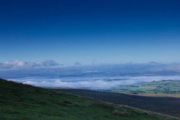
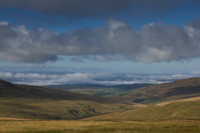
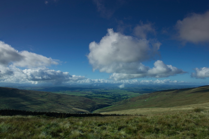
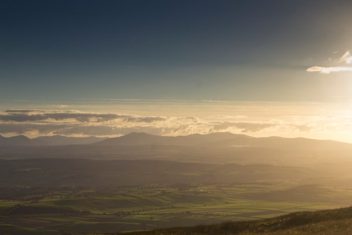
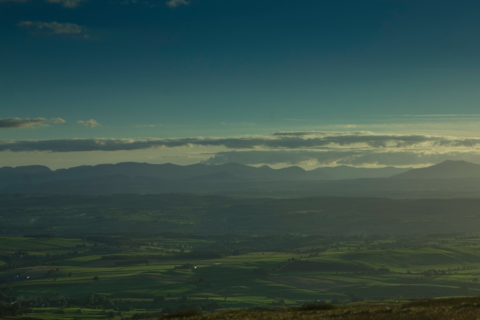
On top of Blotting Raise with fantastic views over to Dumfries and Galloway.
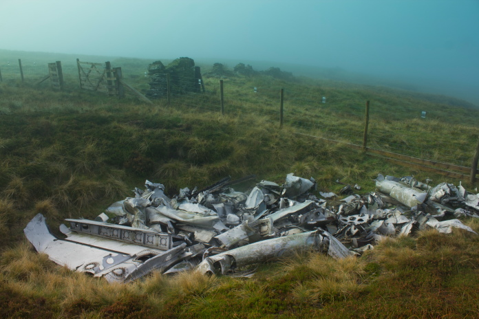
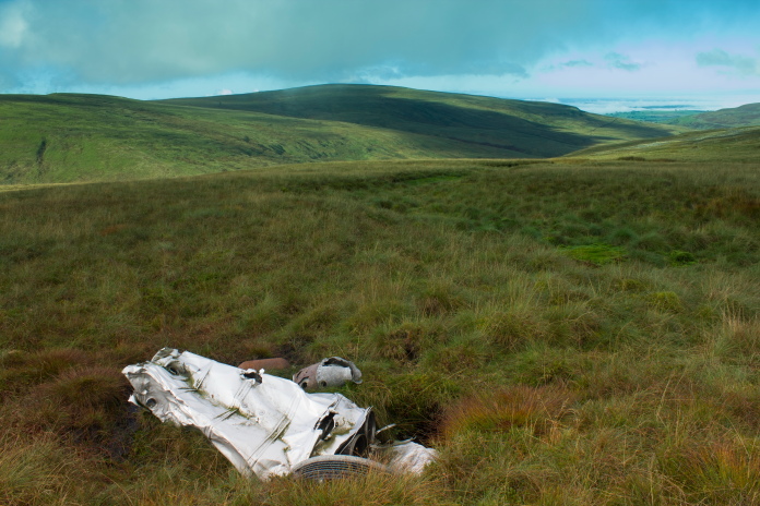
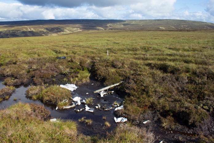
To find the remains of the Dakota involved dropping quite a way off the northern side of Blotting Raise, luckily there was a Landrover track going in the right direction and it passed withing 100 yards of the wreckage so I was able to make good time. By the time I found the wreckage it was 1:30pm and I spent half an hour taking photographs so I had to put a scootle on back up to the top of Blotting Raise.
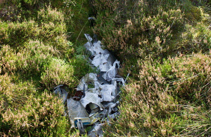
Above and next 8 photos:-Pieces of the Dakota have been collected together into 3 or 4 small pits.
Pieces of exhaust manifold.
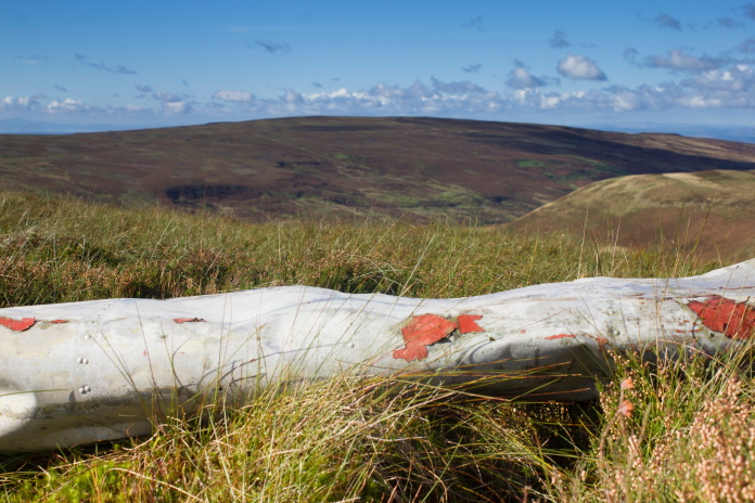
Large lump of wing leading edge.
 One of the burial pits, the object in the background is one of several shooting butts on the side of the hill.
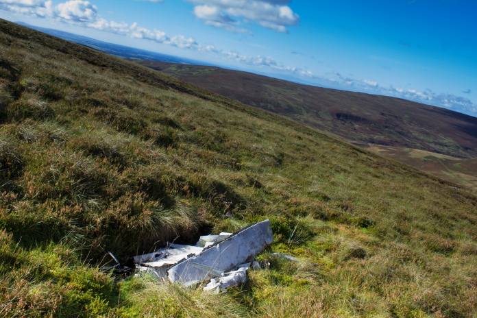
Leaving the crashsite, a piece of Dakota can be seen sticking up from the heather.
The Farmer who first found the wreckage of this Dakota after it crashed was actually booked to fly on it after it had been hired to take a group of Farmers to a Farmers Market. When it didn't turn up at the Airfield he returned to his farm to find some Policemen waiting who asked him for his assistance in finding and Aircraft that had recently crashed in the hills above his farm.
Back on the top of Blotting Raise.
Once back to the top of Blotting Raise it was decision time, head straight back to the car the way I'd come or go back via Thack Moor and have a quick look for the Hurricane and Phantom crashsites over there. As the route I'd followed on the way out was a bit of a chowing in places I decided a different route back would be better as I wouldn't then know what nasty sections I would come across whereas going back the way I'd come, I would! aka 'ignorance is bliss!'
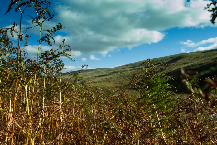
First unknown nasty section on the way back, freakishly tall ferns which were in the process of dying off so were brittle and scratchy!.
I was actually standing up when I took this photo!
Second nasty section on the way back, a deep gully containing a wide and fast flowing Croglin Water with no easy place to cross!
Once over Croglin Water I completely forgot about any issues with having enough time and went into wreckhunting mode, I searched the grid ref I had for the Hurricane then went and checked all the scars I had previously spotted from Croglin Fell, all proved fruitless. It was only after I set off for the given grid reference I had for the Phantom that common sense prevailed and I reluctantly changed course and started the long walk back to the car.
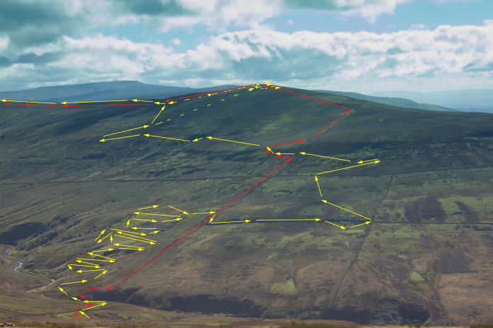
View across to Scarrowmannick Fell and Thack Moor
from Blotting Raise. The red arrows indicate the route a normal person would take, the yellow arrows indicate the route I took.The
dotted line is my planned route that I had to cut short because of the
impending threat of running out of daylight!
One of the scars I checked out I had also spotted on satelite images, just like the Vulcan shaped scar on Hill of St Colm that the Vulcan made** this ones shape was similar to a Phantom and it appeared to contain objects which could have been aircraft wreckage, in fact they were very elaborate cairns someone had seen fit to build in a boulder field miles from anywhere for what reason I could not fathom other than to confuse someone looking for aircraft wreckage on a satelite image.
One of the cairns in a boulder field on
Thack Moor.
Thack Moor is the UK's newest mountain as up until about 4 year ago it was
classed as a hill, because it was a couple of cms under the required height
to be classed as a mountain. In a more recent survey carried out on the
mountain with more accurate modern equipment it was found to be actually a
couple of cms over the required height so its classification was changed
to a Mountain.
Whatever it was I didn't have time to go to the top of
it!
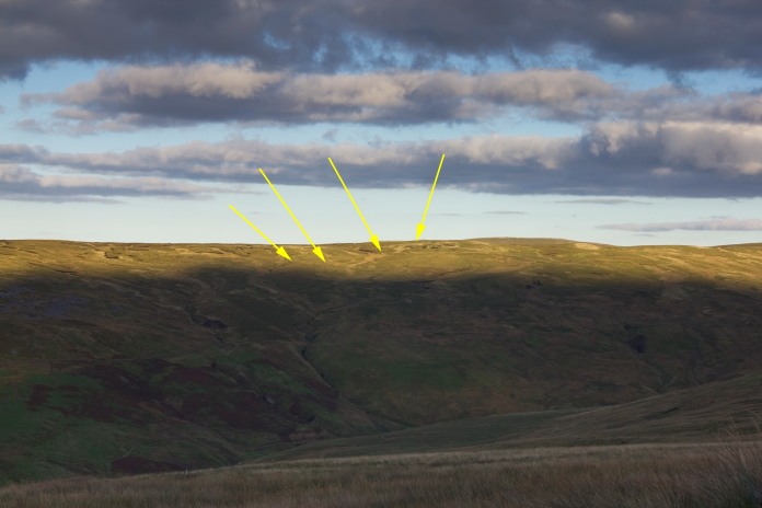
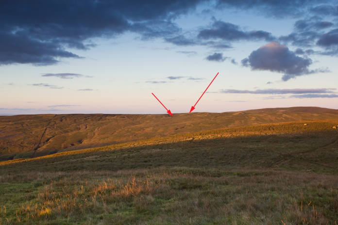
View over to the Venom crashsite from Thack Moor, the four arrows point to the main areas of wreckage.
I had an accurate grid reference for the Phantom crash on Thack Moor but I abandoned going to look for it because I wanted to at least be back onto the top of Black Fell before the daylight failed. What I didn't realise was I passed very close to it, but didnt realise at the time because I was following a very good path that lead to Watch Hill, so I had no need to check my map to see where I was. In hindsight this was probably just as well, because if I'd realised I was so close I would have gone and had a look, a delay which would have caused me to end up well short of Black Fell in the darkness with no wall to follow. I returned to Thack Moor in April 2019 and found the gouge where the Phantom hit the hill, which contained a few peices of wreckage.
Another view over to Farlam Currick and the location of the Venom.
Hartside Cafe just visible near the left with Cross Fell beyond.
View over to the Lakeland Fells from the eastern slopes of Thack Moor. If I'd walked a couple of Hundred feet in that direction I would have found where the Phantom crashed, unfortunately I didn't know that at the time.
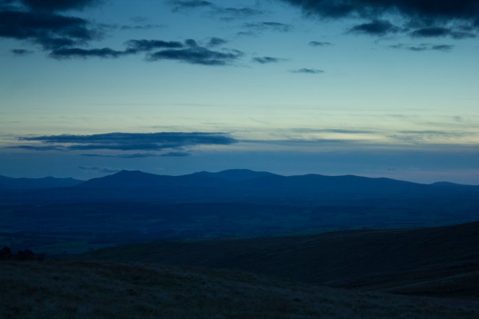
above and below:-The light starting to fade down below.Cumbian Fells off in the distance.
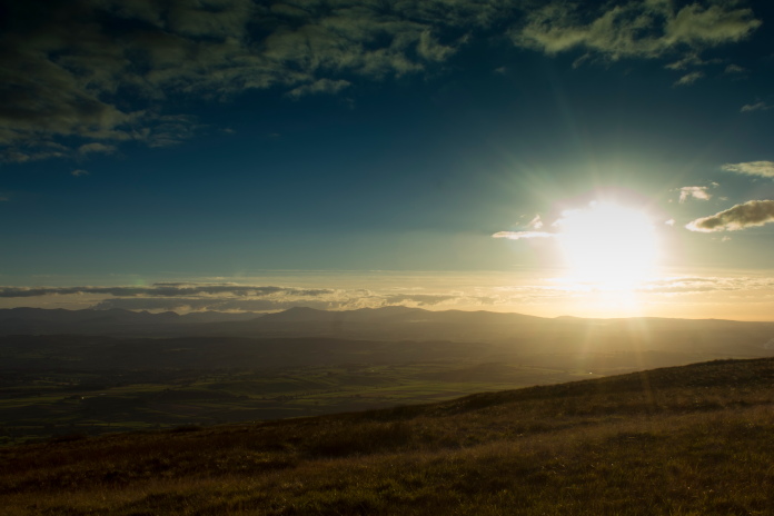
Luckily where I was heading is still bathed in sunlight.
Approaching Watch Hill on the right, once over that there was only Black Fell and Hartside Heights between me and the Car.
Lovely light on the summit of Watch Hill.
The Venom site taken from the saddle between Watch Hill and Black Fell.
I managed to make it back to the ascent up the northern slopes of Black
Fell before the light started to deteriate and by the time I had reached
the top it was dark. I stuck to the previously mentioned wall across the
top of Black fell and on starting my descent down the other side it had
become pitch black. It became so dark in fact that if I looked down I
couldn't even make out my feet and I was having to use my walking poles to
probe ahead to see what I was about to stand on. As I had to stick close
to the wall on a couple of occasions I walked into an unseen bog and had
to prod and poke around until I could find ground firm to get past then
get straight back to the wall. To make things worse I was constanty being
blinded by the headlights of cars snaking their way up the Hartside pass.
I've often mentioned those 'Can't get any better than this' moments well
walking down from Black Fell back to Hartside in the pitch black was a
'Can't get any worse than this' moment.
Click this link for more information about the crashes
peakdistrictaircrashes.co.uk/beaufighter jm223 croglin fell
peakdistrictaircrashes.co.ukdouglas dakota g-amvc