Hokiecokie
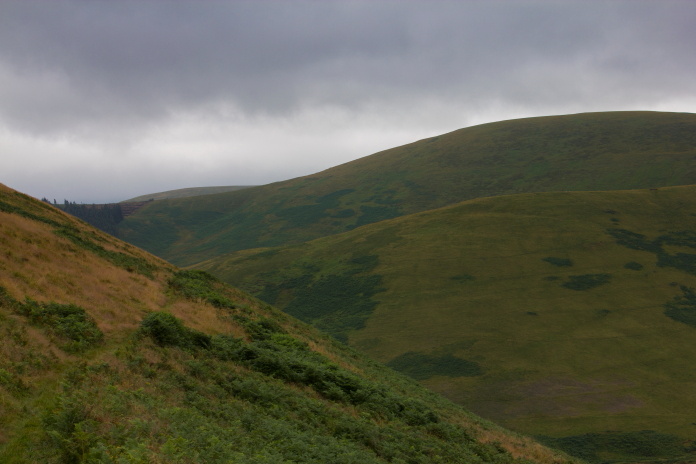
Hawker Hurricane V6860 on The Curr.
(Distance
covered = 9.1 mile/Ascent =+685m)
A competition in the Border town of Duns for Heather, a chance to visit The Cheviots from the Scottish side for me,starting at Kirk Yetholm which is also the start of the Pennine Way.(or the finish depending on which way your doing it)
It was reading about the crashsite of a DH Mosquito in the Cheviot Hills way back in the 1970's that first tweaked my interest in looking for crashsites in the hills. There wasn't much information readily available back then before the advent of the interweb and Aviation Archaeology groups were reluctant to pass on any crashsite locations to me in case I was a souvenir hunter, so the only source of locations I had was a book called High Ground Wrecks and Relics. Although there were quite a few crashsites listed in my book, there was also a quite a few that weren't, so back in the 1980's when I visited the Mosquito wreck* on The Curr that I had read about , I walked right past the crashsite of a Hawker Hurricane that I was unaware of
at the time because it wasn't listed in my book. Since then however I was
given an invaluable list of crashsites by Jim Corbett of ACIA and included
in that list was the Hurricane on the Curr.
But at least all that meant I had something to aim for on this day!
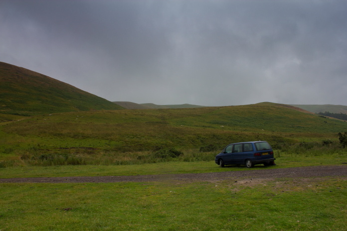
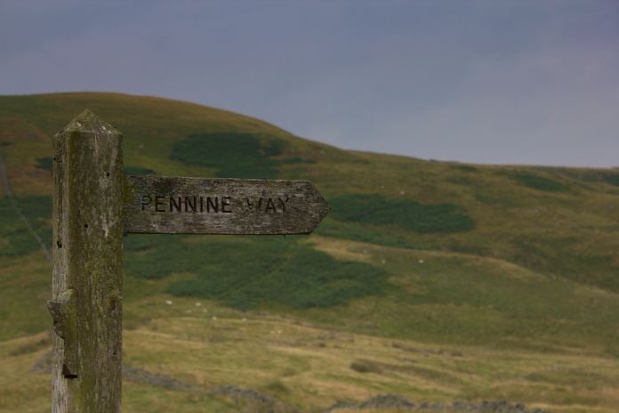
Blueberry Esmerelda Muffin II parked near Kirk Yetholm at the start of the Peninne Way, or the finish depending on which way round your doing it.
It was the same routine as usual to start the day, drive the girls to the competition venue in Duns then off down the road to find the starting point for my walk. To get to Kirk Yetholm I first had to drive south across the Coldstream Bridge back into England then take a right at Cornhill, down a B road and back into Scotland again. It was also going to be a case of 'in' 'out' on the walk as well but I avoided the 'shake it all about'.
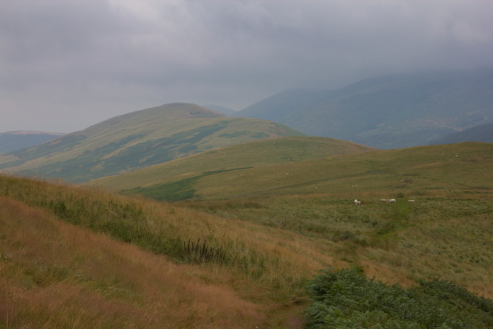
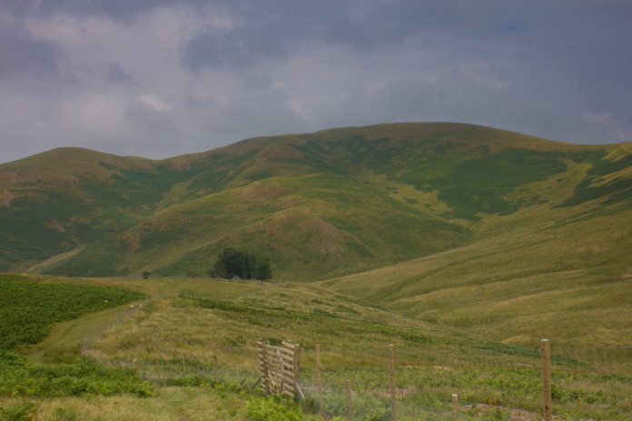
The low level route continues up the Halterburn Valley for a couple more miles.The Curr is the hill in the distance, left of centre
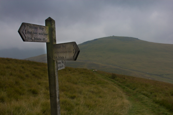
The first mile or so of the Pennine way follows a single track road down into the Halterburn valley. Just after the road drops into the valley the Peninne way splits into two routes, the high level route and the low level route, the two routes join into one again at the base of The Curr so I decided to take the high road out and the low road back steadfastly resisting the urge to sing a song that sprung to mind!
Where the high road and Low road meet up again.
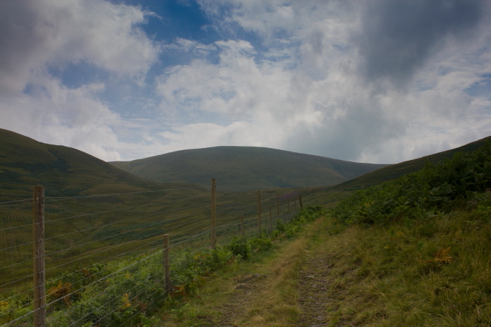
The Pennine Way follows alongside the Border fence for quite a distance but as soon as I was up out of the Halterburn Valley onto the ridge I crossed the fence back into England to make a small diversion to look for the crashsite of a German Dornier Do217E bomber which crashed on Madam Law. I'd searched for this one back in the 1980's but failed to find anything because I didn't have a metal detector or a licence to dig.
 Back in England walking towards Madam Law.
I had two possible grid refs for the location of the Do217E crashsite
one from my book and one from my list, I could find no sign of it at the first one, possibly because of the thick waist high bracken, and there was forestry work going on near to the second one, so I didn't venture over there,
I can always go back for another look next year if Heather's back at Duns!.
(I now know it's over beside the second grid ref as a post has now been placed at that
location.)
Approaching one of the grid refs I had for the Do17.
One unforeseen advantage of my little detour was I could go around White Law instead of following the Pennine Way up and over it, which was much easier.Once around the south of White Law I again crossed the Border fence back into Scotland and back onto the Pennine Way.
Still in England, The Border fence and the Pennine Way come over the top of White Law on the right of the photo then run up the ridge in the centre.
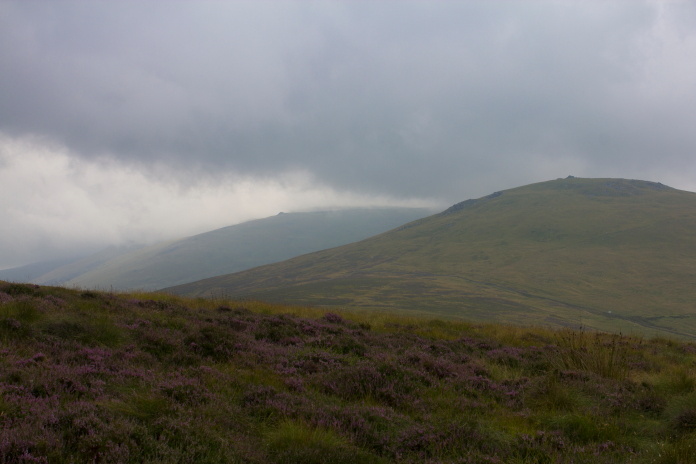
It was then a bit of a slog up a long ridge called Steer Rig towards The Curr. Halfway up the ridge I crossed the fence into England again but decided the weather was nicer in Scotland so immediately crossed back again.
On the Pennine Way, back in Scotland, England is on the left of the fence.This fence is electric to prevent the wild Haggis from entering England.
At the top of Steer Rig the two Pennine Way routes join up again before heading off up a hill called The Schil, I however did not, I had to follow a path to the south west that skirted around The Curr.
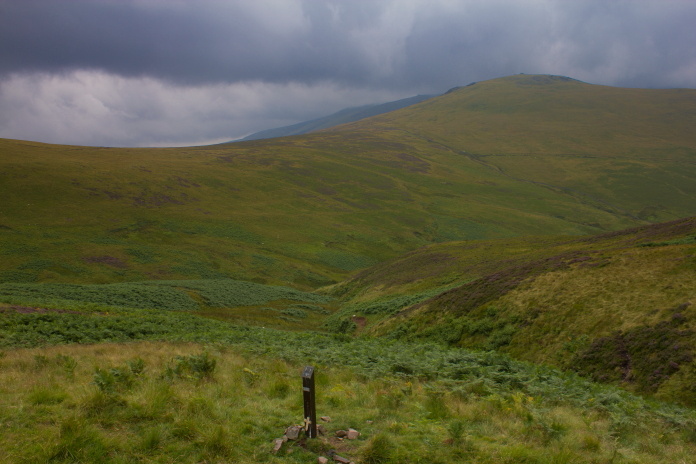
The crashsite of the Hurricane has also been marked with a memorial post,
which seemed to have proved popular as a perch for the local birds as it was
caked in bird shit, luckily I was able to acquire water from a nearby stream
to clean most of it off.
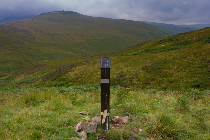
The memorial post and a couple of tiny fragments of the Hurricane.
I had planned to revisit the Mosquito wreck which was less than a mile away on the top of The Curr but the competition at Duns was not one of the longest and I had a way to walk back to the car so I erred on the side of caution and headed off down the low road.
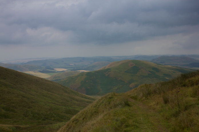
The Schil on the right and just left of centre in the distance is Braydon Crag scene of a USAAF Boeing B-17 crash.
If I'd took the high road back it would have mean 't going up and over White Hill whereas the low road was all downhill, plus it was a whole lot of new scenery to look at.
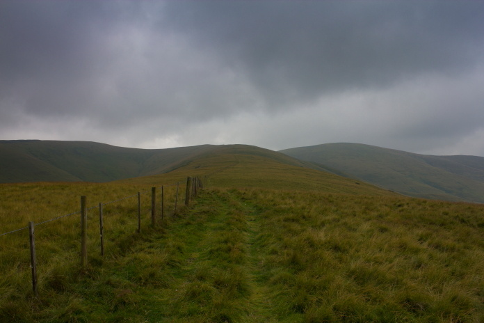
The start of the Low level route back to Kirk Yetholm.
I spent the first mile on the way back pondering whether I could have made it up to the Mosquito crashsite but as time progressed I convinced myself that I had made the right decision.
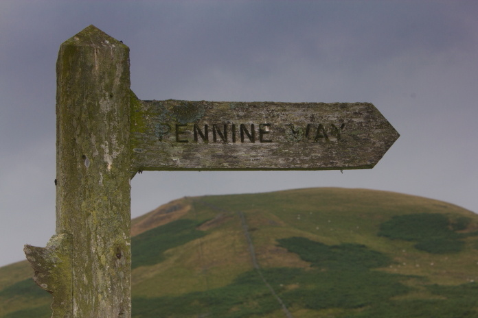
Above and below:-same sign different perspective, I couldn't decide which one was best so have put both them on.
White Hill, by coming back along the low road I avoided having to go up and over that.
Looking back to The Curr, the high fence is to keep Deer off Trees, newly planted to prevent flooding occurring lower down the valley.
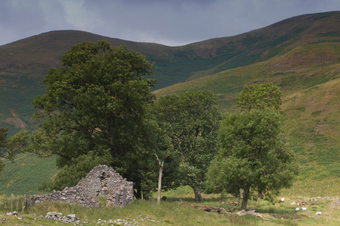
The ruins of Old Halterburnhead
Further down the valley the road is rejoined for the last few miles back to the starting point, approaching the road I thought I must have become dehydrated and had begun to hallucinate because I could see a giant Tunnock's Caramel Wafer sitting on the side of the road.
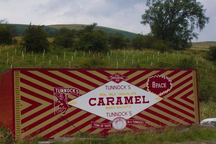 The container off the back of a Lorry, don't know why or how it ended up where it was.
After the disappointment that I hadn't actually found a giant Caramel Wafer the only other thing of interest I found was what looked like a Horse Prison, where one of the inmates gazing forlornly out of a window provided me with a good photo opportunity.
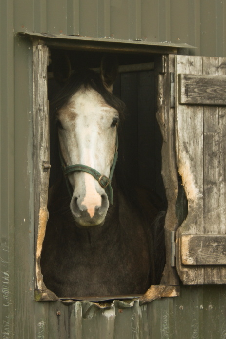
5 to 10 for stealing sugar lumps.