What's all those orange lines?
Avro Lancaster KB745 on The Cheviot.
(Distance
covered = 7 mile)
Donna and Heather had a lift to a Competition in Dumfries so I took the opportunity to go and have another look for Lancaster KB745 on the Cheviot.
Lancaster KB745 was the first Wreck site I ever visited way back in 1979, it was one of the few occasions I went with someone else, as I wasn't old enough to drive at the time so needed a lift from my Dad, so he went up the hill with me. As well as being the first plane wreck I'd ever gone looking for it was also the first time I had ventured into the hills and although I had a map, my ability to interpret it was lacking! One specific thing I didn't comprehend at the time was contour lines, and the fact that the closer together they are, the steeper the incline is. I had therefore decided on an intended route directly from the Lancaster site to the B-17 site a mile or so away on Braydon Crag, epic fail to say the least!
We did however succeed in finding some pieces of the Lancaster and I also gained some much needed experience in navigating the hills.
Rough track leading up the lower slopes of Scald Hill towards The Cheviot
Unlike my visit earlier in the year* when the weather started of atrociously, on this day it was glorious sunshine from the off.
Unlike my visit in 1979 I was now accomplished at reading a map, sadly though my Dad wasn't with me this time.
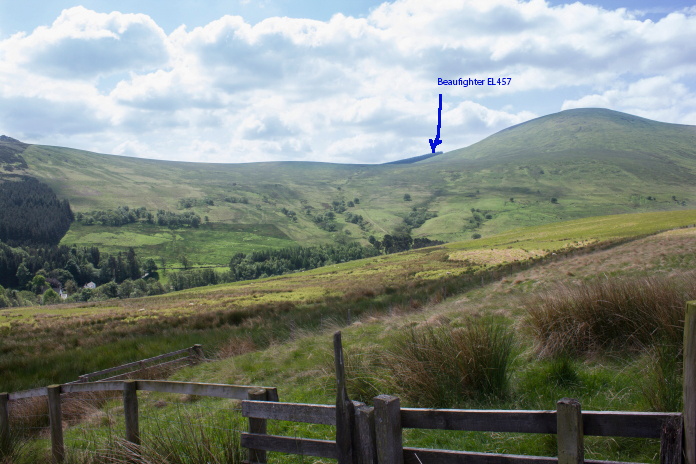
Hedgehope Hill across the Harthope Valley,another crash site** which had eluded me on previous visits is marked.
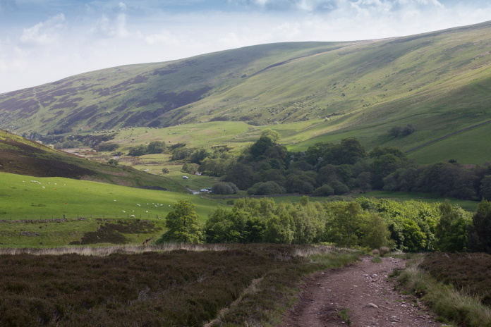
Onwards and upwards would best describe this route up the Cheviot, I usually prefer taking the slightly longer but less steep and more interesting route via Langleeford Hope up to the top of the Harthope Valley and onto Cairn Hill which also passes a very picturesque waterfall, but as my aim today was solely finding KB745 again I used the more direct route via Scald Hill.
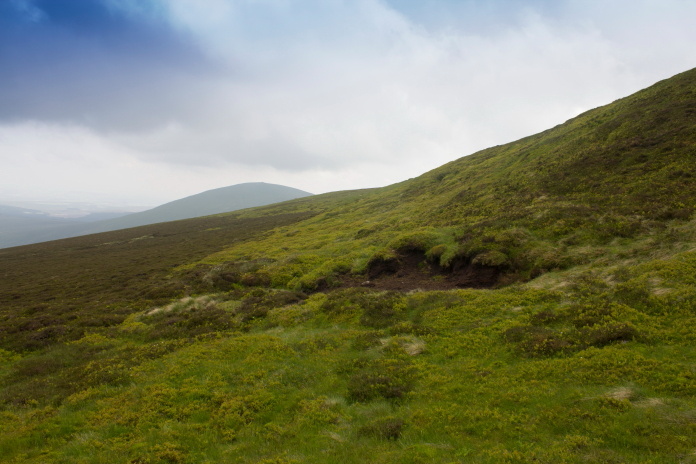
The path making its way up Scald Hill with Cheviot in the distance
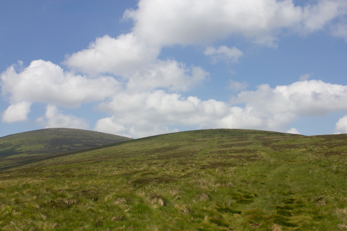
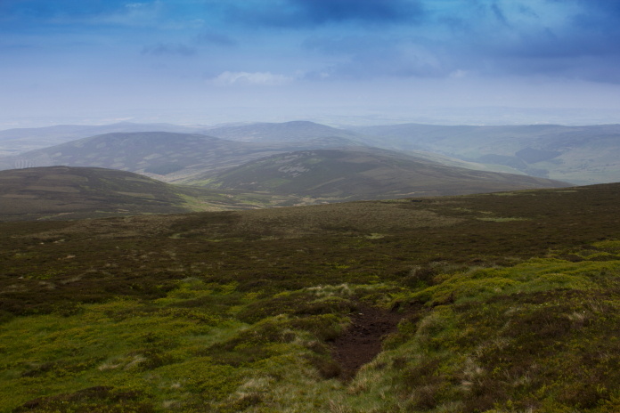
Thanks to modern technology,specifically google earth, I knew by the light green dark green patterns in the heather exactly where KB745 had crashed and because of the clear weather could see the location from 2 miles away. This ironically is not the location where we found pieces in 1979, I did search that location again but found nothing.
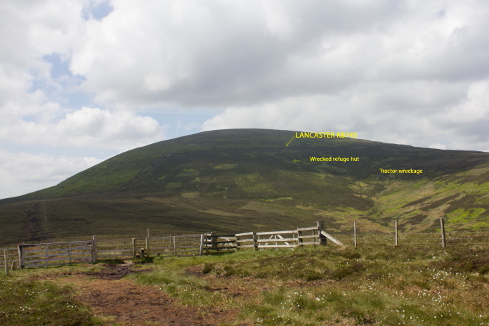
The location of KB745's crash site
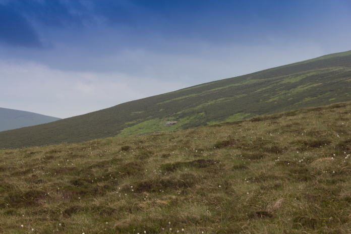
At the crash site there is very little remaining to be found on the surface, more fragments hidden in the deep heather or buried could probably be found with the aid of a metal detector but without such a device all I found was a couple of tiny fragments and one larger piece of strut.
The area where the remains of KB745 are buried, there's very little to find on the surface.
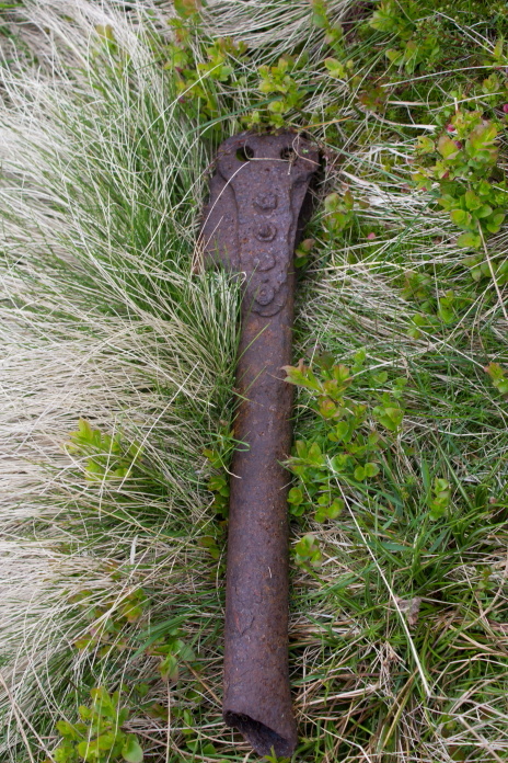
The largest piece remaining on the surface
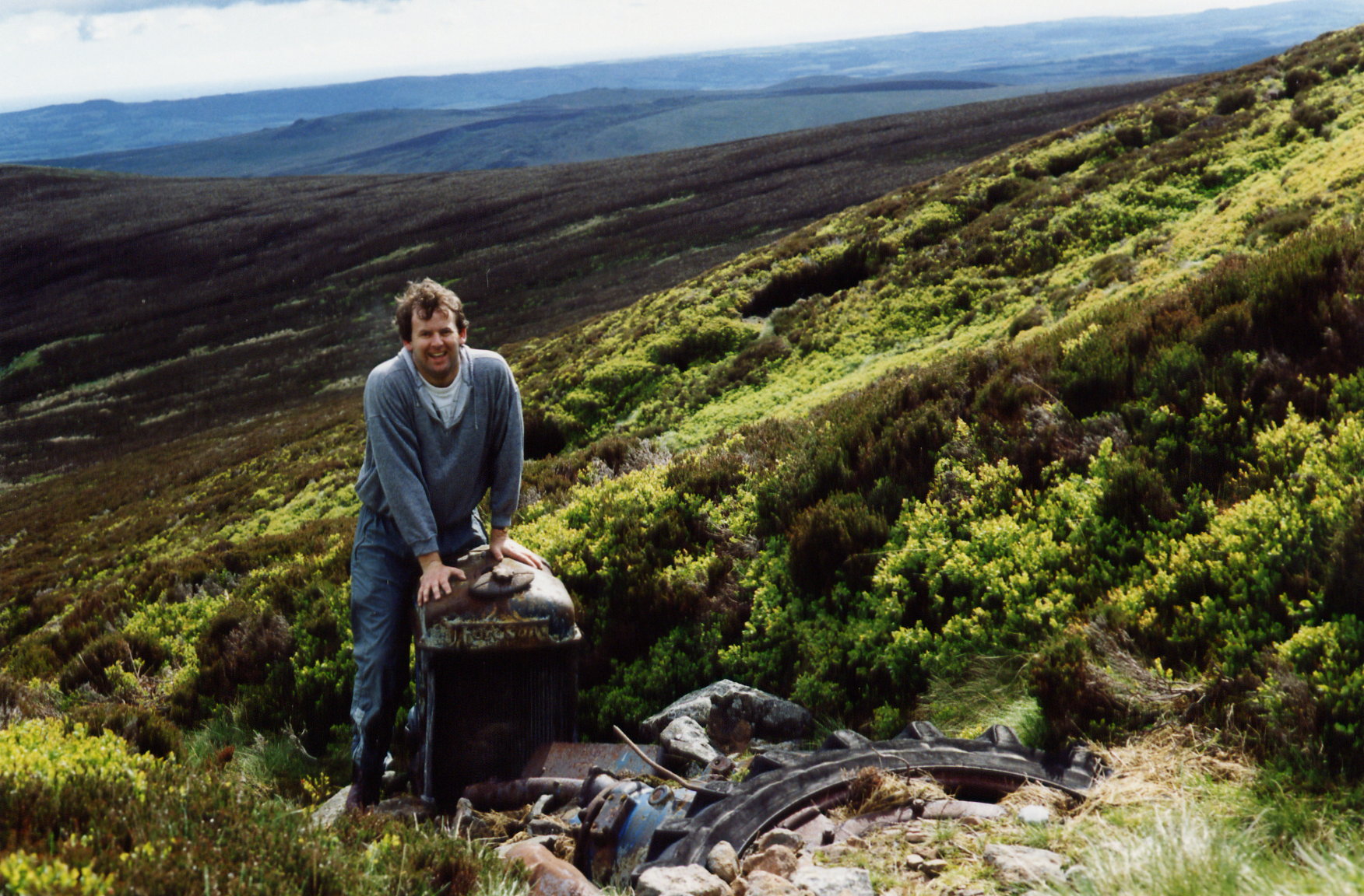
A short distance downhill from the Lancaster site are the remains of a Tractor, it was believed that this tractor was lost by the RAF while they were attempting to recover the Lancaster but it actually belonged to Northumbrian Ski Club who rolled it down the hill and buried it in a ravine after it threw a piston.
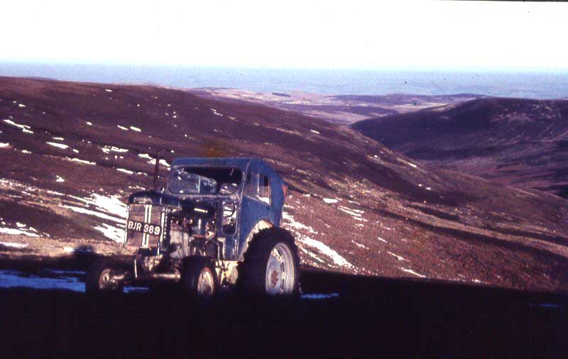 The Fordson Tractor on Cheviot, it was utilized by the Northumbrian Ski Club as a Ski Tow
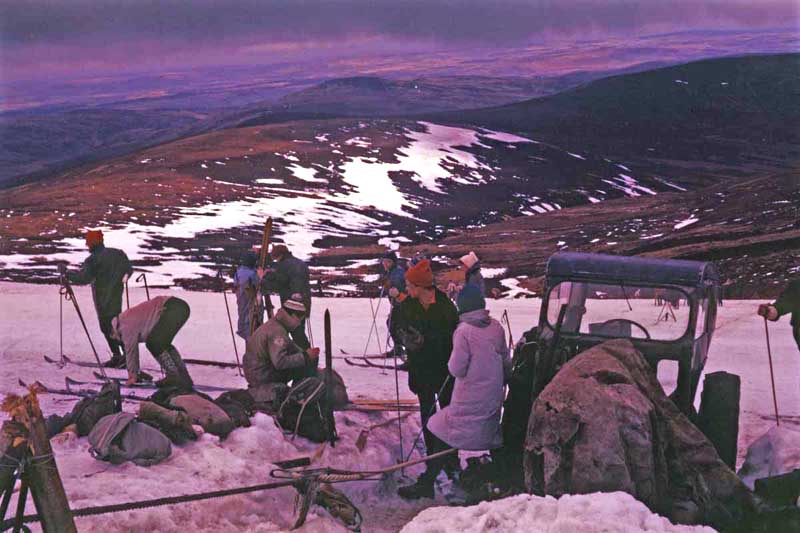
The Tractor in use as a Ski Tow in the same area that KB745 crashed, after it threw a piston they pushed it down the hill and buried it in the ravine in the background.
 The area where KB745 crashed, the area where the above photo of the skiclub was taken is to the left of the photo and downhill a bit.
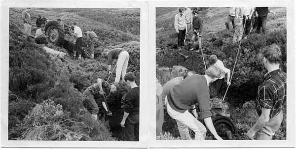
Members of the Ski Club burying their deceased Tractor
There is also a wrecked refuge hut just below the Lancaster crashsite, this looks just like aircraft wreckage from a distance and has probably misled a few people, but as it was intact on my first visit I knew what it was.
Unless you know better the remains of this refuge hut look just like Plane wreckage from a distance
and is just downhill from where the Lancaster crashed.