
2 out of 4 in the Cheviots.
Short Stirling EE972 and Hawker Hart K6482.
(Distance
covered = 11.6 mile/Ascent =+1029 -1028)
A Highland Dancing Competition at Stannington, about 10 mile from our house meant I could drop the girls then go home again, but instead I took the opportunity to revisit my old stomping ground in the Cheviots.
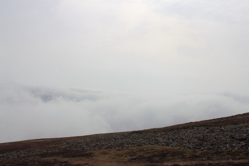
The weather this day was atrocious: windy,low mist and rain.
By the time I parked the Pug at Langleeford, in the Harthope valley, there was no sign of it improving. I decided to take a chance
and continue in the hope that some of my good luck with the Scottish weather
might work in England. I set off towards Cheviot taking the more direct route to the summit via Scald Hill
on this occasion, as opposed to my favoured route via Langleeford Hope..
After about an hour I began contemplating calling it a day as the wind and rain were still showing no sign off letting up and the visibility was only about 100yrds. As I began climbing the last steep slope
up onto the summit plateau the cloud started to thin and the sun started to appear. This was not due to the weather improving
however, I had in fact climbed above it, eventually emerging into clear blue skies and sunshine.
"A day is not wasted if a memory is made", so walking around in the sunshine with the Cheviot taking on the appearance of an Island in a sea of cloud, meant this day was definatly not going to be wasted.
emerging from the clag into sunshine on top of Cheviot
My itinerary for this day was to revisit 4 sites I had previously looked for during my first shift of Wreckhuntng in the 80/90's. Supermarine Spitfire P8587, Short Stirling EE972, Avro Lancaster KB745 and Hawker Hart K6482. I did find parts of the Stirling on some of my previous visits, in a gulley lower down the hill, but these had been dumped there by the recovery crew at the time, so on this visit I hoped to find some pieces at the actual crash site.
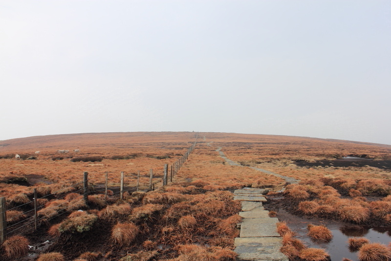
Approaching the summit of Cheviot, the trig point on the summit can be seen on
the horizon just to the left of the fence, The Stirling crashed just to the right of the path and there are also pieces in a gully to the left of the sheep.Before this path was constructed reaching the trig point on the summit was a very muddy affair.
Although there is not much left of the Stirling at the crash site it proved easy enough to find being just of to the right of the flagstone path that leads to the summit.
1 out of 1, good start.
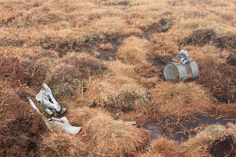
Pieces of EE972, not much left for such a big Aircraft, the cylindrical shaped object is an oil cooler
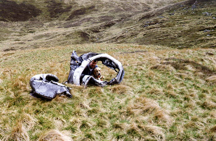
Taken in the 90's this photo shows some of the parts of EE972 down in
a gully below the summit, these parts would have been dumped down here by the Recovery crew who salvaged the Bomber during the war.These
parts have since been removed by a local farmer and were last seen in a barn
on his farm.
More wreckage photos
After visiting the Stirling crashsite
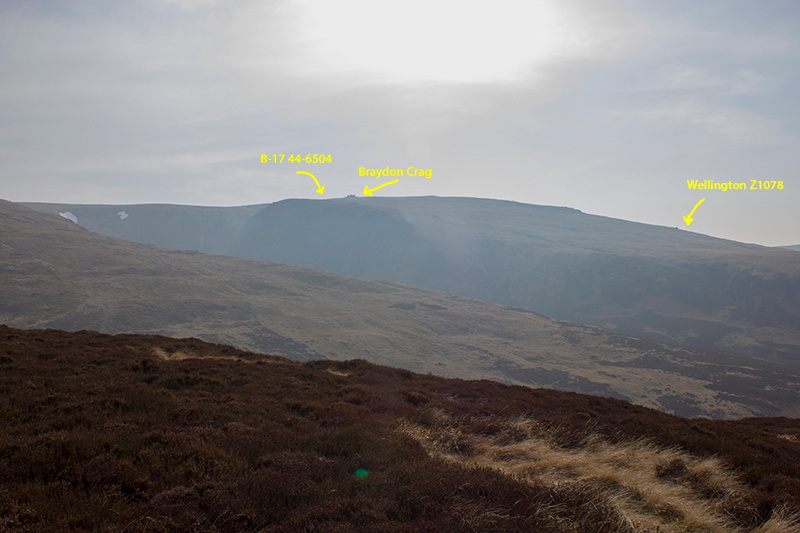
followed by a quick detour to the Cheviot summit, I went to look for Lancaster KB745.
KB745 was the first crashsite I ever visited way back in 1979. This site lies below the eastern cairn of the Cheviot summit plateau but the area was still enveloped with mist and rain so I didn't spend much time searching before deciding to leave it for another day. When I was taking photographs of the Hart wreckage
someone else appeared, of the 80 or so crashsites I had visited prior to
this one, this was the first time I had encountered someone else looking
for the crashsite as well. The bloke was Polish but coincidentaly was now
living in the same Town as me. Since my encounter with the Polish man I
have since also met a German at a Wellington site in Glen Affric* and
another 'wreckhunter' called Jerry Drury on the way back from a Miles Master crashsite on Tipperweir**.Not long after finding the Hart wreck site the mist lifted and the sun caught me up lower down the hill.
1 out of 2.
As I descended the slope towards the area where the Hart crashed the cloud was getting thicker and an annoying drizzle was trying its best to infiltrate my waterproofs. I was starting to think it was going to end up as 1 out of 4 for the day.
The Hart wreck was just off to the right of a distinctive sharp left turn in the track I was following downhill; a compass bearing from that point should lead me right to the wreck presuming of course the grid ref I had was accurate.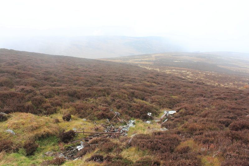
Remains of Hawker Hart dumped in a shallow gully by the recovery crew, it crashed about 100ft further up the hill from here.
2 out of 3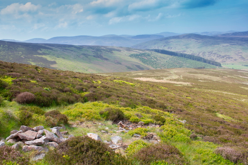
Where the Hart crashed, there's only tiny pieces left here and a cairn to mark the spot, which has now collapsed.The next hill over is Bellyside Hill, a Spitfire crashed here in the area immediately to the left hand side of the woods
My next destination was the crash site of a Supermarine Spitfire on Bellyside hill***.
I had searched for this crashsite on a previous occasion and found no
sign of it but a memorial post had now been placed in the vicinity about 300
metres further
east from where I had searched, so I went back for another look but again
managed to miss it.
2 out of 4
The route I took to get from the Hart wreck to Bellyside Hill involved negotiating this fairly steep gully
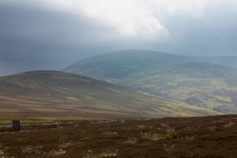
Taken from Bellyside hill this photo shows the location of 2 other wrecks
over on West Hill.
After unsuccessfully searching for any remains of the Spitfire for a second time I dropped down into the Lambden Valley and headed east to return to the Harthope Valley and the car. Passing through some woods at the head of the Lambden Valley I remembered from my earlier visits that the path over to the Hawsen Burn, which flowed down into the Harthope Valley where the Car was parked, turned left and uphill not far after the woods were exited. After taking a left turn immediatley after exiting the woods and heading uphill to cross the saddle into the valley on the other side the mist descended again and the visiblilty was reduced to about 50 yards. Because of the now poor visibilty I walked about two mile before I realised I was not where I should be. After referring to my map it transpired that I was following the Broadstruthers Burn to the North of Broadhope Hill instead of the Hawsen Burn to the south, my error had been caused by: my memory not being as good as I thought, not wanting to stop to get my map out of the rucksack and half of the woods being felled since my last visit. I had turned left as I emerged out of the woods like I remembered but half of the woods were no longer there so I had turned left and uphill way too early. This gentle reminder not to take anything for granted while navigating in the hills may have turned out to be a good bit of navigating practice as I was now in unfamiliar territory and had lost awareness of my surroundings, unfortunately though, once I had been forced to retrieve my map from my rucksack it proved dissapointedly easy to work out where I was and find my way back to the car.
When I eventually got back to Stannington to pick up the girls no-one would believe me when I told them I had spent most of the day in sunshine.
***--Spitfire on Bellyside Hill