
Carpark Curfew
Avro Anson L9153 on Corserine
and Douglas Dakota
K-14 on
Carlin's Cairn.
(Distance
covered = 11 mile/Ascent +1290m -1290m)
The Girls had a lift back from a Competition in Dumfries but they still needed me to take them, which was ideal as it mean't I wouldn't have to worry about the time after I dropped them off and headed up to the Rhinns of Kell for a good days walking.
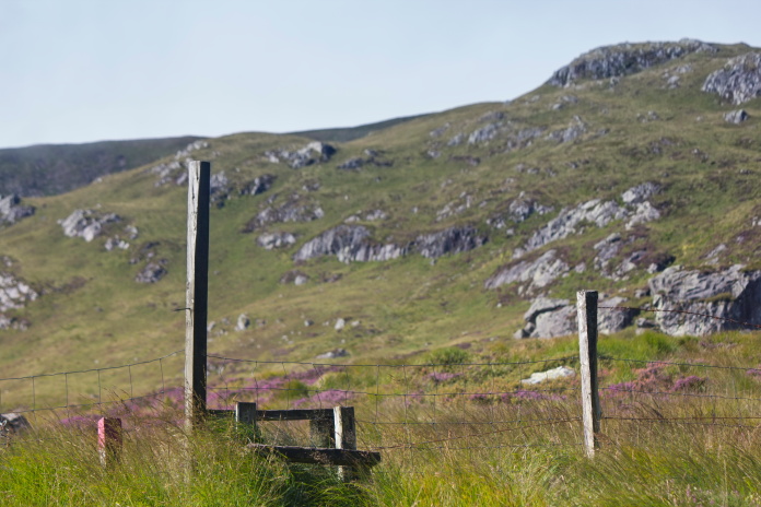
There is a nice carpark at Forest Lodge not too far from Corserine, starting out from this carpark are a number of signposted walks which all had very Scandinavion sounding names. There is also a large signpost in the carpark which, as well as holding information about the walking routes available warns that the occupants of any car still in the carpark after 8pm will be reported as missing to the Police, nice to know in case I got into trouble or lost but it would mean I was still going to have to keep one eye on the time!
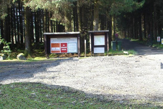
Large Noticeboard at Forest Lodge Carpark,
as well as details of the walking trails there is also a warning that you will be reported to the Police as missing after 8pm.
Just after I left the Carpark and headed towards Corserine I noticed something odd through the Trees over to my right which necessetated a small diversion to investigate. It was an 8ft tall statue of a Highland Piper in full military gear standing on top of a pile of rocks.
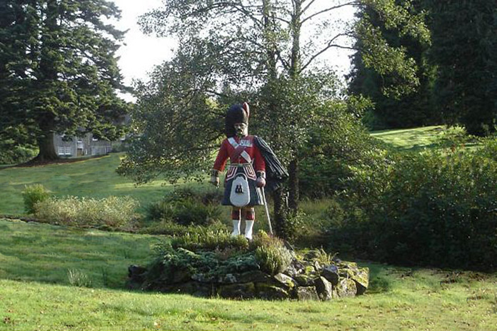
Not something I expected to encounter in the middle of nowhere.
After a quick look on the interweb when I returned home, the Scandinavian trail names and the Piper's statue all began to make sense. The Forest Lodge Estate is owned by the Fred Olsen Group and the Piper used to be a figurehead on a Fred Olsen Liner called 'The Black Watch' that was sunk during the second world war while sailing between Newcastle and Oslo.
Heading down the Birger Natvig Road towards
Corserine.
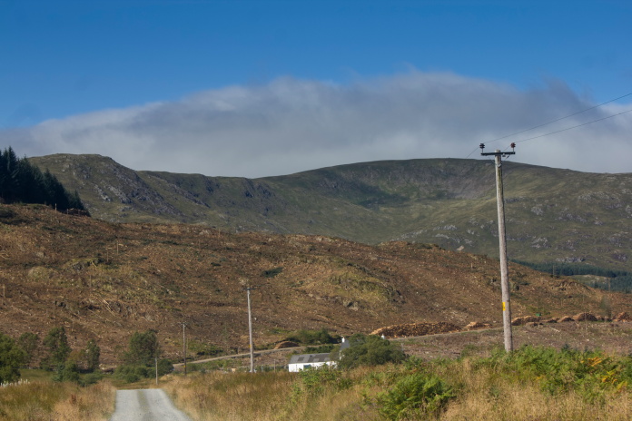
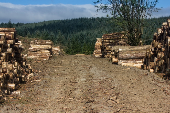
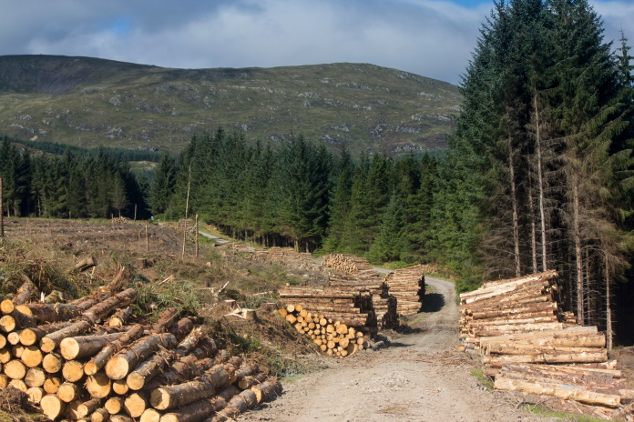
There was a lot of logging activity going on which meant the walk in to the base of Corserine was a lot more open than last time I visited with much better views. I was pleased I didn't bring my bike this time as the tyres may not have fared very well as the track was understandably covered in forestry debris. The Forrest Estate sustainably produces around 30,000 tonnes of timber per year which is used in mills to produce roof trusses, joists, C16 carcassing etc to pallet wood, fencing and low grade Roundwood used in combined heat and power plants¹.
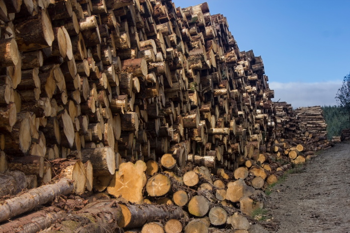 Canny supply of firewood!
 Don't
think my Bike tyres would have liked this road but it was lovely
and springy to walk on!
Don't
think my Bike tyres would have liked this road but it was lovely
and springy to walk on!
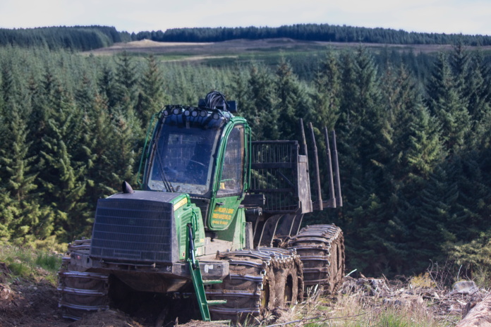
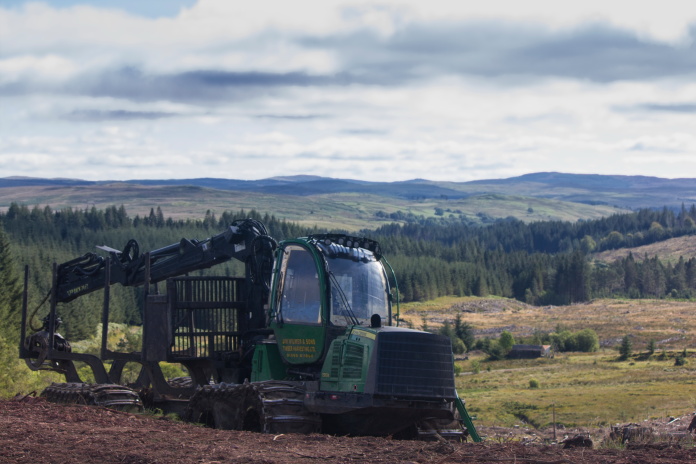
above and below:-As it was Sunday the logging machinery was all stationary so it was safe for me to use the track.
My progress on the walk in was much quicker than last time as I didnt have the bike to push up the hill so I was wondering if taking the bike last time had been worth it. I wouldn't be thinking that on the way back!
 Nearly
to the end of the forest track and the start of steep path up Corserine.
Nearly
to the end of the forest track and the start of steep path up Corserine.
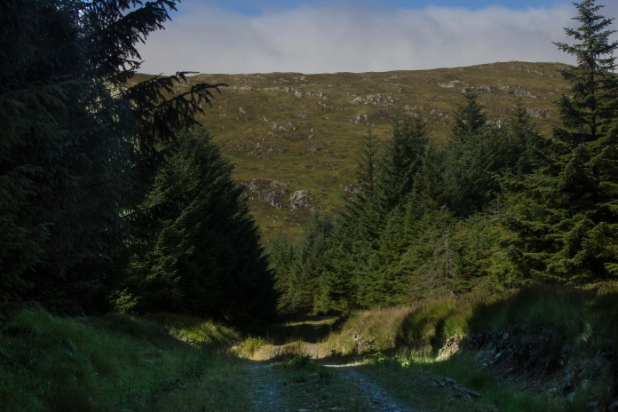
Once I'd exited the forest and huffed and puffed my way up onto the Baelach between Craigrine and Corserine I continued straight over and dropped down the other side to where a large section of Dakota wing can be found lying in a plantation. My plan was to go straight over and up the rock strewn Castlemaddy Gairy opposite to look for other pieces of the Dakota in amongst the rocks and hopefully find the area where it crashed near the top of Carlin's Cairn.
 Over
this stile is a nice wee path that zigzags up between the rocks in the
background..
Over
this stile is a nice wee path that zigzags up between the rocks in the
background..
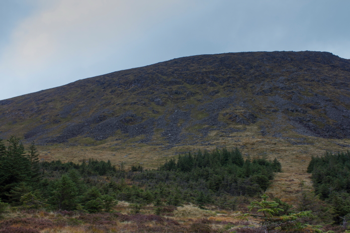
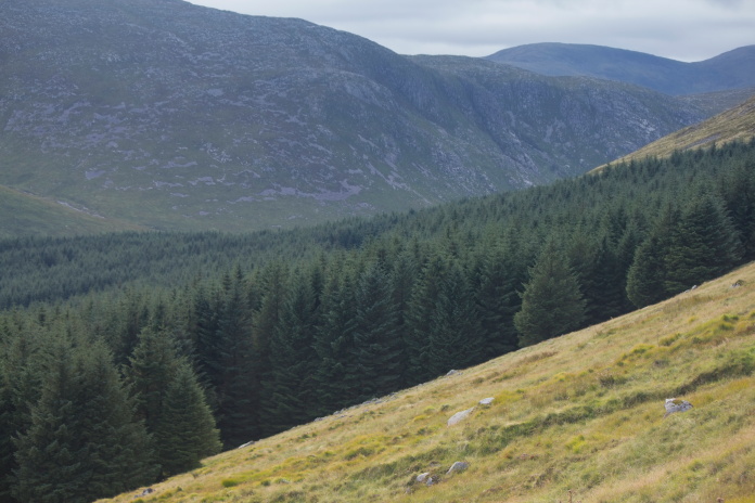
Carlin's Cairn viewed from the other side of the Glen.
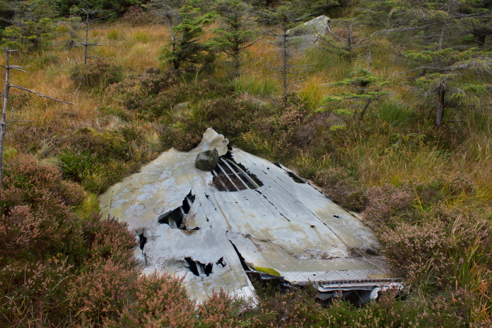
The Dakota wing lies in the trees to the left of the ride.
I have read reports that an engine and other parts are to be found near the wing section so before heading off up the rocky slope I had a good root around in the trees but could find no sign of anything else. The large bit of wing section looks like it had been buried but then uncovered by erosion so perhaps the engine was there but buried as well.
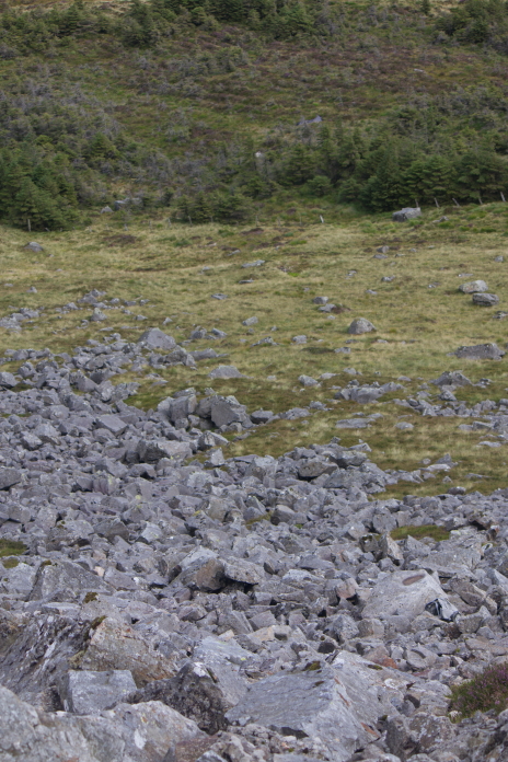
Looking back down the gairy to the trees where the wing section can be found.
Gairy is Gaelic for steep rocky place, so spot on here!
A piece of Dakota lying in the rocks.
After finding 3 pieces all in the same boulder field I reckoned that was the one to follow uphill so abandoned the zigzags and started climbing straight up . Although I found a few more pieces I didn't find anything other than crumpled panels and failed to find the area where the crash occured. After a search on the interweb when I returned home I found some photos of more wreckage further south than the pieces I found, so it would seem I followed the wrong boulder field uphill, the pieces I found probably having been blown further north by the wind. Never mind, an excuse for another visit and I now know exactly where to look.
In may of 2023 I did indeed pay another visit to Carlin's Cairn and on this occasion succeeded in finding a lot more wreckage from the Dakota and also the impact point, which was a couple of hundred metres south of where I searched on my previous visit. This would also explain why I had no luck in finding the engine that is reported to lie in the woods below as I had only searched in the vicinity of the large piece of wing, so presuming the engine rolled down the slope from the impact point, it is most likely a couple of hundred metres south of the wing. Never mind, an excuse for another visit and I now know exactly where to look.
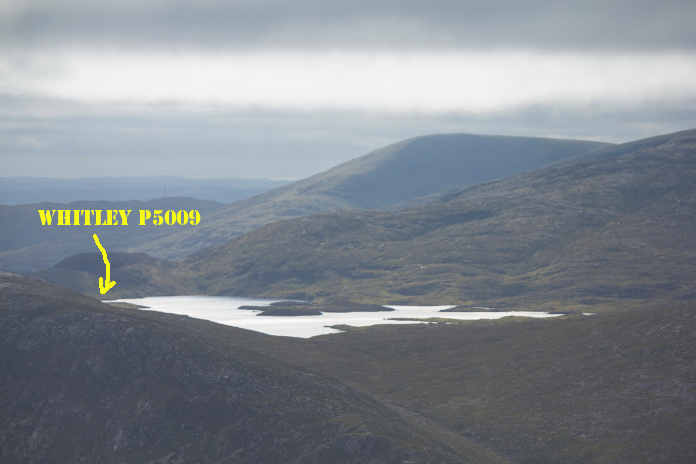
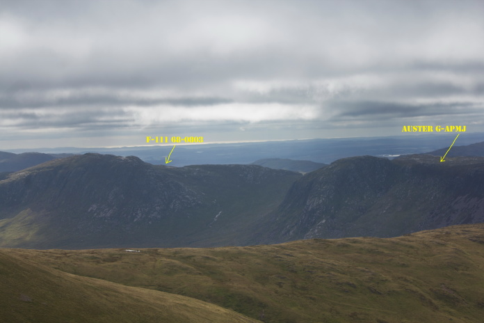
above and below:-Great views across the Glen to the locations of 3 other crashsites I have visited. Loch Enoch* above and Craignaw** and Dungeon Hill*** below.
It was blowing a bit of a hooley on top of Carlin's Cairn but luckily
Carlin's Cairn has a large cairn on the top, probably built by someone
called Carlin. This cairn provided enough shelter for me to have a sit down and scoff
my butties.
My next objective was over the other side of Corserine, but instead of going up and over I contoured around
the western slopes along an area called Fallincherrie Scar then over the
baelach between Meikle Craigtarson and Corserine.
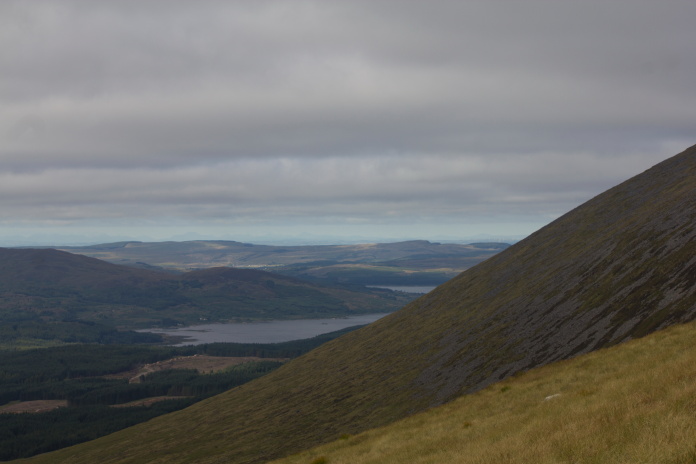
View North past Carlin's Cairn to Loch Doon****,the location of yet another crashsite I have visited.
To reach the crashsite of Avro Anson L9153 mean't losing all the hard earned altitude I had gained earler as it lies right down the bottom of Corserine to the south west. To make matters worse, the last 200yrds dropped off quite steeply and the going was quite tough because of boulders concealed by long grass.
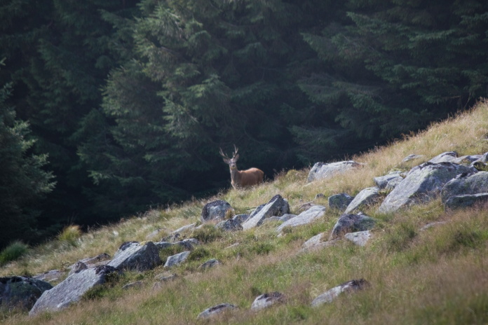
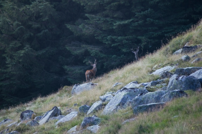
Above and below:-A couple of Locals wondering what I was up to.
After spending a bit of time searching around in the long grass and forestry debris for bits of L9153 I had to start thinking about how I was going to get back to the carpark before the 8pm curfew. I was now pretty low down on the wrong side of Corserine and the only viable route was back over the mountain, but I did not want to be reported as missing as that would incur an instant ban on Hillwalking from the wife so I had plenty of incentive to haul myself back to the top.
I made a rising traverse around the south slopes of Corserine aiming for The Scar of the Folk. As a clag had descended on the top I aimed off to the right a bit so I would know to turn left when I hit the North Gairy Ridge to pick up the path down that I was familiar with. There's another ridge that runs south to Millfire and Milldown that I almost mistook for the North Gairy as it looked very similar, but the fact it was too far south and a glimpse of Loch Dungeon in the distance was enough to prevent me heading off in the wrong direction.
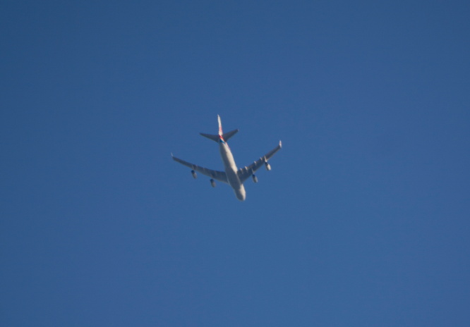 Boeing 747 flying over Corserine.
By the time I arrived back at stile at the edge of the forest I had 20 minutes left to cover the last 2 mile or so back to the carpark. It was at this point that I wished I had fetched my bike, because on my last visit here it took me 6 minutes from re-entering the forest back to the car. On this day without the bike and now having set myself the challenge of beating the Carpark Curfew; I ran!
*--Loch Enoch **--F-111 ***--Auster ****--LochDoon
¹--Information kindly provided by Brian Hilditch(Forrest Estate)
Click this link for more information about the crash
www.peakdistrictaircrashes.co.uk/L9153