Not a Crow's route!
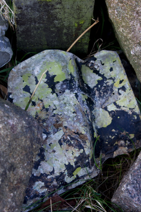
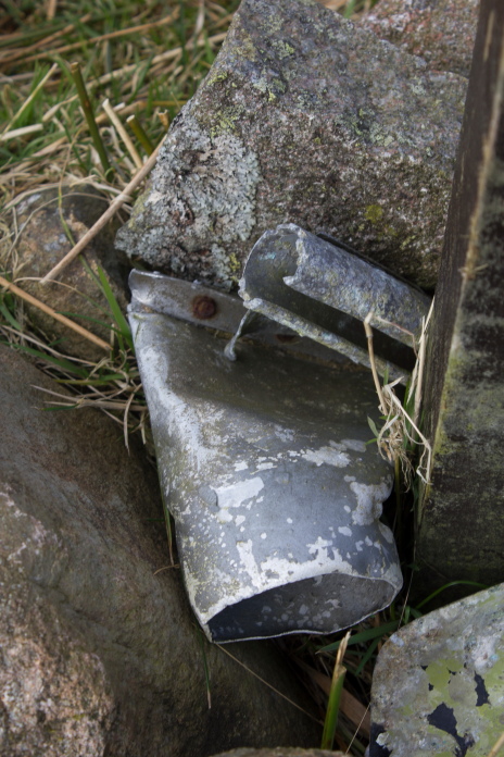
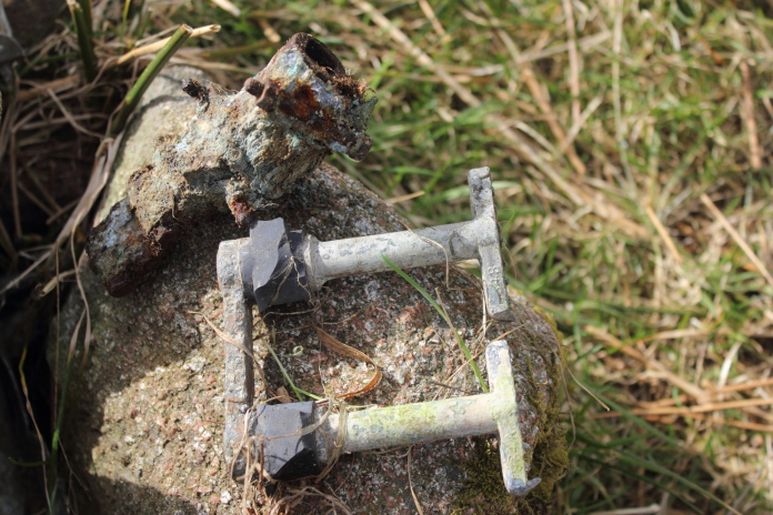
Vickers Wellington R1535 on Dunmoor Hill.
(Distance covered =10.8 mile/Ascent =+542m)
Competition in Stannington = Hiking Expedition to Cheviot Hills!
Stannington is only about 10 miles from our House and right next to the A1, so after dropping the Girls off in the morning I nipped up the A1, then just past Morpeth onto the A697 towards Wooler, 10 miles before Wooler is the Ingram Valley.
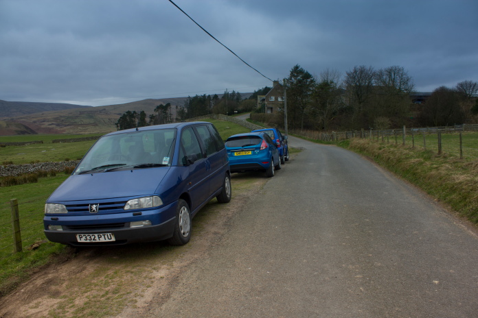
Blueberry Esmerelda Muffin II parked at Hartside
Farm in the Ingram Valley.
The public motor vehicle access at the top of the Ingram Valley terminates at Hartside Farm where there is a parking area of sorts on the grass verge, from here I had to continue along the same road almost to Linhope, to pick up a public/permitted footpath that headed north east along the base of Dunmoor Hill.
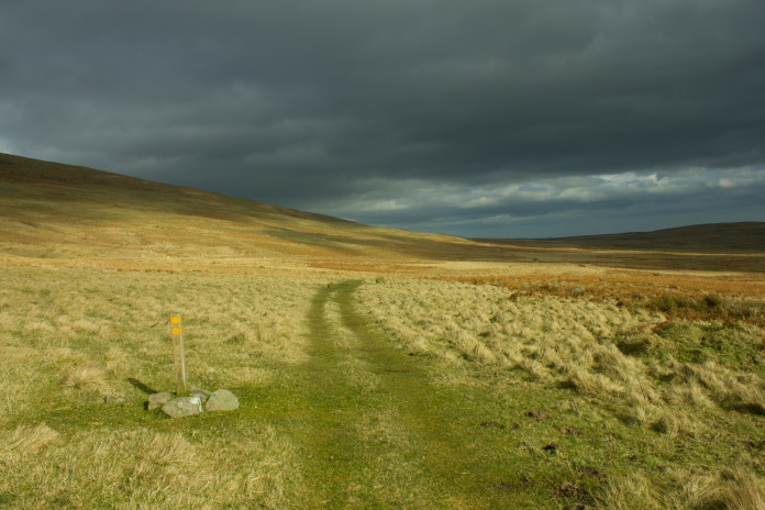
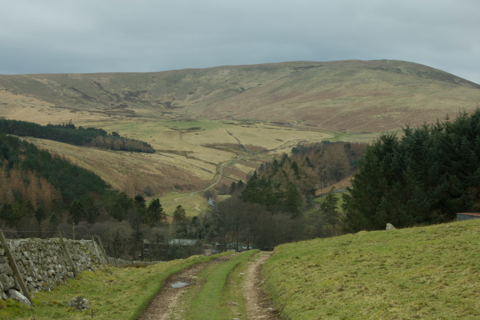 Climbing away from Linhope
on the public path, with Shill Moor in the distance.
Climbing away from Linhope
on the public path, with Shill Moor in the distance.
If I could have walked as the crow flies from Hartside Farm it would have only been a one mile trek to reach the Wellington Crashsite, but the land between Hartside farm and Dunmoor Hill is not open access so I had to make the diversion to the public/permitted footpath which left the road I was on just above the Hamlet of Linhope, to the south of Dunmoor Hill.
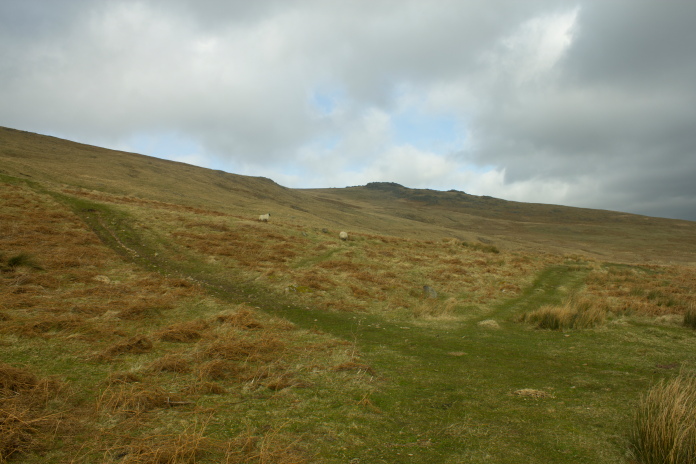
Above and below:-Following the Footpath to the north east along the base of Dunmoor Hill.
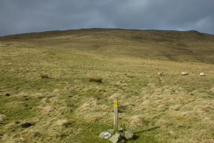
Dunmoor hill from the path below.
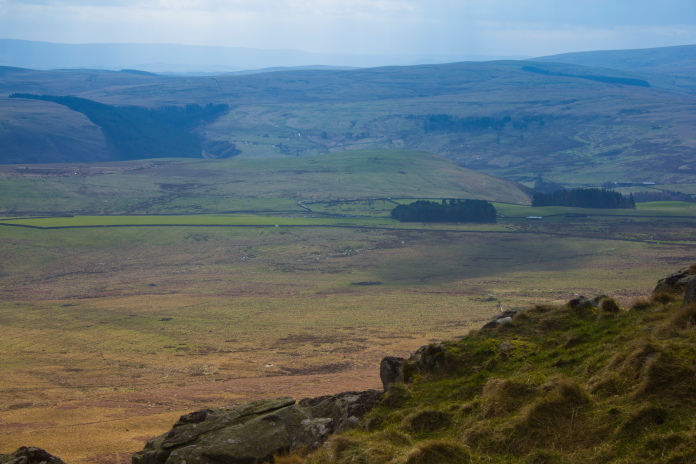
At the eastern end of Dunmoor Hill there was a maze of footpaths going off in all directions, one of which turned back to the west and went up to the summit of Dunmoor Hill via Cunyan Crags.
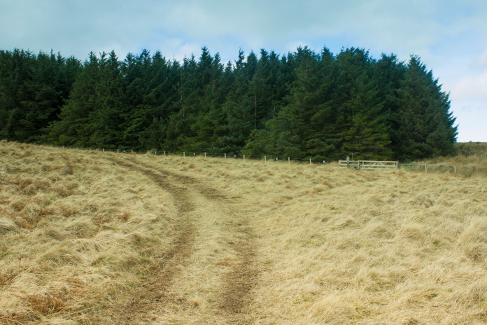
At the eastern end of Dunmoor, the path on the left leads back to the west and the summit of Dunmoor.
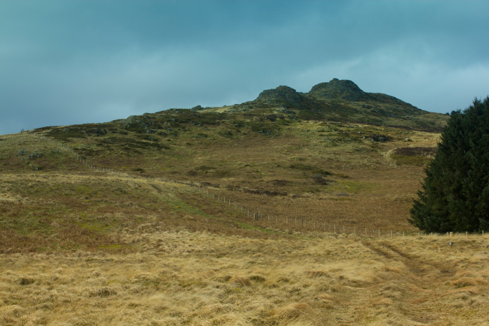
Heading to the west and Cunyan Crags
 On top of Cunyan Crags, the parking area is to the left of the nearest trees, on
the other side of the light green field.
On top of Cunyan Crags, the parking area is to the left of the nearest trees, on
the other side of the light green field.
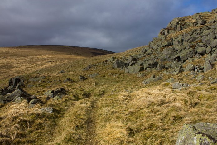
Once past Cunyan Crags I had to leave the path for the last half a mile to reach the crashsite, but luckily there was a quad track going in exactly the right direction.
Passing Cunyan Crags, the summit of Dunmoor in the distance.
This was another wrecksite that I had unsuccessfully searched for back in the 1980/90's, back then I had an incorrect grid reference which was over to the north of Dunmoor, but on this trip I found it easily thanks to there being a memorial post there now.
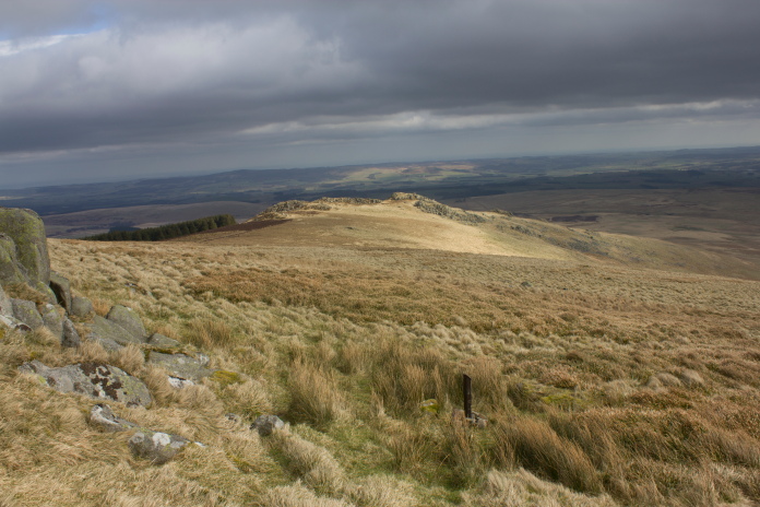
 Although
not easily made out on this photo, in the foreground is a fork in the quad track, the one to the right continues onto the summit of Dunmoor, the one to the left skirts around to the south and passes very close to the crashsite.
Although
not easily made out on this photo, in the foreground is a fork in the quad track, the one to the right continues onto the summit of Dunmoor, the one to the left skirts around to the south and passes very close to the crashsite.
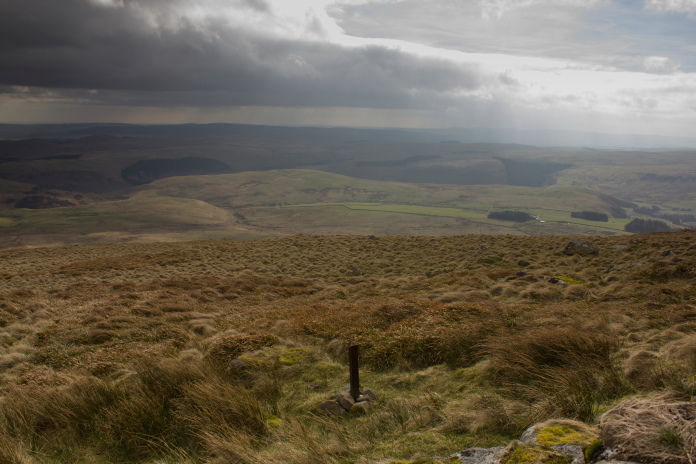
The crashsite is near to the small crag on the horizon,
my compass is still over there somewhere!
After searching about on the hillside for about an hour; not for the crashsite but for my compass, which I'd manage to drop somewhere, I eventually gave up and after taking photographs of the memorial post and the fragments gathered around it's base, I reversed my course and headed back for the car.
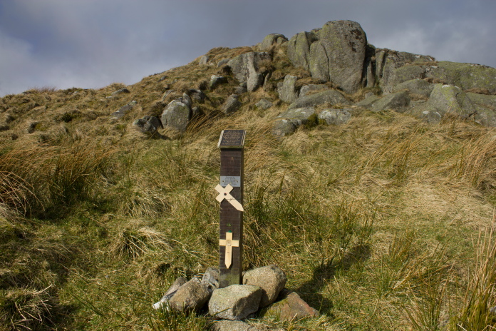
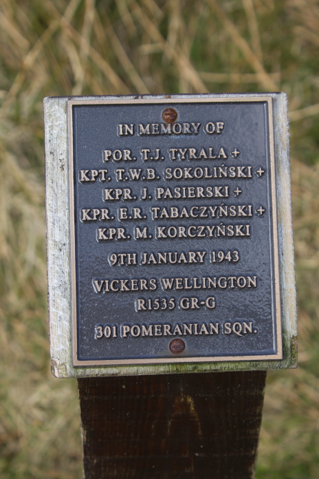
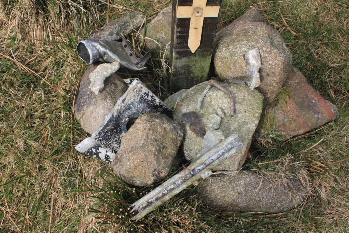
Above and below:-The memorial post for the crew of the Wellington, there are several like this in the Cheviot Hills.
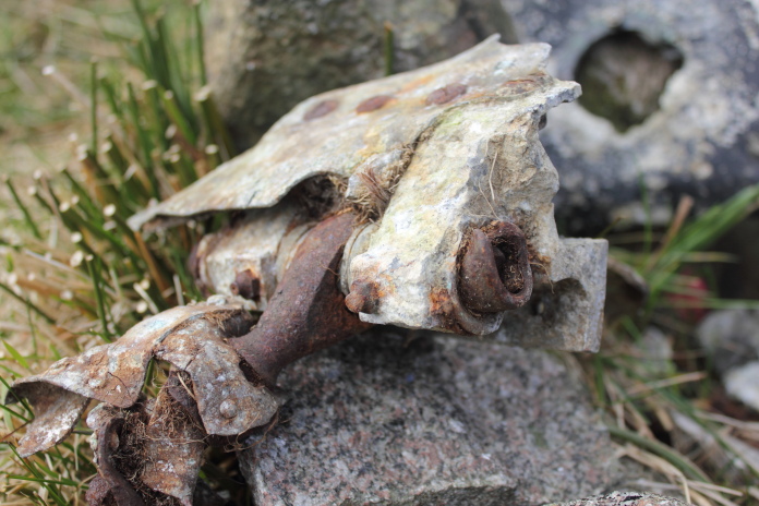
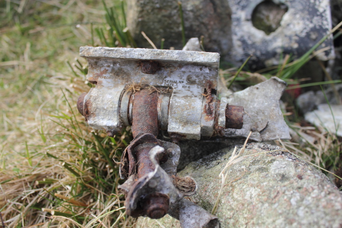
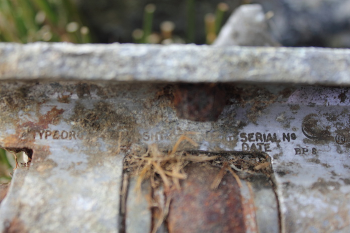
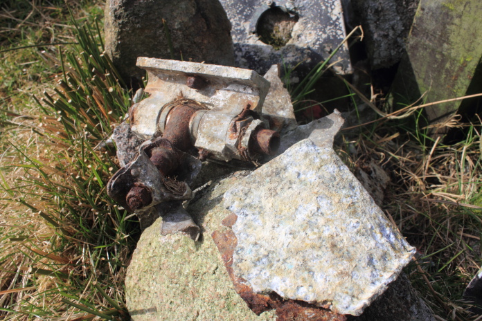
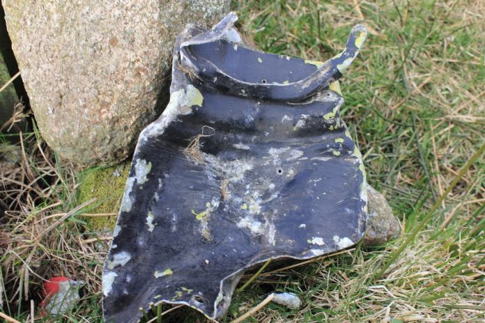
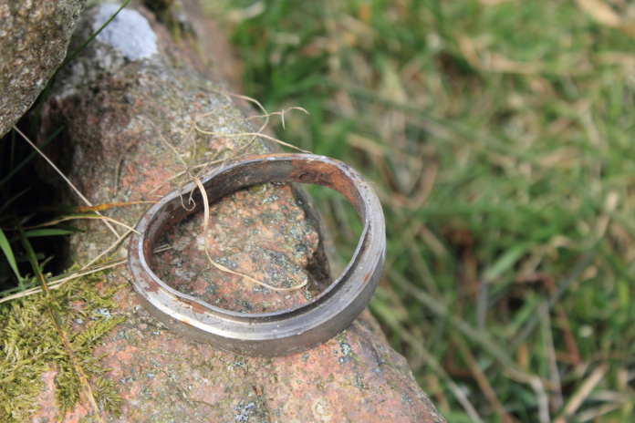
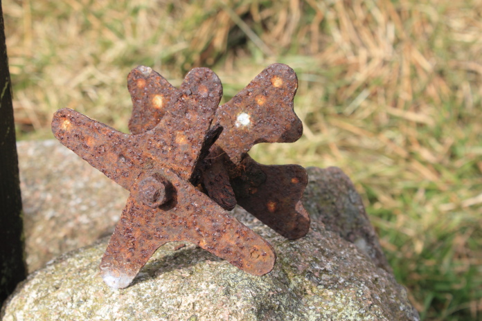
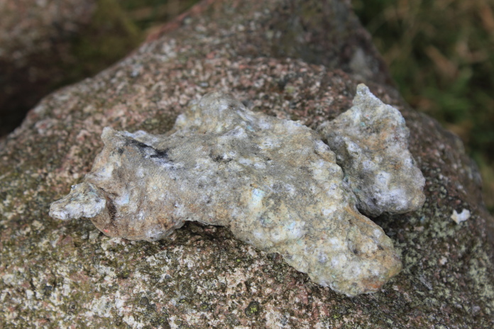
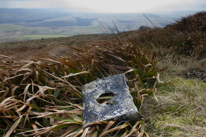
Above and next 12 photos:- Fragments of the Wellington collected around the base of the post.
Because of the diversions necessary to follow the allowed footpaths, the course of my route resembled a large Z and instead of the 1 mile as the crow flies to reach this site it was more like upwards of 4 mile, then 4 mile back, plus another 2 mile searching for my compass, but as I had plenty of time and the weather was pleasant enough that really didn't matter.
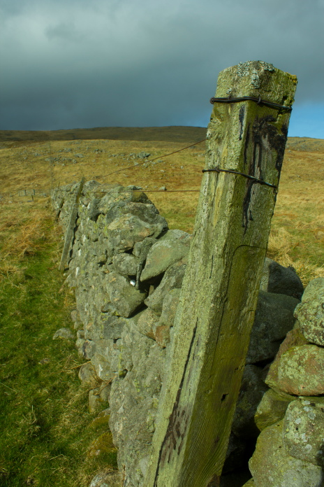
Due to a lack of Waterfalls I had to do my bit
of creative photography with an old fencepost instead!
 Heading back home the way I came.
Once back at the Car I still had loads of time so I nipped over to Meggrim's Knowe where there is another memorial post for Hurricane N2522*. According to the Grid ref I had it was on open access land, but after having a walk around that area and failing to find it I eventually spotted it a bit further to the east in an enclosed bit of land. As I wasn't sure if this field was open access or not and as I had heard a couple of loud bangs like someone was letting off a shotgun I decided to leave that one until my next visit up this way.
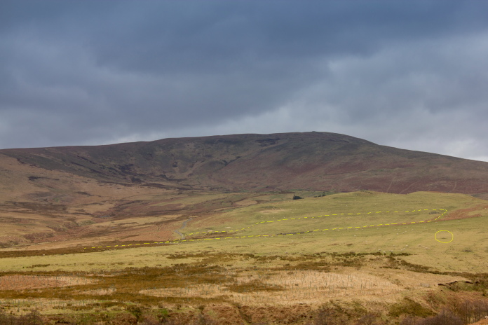
Meggrim's Know. the yellow dashes show where I walked around on the open access land and the yellow circle is the memorial post which is in an enclosed field.
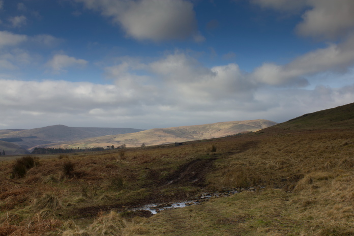
Still with plenty time on my hands I made another detour on the drive home to the site of another Hurricane crash, this one was in woods right next to a public road and although I was sure I had found the exact spot as there was evidence that someone had been digging, there was not the tiniest scrap to be found on the surface or a memorial post, so it wasn't added to my list.
 I was pretty the sure the Hurricane crashed in the waterlogged area, there was evidence of digging there as well. It is believed a large amount of the Hurricane is buried here.