Ball Tingler.
Sepecat Jaguar XZ359 on Brander Haugh
(Distance covered =
6.4 mile/Ascent =+611m)
I wasn't planning on going for a walk on this day, but when my two sons mentioned they were going to St Abbs Head fishing I quickly seized the opportunity to tag along, as I knew there was a crashsite in the vicinity.
As we left the A1 and headed east towards St Abbs Head we
noticed some wit had been busy writing "New Asgard" under St Abbs on the
road signs; this is because St Abbs was used in the scene from The
Avengers Endgame movie where the Avengers travel to 'New Asgard' to
retrieve Thor.
The crashsite I was going to visit was on a cliff face
a couple of mile north of where the boys were going fishing. I didn't expect
there to be any wreckage to see; with it being a more modern crash, and as
well as that it was on a cliff, but I knew there was a marker post above the
cliff face so I could at least check that out.
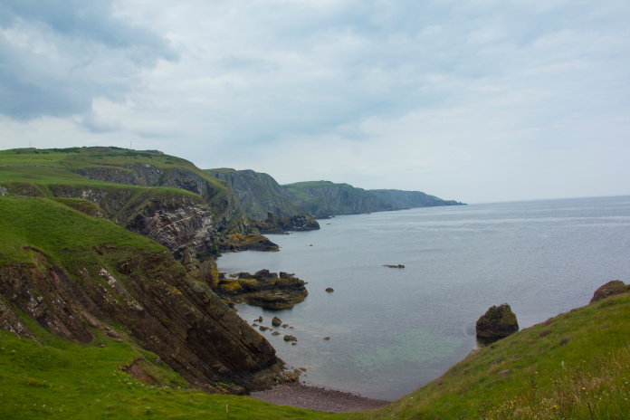
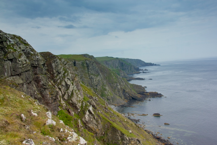
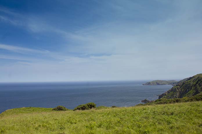
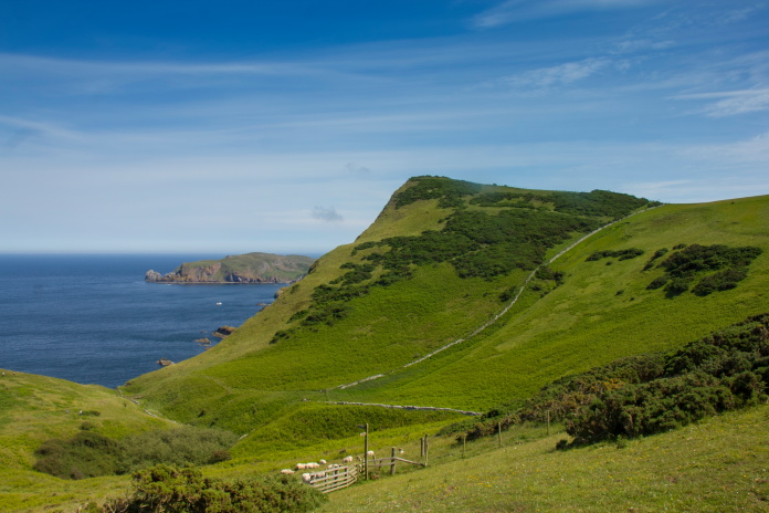
View north from St Abbs Head.
To reach St Abbs lighthouse, where the boys were going fishing involved driving for a couple of miles along a single track road: as were started off along this road there was a fork just past a gate that one of the boys had to get out and open. There were two parked cars on the other side of the gate blocking the right fork, one of the occupants informed us we couldn't go that way because there was a helicopter blocking the road! We informed them we were taking the left fork and continued on our way.
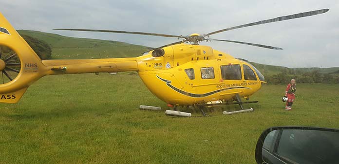
The Helicopter in question, an Air Ambulance.
The tourists blocking the right fork had managed to get two facts wrong:
Firstly it wasn't a Helicopter blocking the road, it was an ambulance; the
helicopter had landed next to the road: and secondly it was blocking the
left fork not the right fork. When we reached the Ambulance a paramedic
simply instructed us to drive onto the grass to go around it.
After dropping the boys at the Lighthouse I backtracked a distance and parked the car at a parking area above an area named as 'Pettico Wick' on the map.
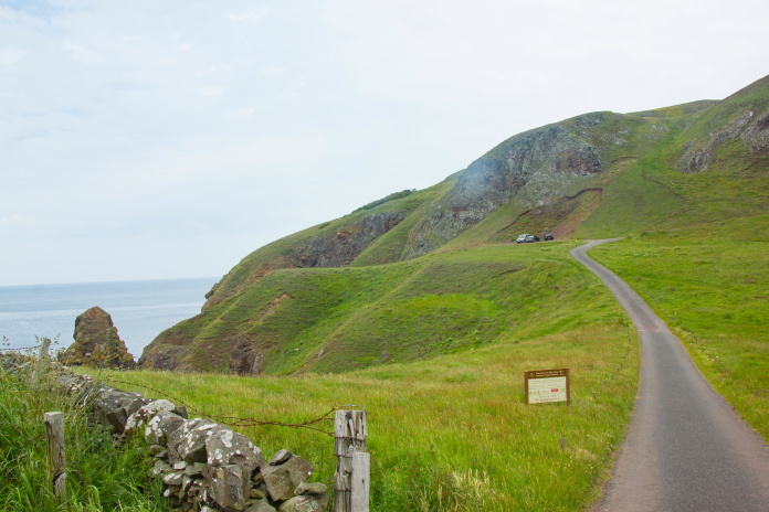
Car parked above Pettico Wick.
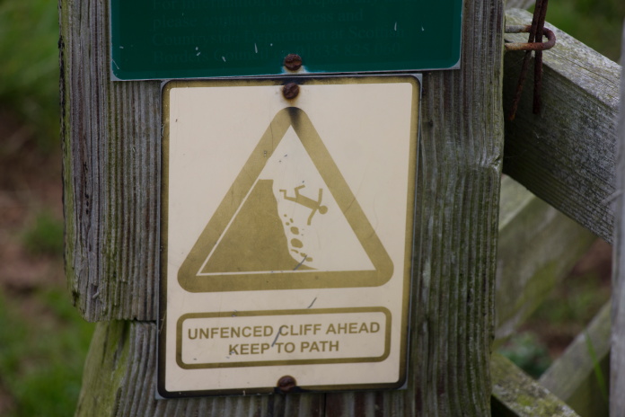
I did take notice of this sign; at least until I reached the crashsite anyways!
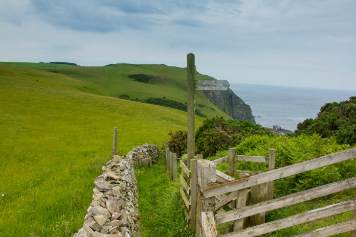
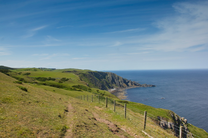
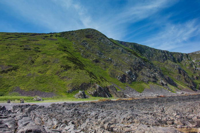
For me; when I go to visit a crashsite it's as much about the walk, and this one looked like it could well be a very enjoyable one as it was following the Berwickshire coastal path along the cliff tops, and the weather was also promising to be quite nice.
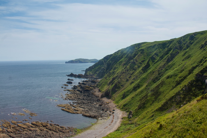
Another view along the cliffs from further up the path.
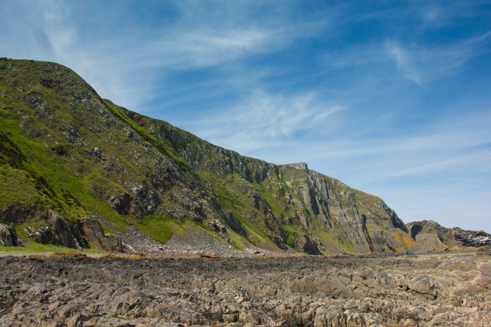
The Jaguar crashed on a cliff just before the little peninsula in the far
distance.
Not far into the walk north the sun made an appearance and it became really warm going, not helped by the fact the path was going up and down some quite steep inclines as it weaved through several quite deep gullies while making it's way along the top of the cliffs. It wouldn't be long before I rued not taking along my 'Indiana Jones hat' that a Dalmally local called Elaine had given me while taking relatives to the crashsite of a F100 Super Sabre on Beinn Donnachan*.
Above and next 3 photos:- Making my way along the Berwickshire Coastal path.
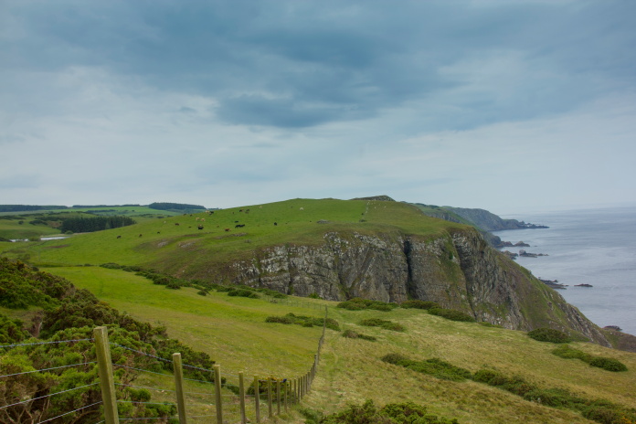
As I approached the area of the crash on Brander Haugh I could see there was what looked liked an easily negotiable path that zigzagged it's way down onto the beach below where the Jaguar had crashed. This meant I could go down onto the beach and have a look up at the cliffs through my binoculars.
Zigzagging route down onto the beach.
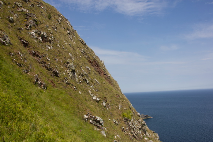
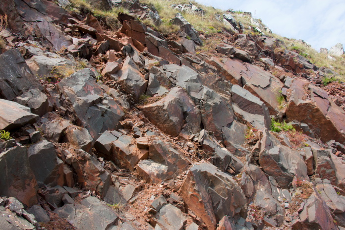
As I walked a little farther, just before dropping down into one last gully that lay between me and Brander Haugh, I could see two scars over on the cliff face, one of which could of been where the Jaguar crashed.
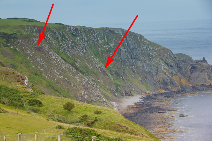
Two scars on the cliffs below Brander Haugh. The one near the top of the
rocks at the left of the photo turned out to be the correct one.
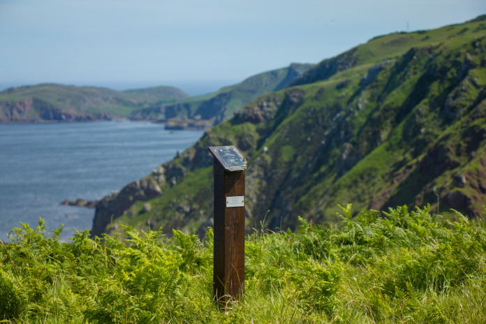
Approaching the top of the cliff, the marker post can be seen over to the left.
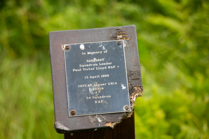
The marker post, in the process of being eaten by the local sheep population.
After taking some photos of the marker post at the top of the cliffs I made my way down the zig zag path that I had spotted from the other side of the gully. This took me quite close to the impact crater.
Impact crater taken from the path down to the beach.
The impact crater is on a very steep bit of ground and I wouldn't recommend trying to reach it without the use of a rope and there is no visible wreckage in it anyway. There are pieces to be found in a gully that runs below the crater down to the beach, I only found a couple of fragments as I visited in the summer when the gully was full of waist high bracken and brambles which made it difficult to spot wreckage and; combined with the loose rocks, made it very difficult going down to the beach.
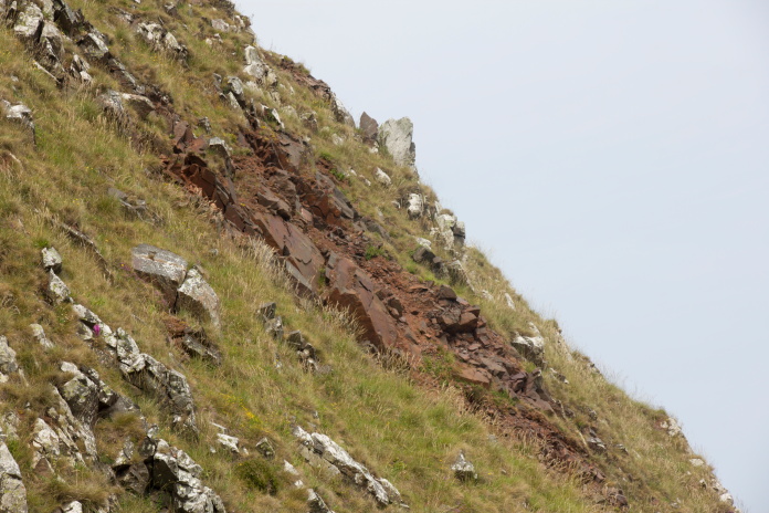
above and below:- Impact crater on the cliffs below Brander Haugh. There may have been some fragments hidden in here but it was just a little too steep and the rock a little too loose to explore.
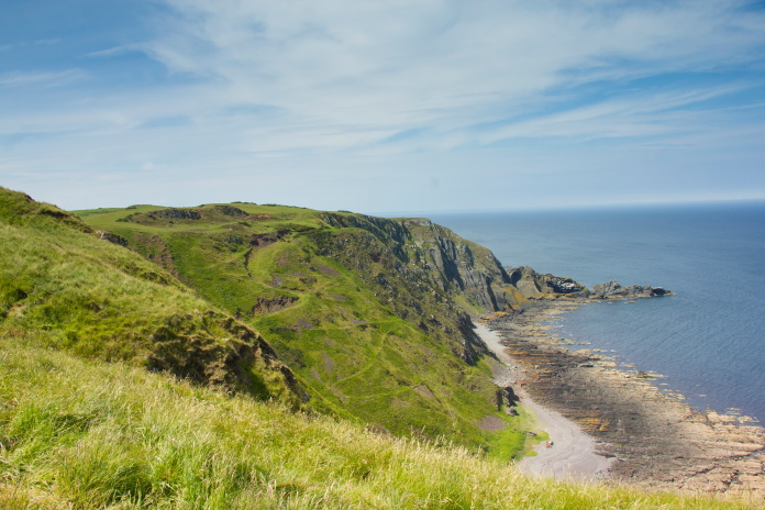
View south from the Jaguar crashsite.
View of the impact crater from further down the cliffs.
The impact crater is just below and to the left of the high point in the centre of the photo. There are pieces in the bracken filled gully below this.
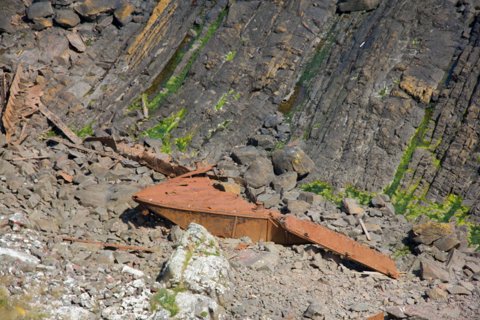
Above and below:-Wreckage of a different kind on the beach below the Jaguar crashsite.
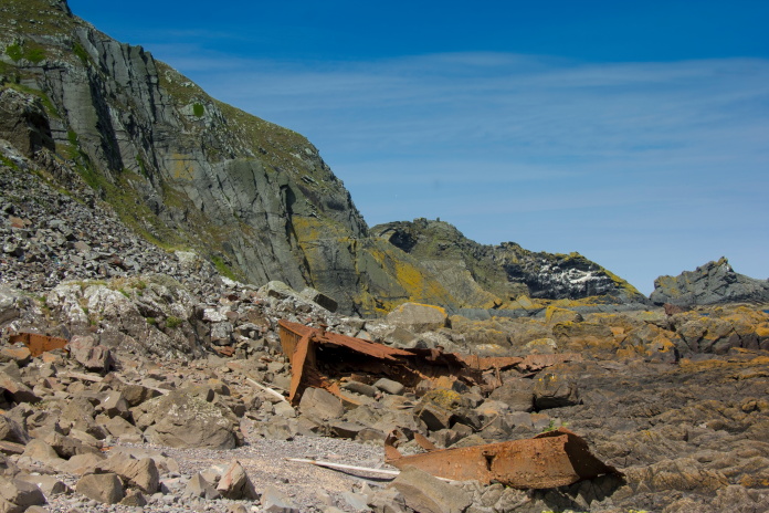
After my ball tingling experience in reaching the crater, then an unpleasant scramble down the overgrown and unstable gully it was a relief to reach the beach below Brander Haugh; which was a lovely peacefull place. There was a bit of a Robinson Crusoe thing going on so I utilised it to eat my butties and then sat in the sunshine for quite a while before tackling what was now a considerable climb back up onto the coastal path.
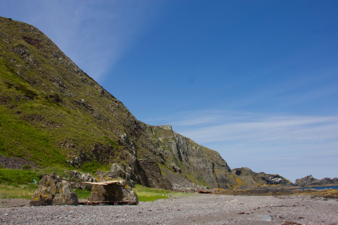
The Robinson Crusoe thingy down on the beach.
The Jaguar crater can be seen near the top of the slope on the left.
Needed to be back up the top of there!
above and below:- Two 'offshore' views of the impact crater.
It was hard work in the heat slogging back up to coastal path then it was just a case of retracing my footsteps back to the car. Walking back I bumped into two woman out for a walk, turned out one of them was the wife of the co-author of some aviation archaeology books; the other author being the man who placed the marker post on the cliffs above the crashsite I'd just visited. Another strange encounter was with a group of people with sticks and machetes who seemed to have a vehement dislike for bracken. Turned out the explanation for their behavior was they were trying to kill the bracken so wild flowers could grow.
The path went right down to the end of this gully and up the other side. Just
discernable in the distance beyond the sheep is the group of Bracken Bashers.
St Abbs head in the distance. By this point it was sweltering hot.
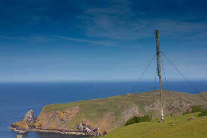
One of the Admiralty marker posts dotted along this coastline. Behind is St Abbs Head.
By the time I arrived back at the car the boys were there waiting for me, they had caught absolutely nothing so had become bored and walked along to the car to wait for me. Shame!, could have fancied a bit of fresh cod for me tea.