
Bob's Hill and Beinn Ochayethenoo.
NA F86 Sabre XB610 in Glen Gheallaidh
(Distance covered =
10.0 mile/Ascent =+742m)
AW Whitley
P5006 on Ben Aigen.
(Distance covered =
2.0mile/Ascent = 187m)
Second days walking of my 2020 walking Holiday in Scotland. This days agenda was to go and look for a North American F86 Sabre Jet that had crashed into a Glen just to the north east of Grantown on Spey.
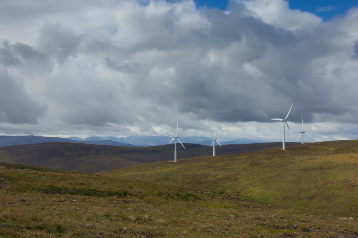
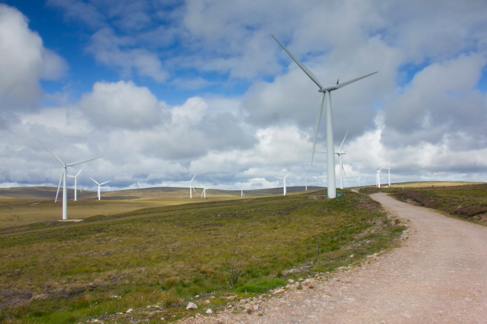
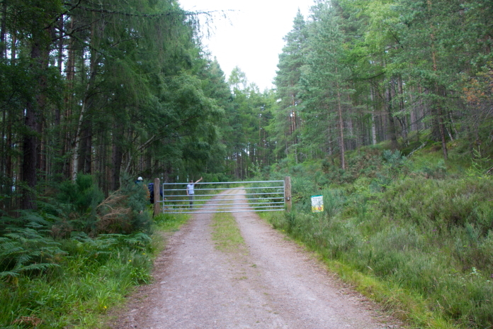
As well as having Stuart and Chloe for company on this walk we also rendevouzed with Chris, our 'amigo' from Inverness at the entrance to Paul's Hill Wind Farm, where we were starting our walk; or to be more accurate in this instance I should say 'starting our cycle'. We left the cars and set off into the hills , we were utilising the mountain bikes as it was a long walk in but it was along windfarm access roads for 99% of the distance. We did have to walk the first 300metres as the access road was very steep as they'd constructed it straight up the side of the hill as opposed to making zigzags.
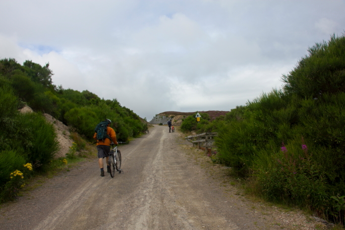
Pushing the bikes up the initially very steep access road into Paul's Hill Windfarm.
Once up the first incline the contour lines widened out considerably so we made good progress along to the most north westerley end of the windfarm; although I think I did delay progress a little as there were still a few uphilly bits where I had to get off and push; thanks to my dodgy knees and their dislike of cycling up hills.
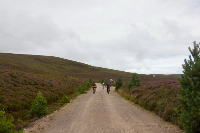
A pretty level stretch around the northen
slopes of Roy's Hill.
This area of Scotland must be one of the few places where the names of the hills can be correctly pronounced by the average 'sassenach', with names such as 'Lady's Hill', 'Roy's Hill', 'Paul's Hill' and 'Carn Kitty'. We did however cycle across one called 'Carn na Dhub-chlais' which would be a bit more challenging to pronounce accurately, which is the case with most Scottish Mountain names.
Don't believe me; then go to the link below and see how many you can get right , turn your speakers on and click the blue arrows to hear the correct pronounciation .
https://www.walkhighlands.co.uk/munros/pronunciation
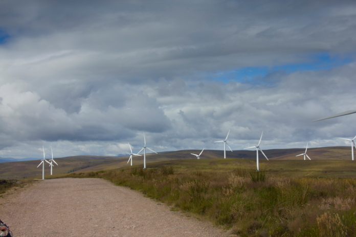
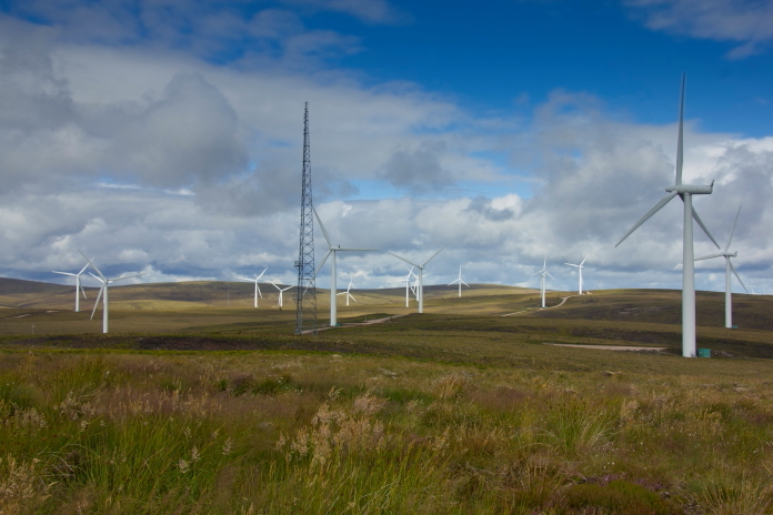
above and next 3 photos:-Making out way through Paul's Hill windfarm.
Once up to the north western end of the windfarm we split forces, with Struart and Chloe heading off in one direction to check out a scar spotted on sat imagrey and me and Chris heading off in the opposite direction to check out an object Chris had spotted.
Many people who go looking for crashsites have experienced the curse of the happy birthday balloon; well that is nothing compared to the dissapointment of realising the large wing shaped and alluminium coloured object you are approaching is in fact nothing more than a large tarpaulin. At least on this occasion I was searching a short distance away, so it was Chris who suffered that one!
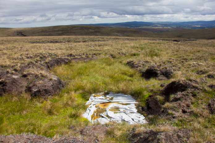
The object Chris spotted on satellite imagrey, a large tarpaulin.
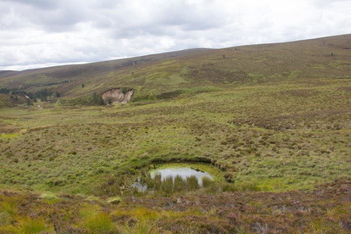
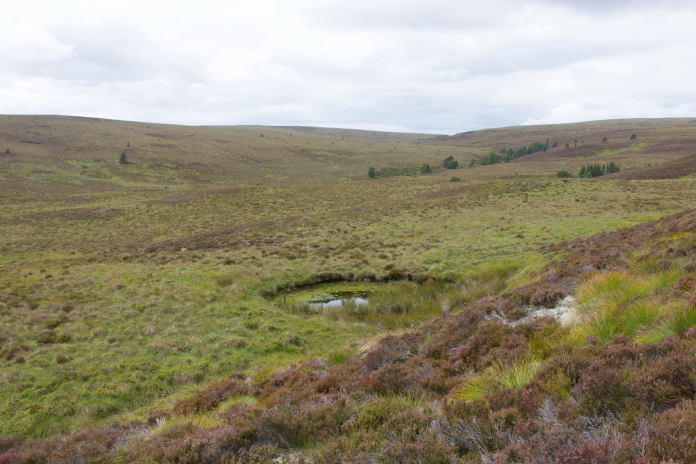
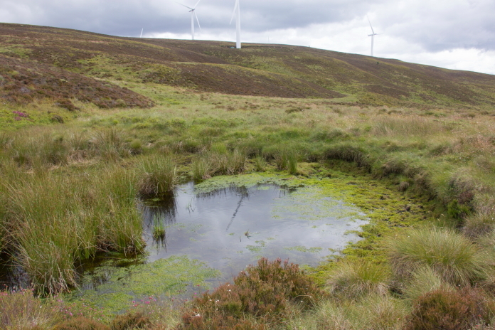
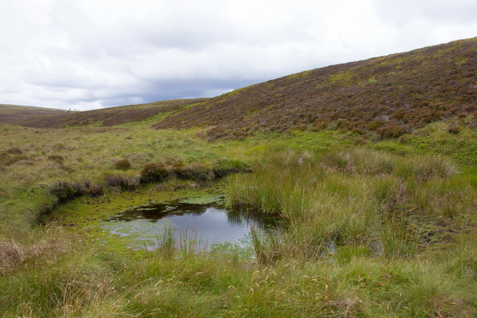
After meeting back up with Stuart and Chloe we commenced searching down each side of the higher reaches of Glen Gheallaidh where the Sabre was reported to have crashed. There was what appeared to be a large water filled crater that was very similar in apprearance to the crater at the crashsite of a Hawker Seahawk* we had visited during CC19b. This crater however did not contain the slightest sliver of alluminium, nor was there any in the vicinity, and as well as being marked on the O/S map it was also visible on pre crash aerial photos. So although it looked the part it was highley unlikely the crater was created by an F86 Sabre diving into it so I couldn't even put this one on my probable list; This was confirmed a year or so later when Chris and Stuart revisited Paul's Hill Windfarm with a relative of the Sabre Pilot and found some fragments in another crater further up the Glen.
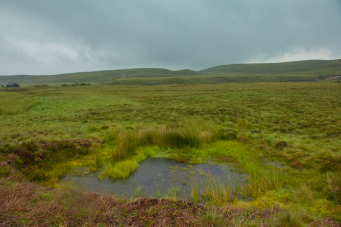
Above is a photo of the crater created by Hawker Sea Hawk WM986 diving into moorland and the next 4 photos are of the crater found in Glen Gheallaidh, now confirmed as definately not where the Sabre crashed.
Our original plan after searching for XB610 had been to go and visit the site of a Gloster Meteor crash on a Hill called Sron Garbh, that would have meant more cycling and we'd had out fill of that activity for the day. Instead we opted for a much shorter walk to visit another Whitley site that lay on the lower slopes of Ben Aigen.
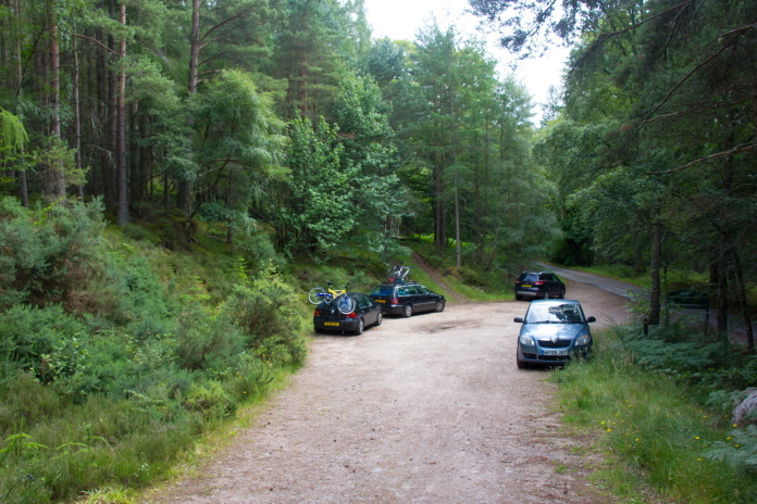
Above and below:-The start of this walk reminded me of the walk I did to visit a Miles Master on Tipperweir Hill in Angus**.
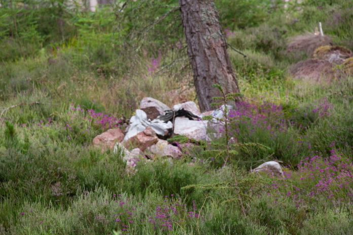
From where we we parked the cars it was a short walk along a forest track which was part of 'The Speyside Way', we then had to head into the trees to find a small cairn with some pieces of Whitley placed in it. This proved no challenge to find as Chris had already visited it fairly recently so led us straight to it.
Into the trees to see what remained of
Whitley P5006.
above and below:-The cairn containing a few pieces of Whitley.
After having a root around in the trees for any other pieces of Whitley we found nothing more than what had been collected on the cairn. We took a more direct route back down to the carpark following a nearby gully down the hillside, as we had read reports that there were some bits lying in there.
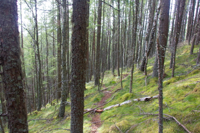
Heading down into the gully on the way back to the cars. The gully was quite deep and overgrown so even if those bits were still there to be found, we didn't find them. Not much to see at this one but still a nice little walk and it mean't day 2 of CC20 didn't end as a complete ftf.
*--Sea Hawk. **--Tipperweir Hill