
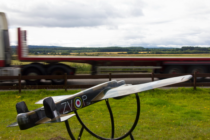
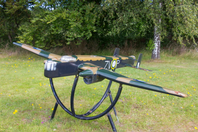
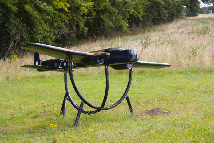
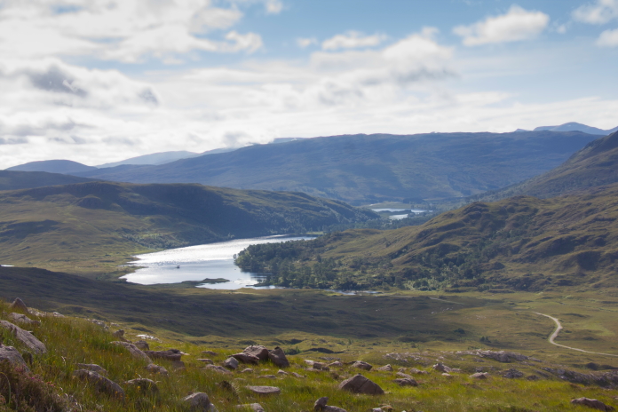
West Coast 100.
Avro Lancaster TX264 on Beinne Eighe.
(Distance covered =
10.6 mile/Ascent =+1264m)
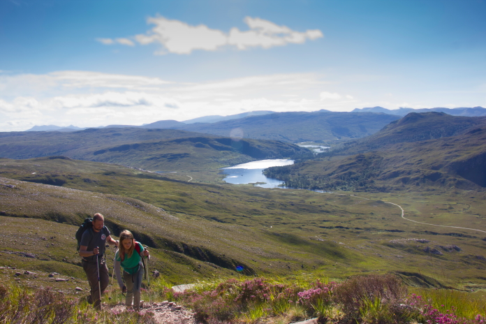
Sepecat Jaguar at Grudie.
(Distance covered =
4.8 mile/Ascent =+317m)
After spending 4 days walking in the hills to the east of Inverness we still had a few crashsites on our CC20 itinerary to visit in that area, but as the weather forecast was looking promising for Ross and Cromarty we decided to head over there early.
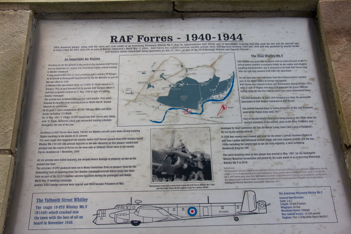
As Chris was joining us we rendevouzed at his house in Forres on the morning of day 5 and set off in two cars for the west coast. On the way we made a couple of stops; the first being to have a quick look at an elaborate memorial that has been built next to the A96 overlooking the site of what used to be the base of 19 OTU at RAF Forres. A lot of the aircraft wrecks in the surrounding hills belonged to 19 OTU and some may have started their fateful last flight from this airfield.
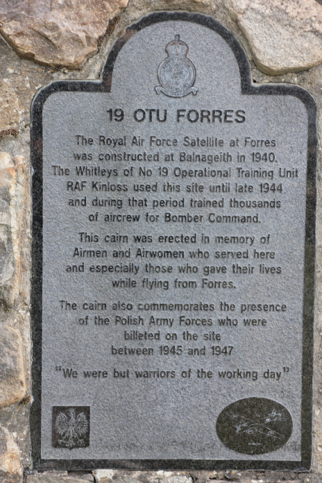
Above and next 4 photos:- A memorial beside the busy A96.
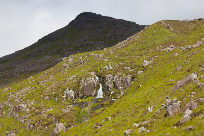
The second stop was to have a search for any remains from a more recent crash of an RAF Sepecat Jaguar in the vicinity of Grudie at the western end of Loch Luichart. We didn't have a grid reference for this one but my 'research team' comprising of Stuart and Chris had figured out a likely search area and had also used satellite imagery to spot a promising looking scar on the hillside.
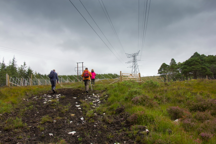
Walking up the very lower slopes of Meallan
a Mhuthaidh Beag and about to eliminate the' promising' looking scar from our enquiries.
After we realised the scar was nothing more than an area of exposed rock I continued to search the lower slopes of Meallan a Mhuthaidh Beag to the south of Carn Glac nam Fiadh whilst Stuart, Chris and Chloe headed over to the other side of the River Grudie to search a much more likely area.
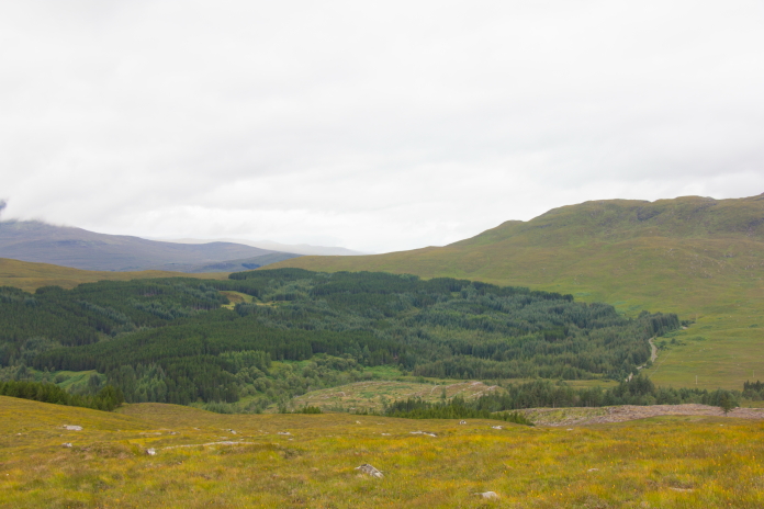
Woods on the other side of the River Grudie.
From a description of the crash I would say it flew up the Glen from left to right and hit a pronounced ridge in the centre of the woods shown in the photo above, scattering bits through the woods and onto the open land to the right; I must re-iterate however that that theory is total speculation on my behalf.

After failing to find any trace whatsoever of this crashsite we jumped back into the cars and completed our journey over to the west coast, where we were equally unsuccessful in being able to find somewhere to camp for the night.
We eventually had to settle on pitching our tents adjacent to a layby next to the A896 in Glen Torridon.
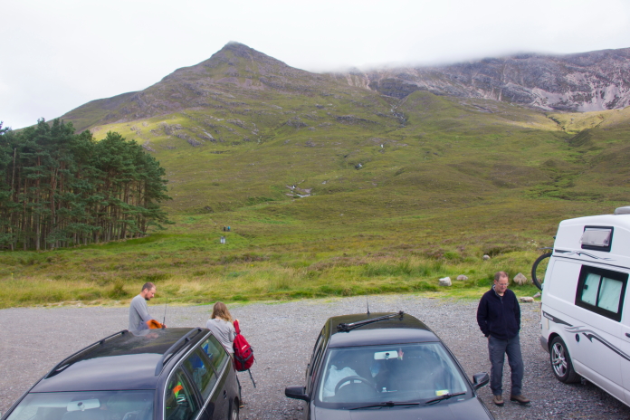
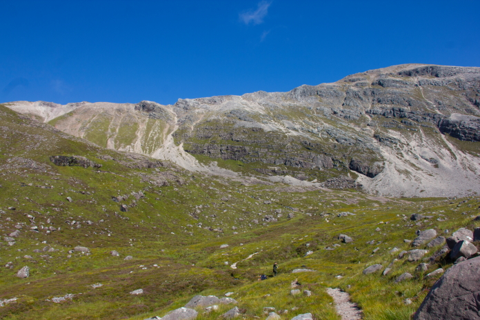
Parked up and ready to tackle Beinne Eighe, this carpark like all the others in the area was chokka block with campervans the previous night. Our original plan for day 6 had been to check out remains of an American B26 Marauder on the top of Ben na Feusaige in Glen Carron then nip over the other side of the Glen to look for the site of an AW Whitley crash. Because we had ended up camping in Glen Torridon instead we changed our plans and decided to tackle Beinn Eighe first.
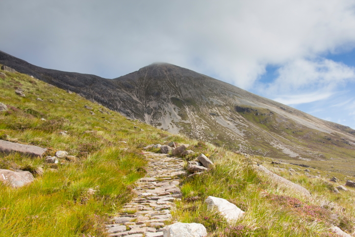
The start of the path up that leads up to the trig pillar on top of Spidean Coire nan Clach. I could quite happily sleep undisturbed on a washing line with the Royal Scots Dragoons Pipeband marching up and down beneath it playing Scotland the Brave all night, unfortunately Chris did not seem to be in possession of this ability so spent most of the night awake, so consequently did not feel to well the following morning. He rather wisely decided to not join us on our expedition so the Cavalry was called upon in the shape of Shona, Chris's wife.
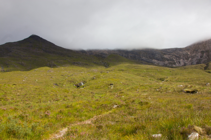
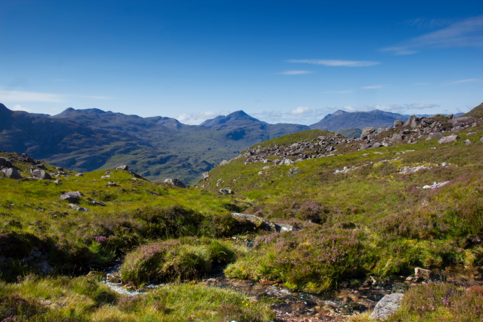
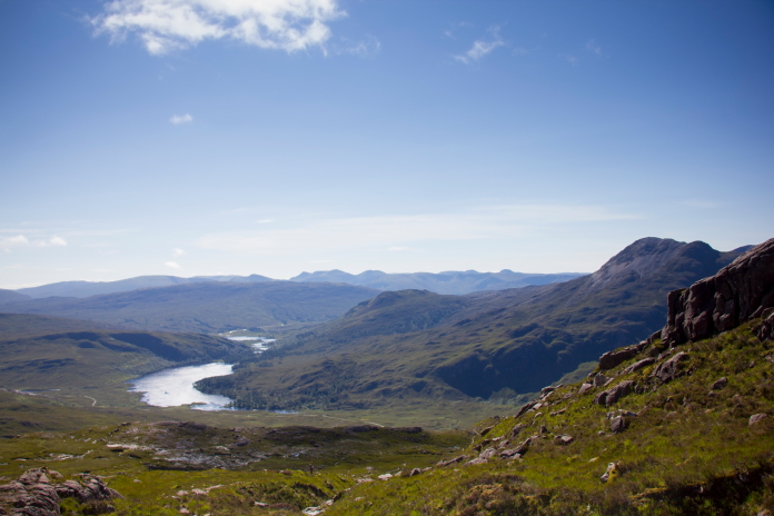
 above and below:- A couple of views up Glen Torridon taken from
near the start of our ascent of Beinn Eighe.
above and below:- A couple of views up Glen Torridon taken from
near the start of our ascent of Beinn Eighe.
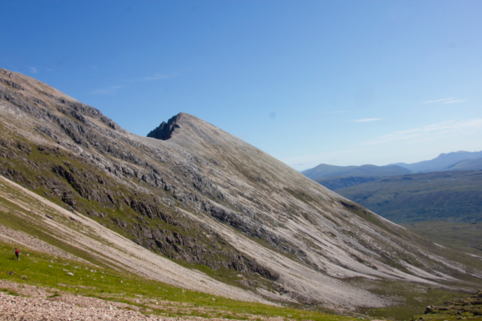
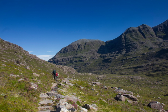
After saying our goodbyes we abandoned Chris in the carpark to wait for his lift home to arrive and set off up the path that would take us up to the top of Spidean Coire nan Clach. Right from the start the views on this walk were fantastic and as we were to find out they just got better and better as the day went on.
 above and below:-Views down Glen Torridon towards Loch Clair with
Loch Coulin just visible around the corner.
above and below:-Views down Glen Torridon towards Loch Clair with
Loch Coulin just visible around the corner.
 The first mile or so of our walk was along a lovely little path which
meandered it's way up and around
Stuc Coire an Laoigh into Coire an Laoigh,
quite often with the Allt Coire an Laoigh burn as company. Unlike the
area we walked on the second day of CC20* the names of the Peaks,
coires and burns in Torridon showed no mercy towards the correct
pronounciation by the uneducated.
The first mile or so of our walk was along a lovely little path which
meandered it's way up and around
Stuc Coire an Laoigh into Coire an Laoigh,
quite often with the Allt Coire an Laoigh burn as company. Unlike the
area we walked on the second day of CC20* the names of the Peaks,
coires and burns in Torridon showed no mercy towards the correct
pronounciation by the uneducated.
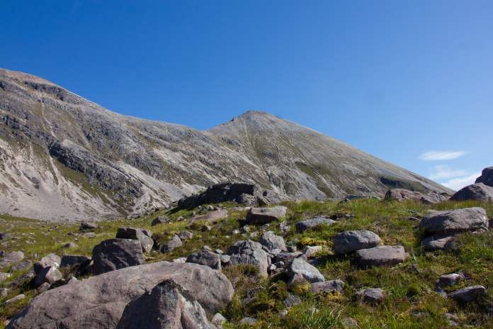
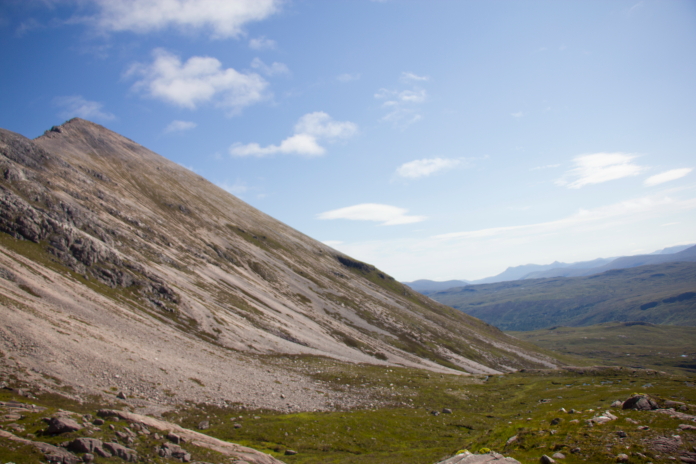
The nice little path, the peak in the distance is Sgurr nan Fhir Dhuibhe.
As well as the views getting better and better so did the weather.
Stuc Coire an Laoigh, first peak of the day, although we kind of went around it as opposed to over it.
 above and below:- Once across this
plateau the path turned west into Coire an Laoigh.
above and below:- Once across this
plateau the path turned west into Coire an Laoigh.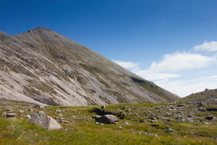
 above and next two photos:-As well as
providing a soundtrack befitting the scenery, the
Allt Coire an Laoigh burn was also utilised a
few times to cool off and refill water bottles.
above and next two photos:-As well as
providing a soundtrack befitting the scenery, the
Allt Coire an Laoigh burn was also utilised a
few times to cool off and refill water bottles.

 above and below:-Entering Coire nan Laoigh.
 Once into Coire nan Laoigh the summit peak of Spidean Coire nan Clach
could be seen up ahead as well as what looked like a near vertical
climb out of the coire to gain a ridge between
Stuc Coire an Laoigh and Spidean Coire nan
Clach.
Once into Coire nan Laoigh the summit peak of Spidean Coire nan Clach
could be seen up ahead as well as what looked like a near vertical
climb out of the coire to gain a ridge between
Stuc Coire an Laoigh and Spidean Coire nan
Clach.
 above and next two photos:- Views from Coire nan Laoigh.
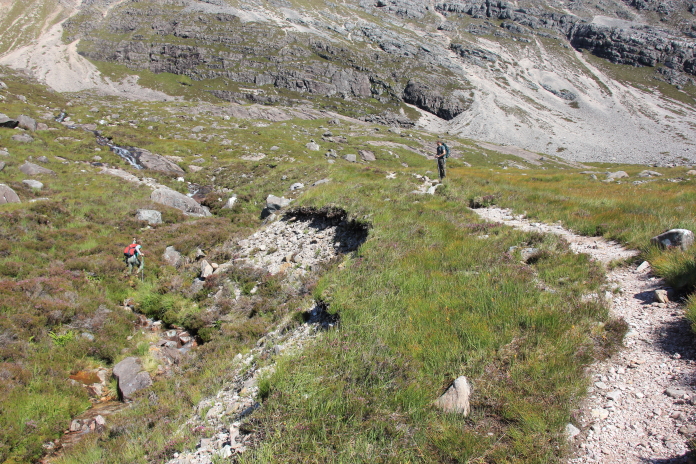
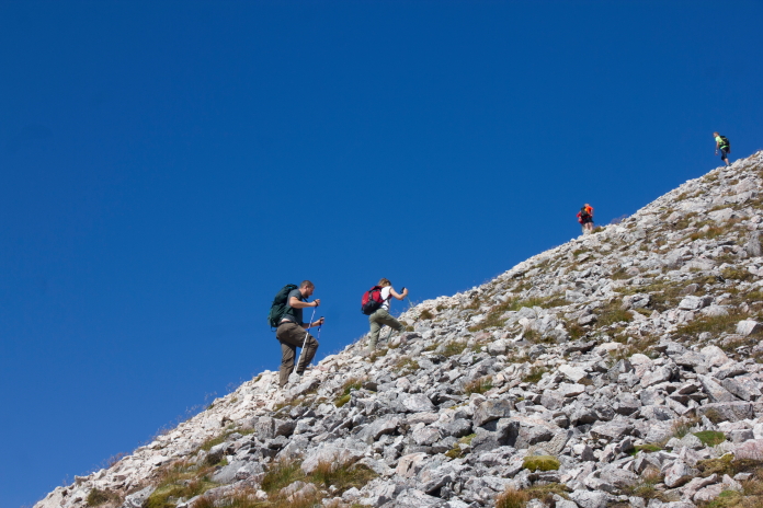
 Luckily our attention was diverted from the upcoming rather steep
climb by a group of 4 Deer grazing in the Coire. These Deer were not
at all bothered by our presence so we were able to get up quite close
to them; they were probably used to countless walkers passing them on
their way to the top Of Bienn Eighe.
Luckily our attention was diverted from the upcoming rather steep
climb by a group of 4 Deer grazing in the Coire. These Deer were not
at all bothered by our presence so we were able to get up quite close
to them; they were probably used to countless walkers passing them on
their way to the top Of Bienn Eighe.
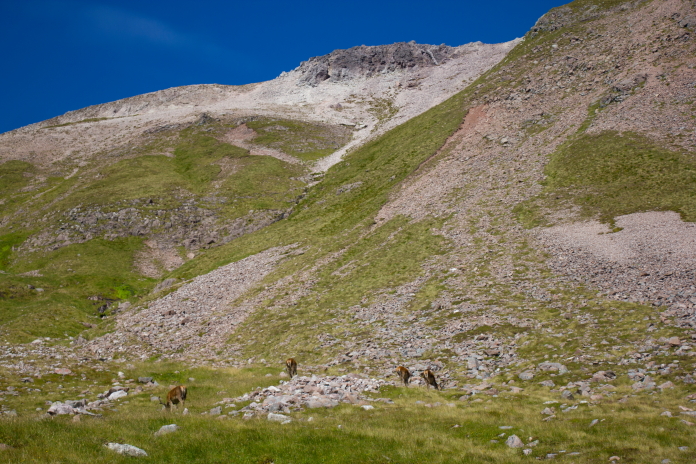 above and below:-Deer in Coire nan Laoigh.
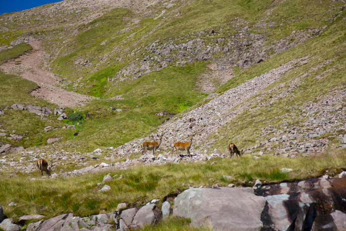
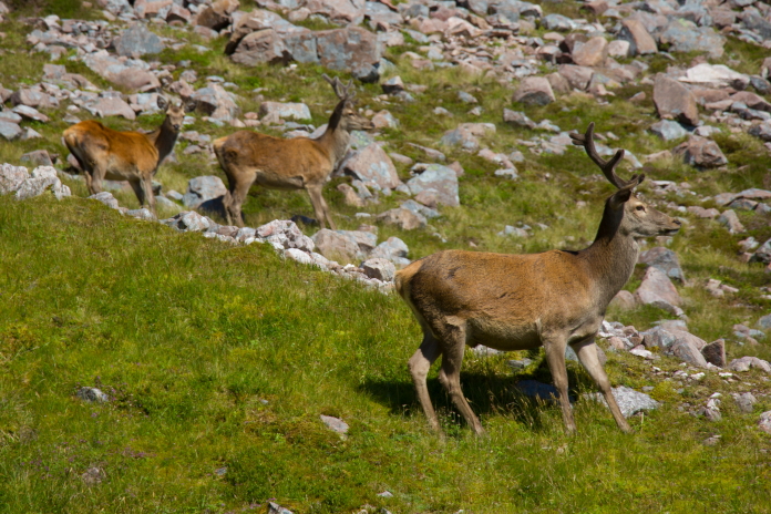
The Deer were more bothered by the group following us up the Coire.
Another view down Coire nan Laoigh towards Sgurr nan Fhir Dhub, this time with a Deer in it!
Above and next two photos:-The group following us went a slightly different route than us to bag Stuc Coire an Laoigh.
 This would be my fourth visit to the crashsite of Avro Lancaster TX264
on Beinn Eighe. On my first visit I had checked out all the pieces of
wreckage in the boulders below the Triple Buttress then scrambled up
Fuselage Gully, intent on reaching the impact point and wreckage that
lay above the Triple Buttress on the top of Coinneach Mhor. I managed
to reach the bealach between Coinneach Mhor and Sail Mhor where the
weather dictated that I should go no further, so I dropped straight
over the other side of the ridge to regain the path I had walked in
along, between Beinne Eighe and Liathach, which was now quite a way
below. In hindsight that was not the best way to get back down off the
mountain.
This would be my fourth visit to the crashsite of Avro Lancaster TX264
on Beinn Eighe. On my first visit I had checked out all the pieces of
wreckage in the boulders below the Triple Buttress then scrambled up
Fuselage Gully, intent on reaching the impact point and wreckage that
lay above the Triple Buttress on the top of Coinneach Mhor. I managed
to reach the bealach between Coinneach Mhor and Sail Mhor where the
weather dictated that I should go no further, so I dropped straight
over the other side of the ridge to regain the path I had walked in
along, between Beinne Eighe and Liathach, which was now quite a way
below. In hindsight that was not the best way to get back down off the
mountain.
Seems I liked this view, at least each one is from a little higher up then the last! On my second visit I had my Brother in Law as company, on that occasion we had a look at the wreckage below the Triple Buttress again but didn't even enter Fuselage Gully, as it was for want of a better word 'pissing down'. My third visit was more successful as the weather was more accommodating so I made it up Fuselage Gully again but this time I also made it to the wreckage at the impact point. My plan had then been to enjoy the views as I walked along the summit plateau of Coinneach Mhor to descend down the Red Chute, which dropped down to Loch Coire Mhic Fhearchair from the bealach between Coinneach Mhor and Rhuad-Stac Mhor. Unfortunately however the weather had other ideas and the only view I got to enjoy was of the inside of a very wet and windy cloud!
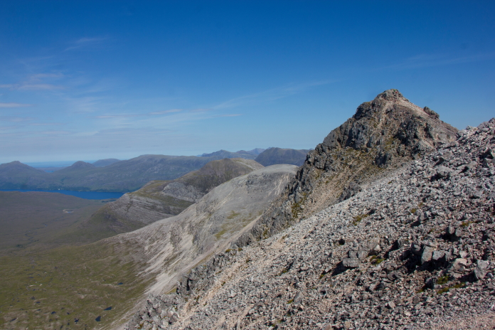
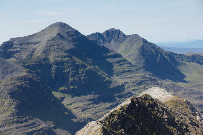
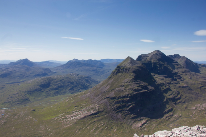
Canny view of Liathach from the ridge below Spidean Coire nan Clach. As I'd already seen all of the Lancaster wreckage on my previous 3 visits my objective for the day was to simply enjoy the views from the top of Beinn Eighe, so by the time we reached the trig pillar on the top of Spidean Choire nan Clach I would say it was 'job done' for me.
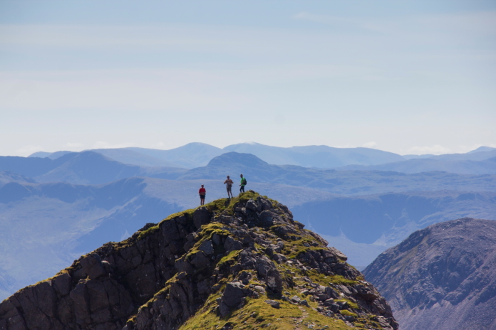
Nearing the summit of Spidean Choire nan Clach; despite their diversion the group who were following us beat us to it.
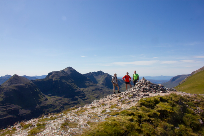
Above and below:-Canny view off to the west.
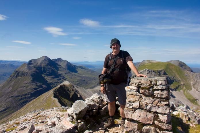
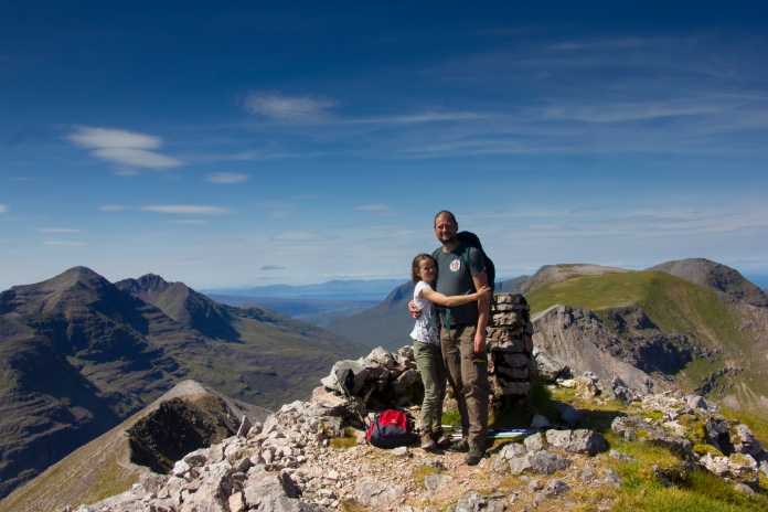 Above and below:-Mugshots on the summit of Spidean Coire nan
Clach. At 977m this is the 3rd highest peak on the Beinn Eighe range,
after Ruadh-Stac Mhor at 1010m and Sail Mhor at 980m.
Above and below:-Mugshots on the summit of Spidean Coire nan
Clach. At 977m this is the 3rd highest peak on the Beinn Eighe range,
after Ruadh-Stac Mhor at 1010m and Sail Mhor at 980m.
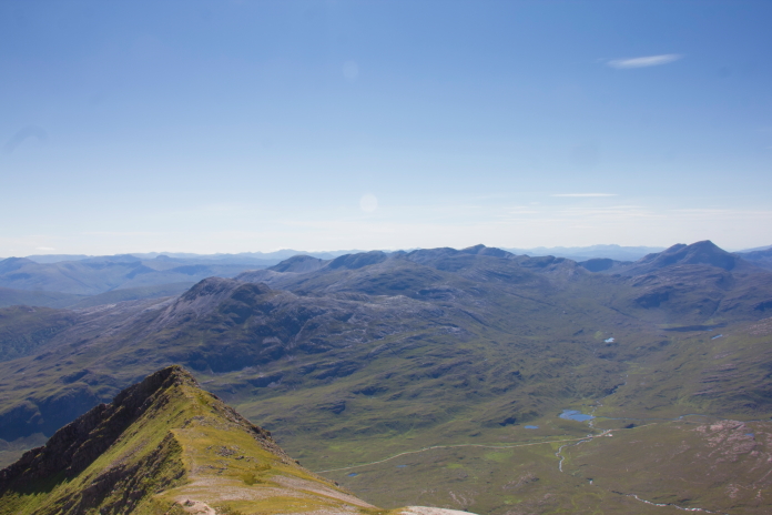
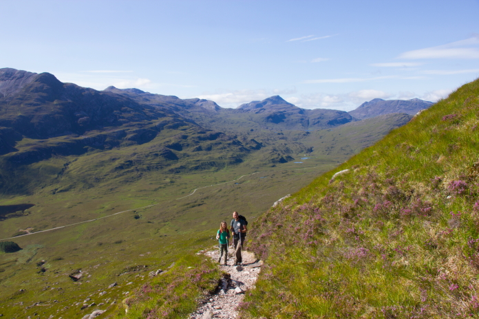
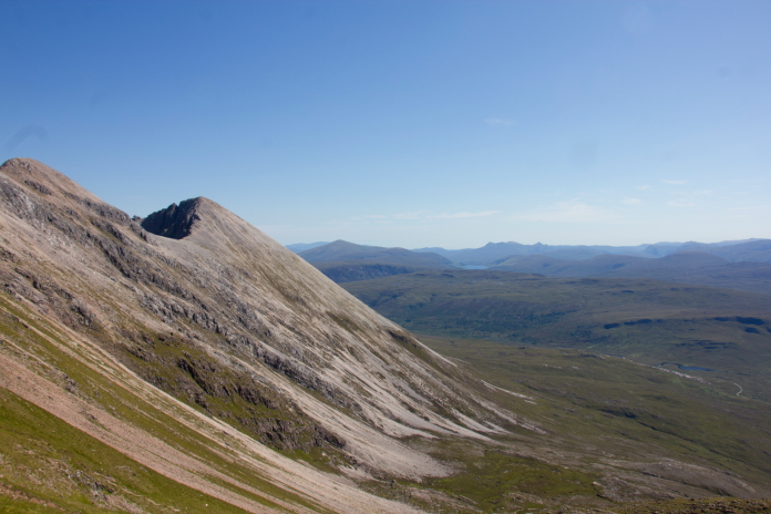
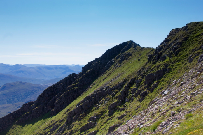
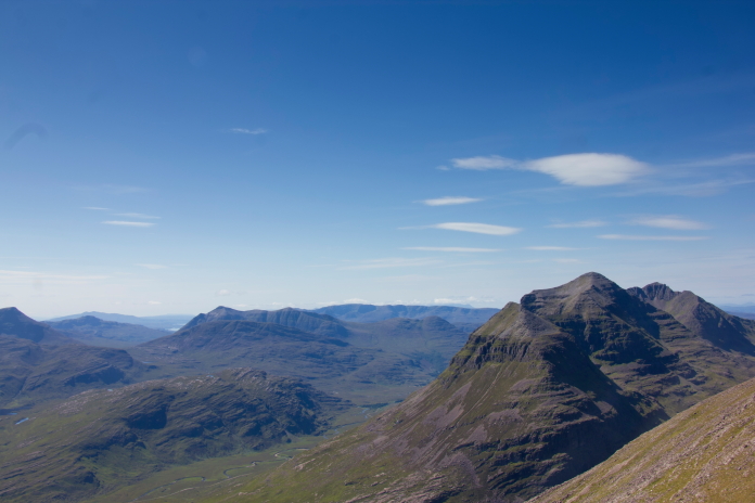
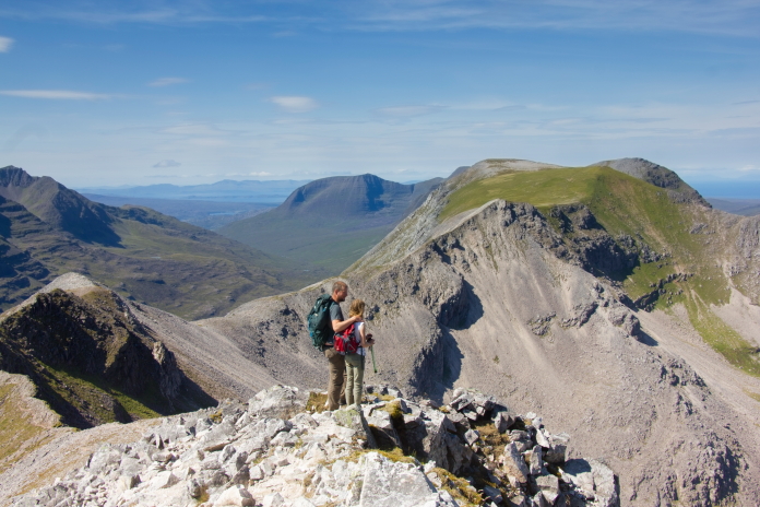
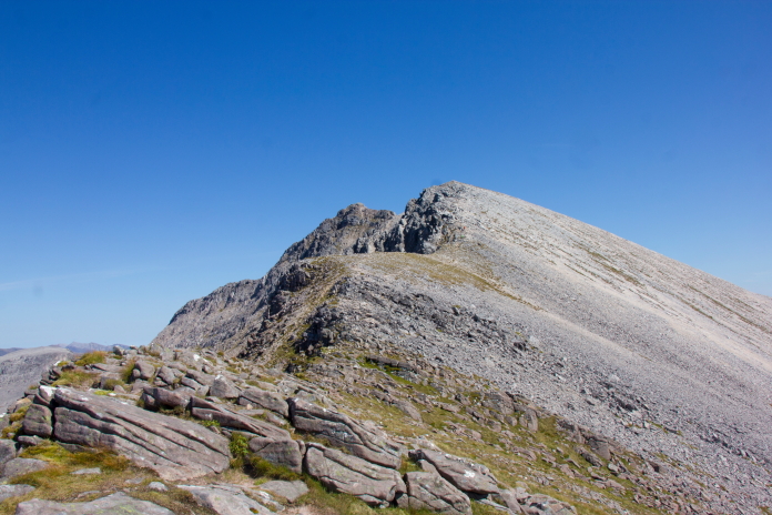
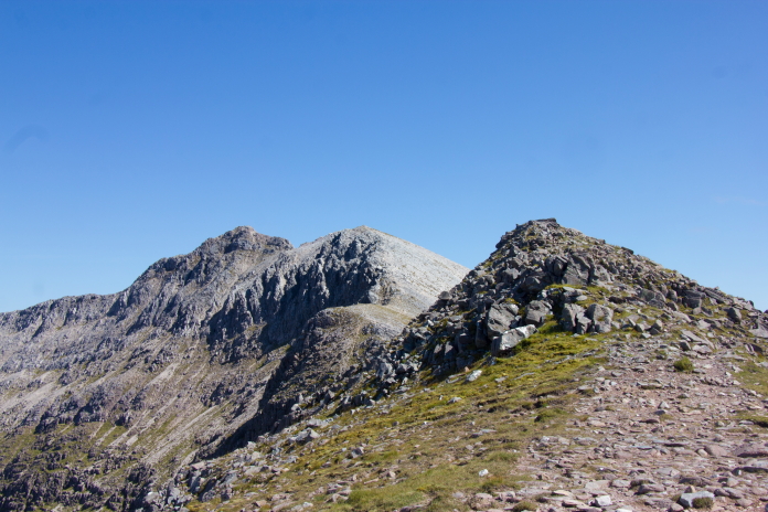
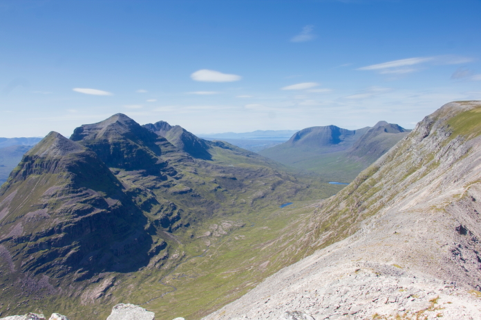
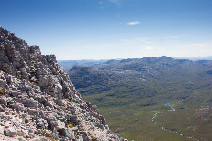
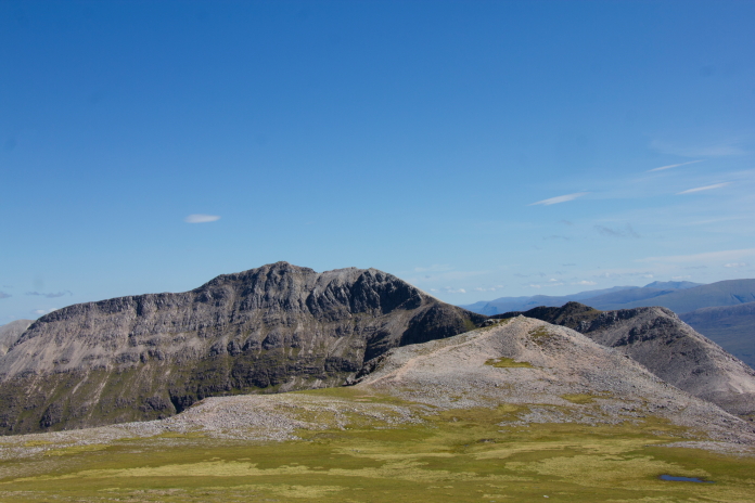
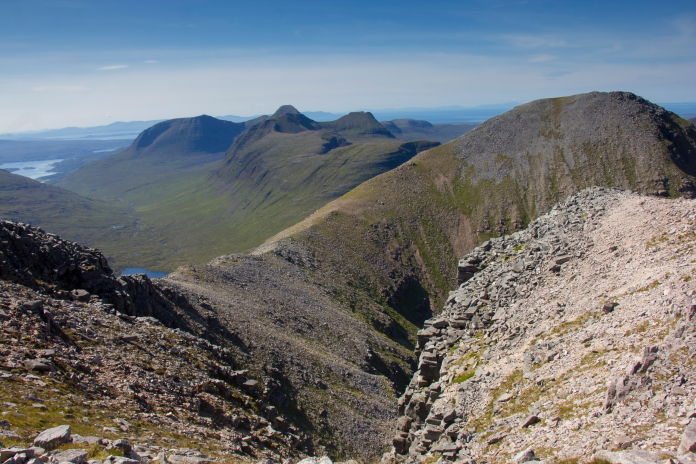
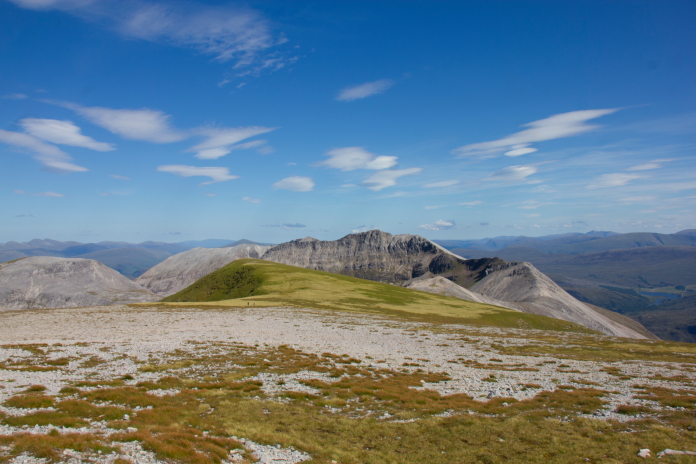
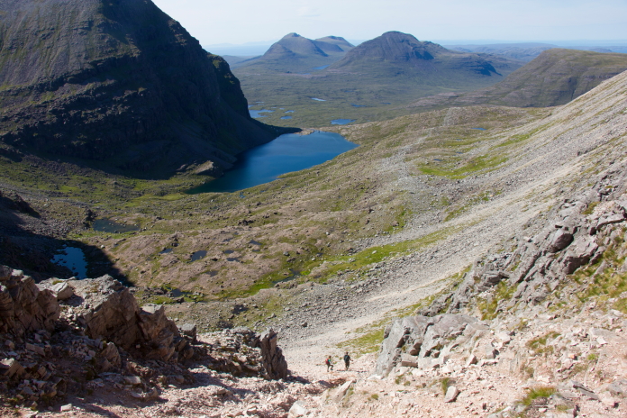
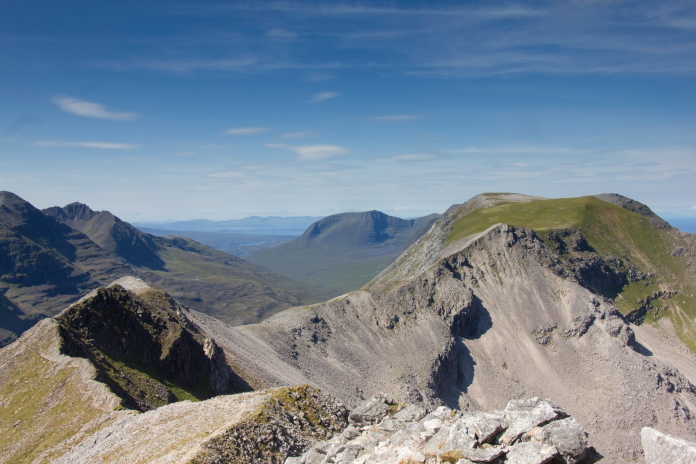
View south from the summit of Spidean Coire nan Clach. Although I had achieved my objective for the day,(and some!) Stuart had not seen the impact point and wreckage of the Lancaster that lay above the Triple Buttress, so another visit was still needed. This however meant a bit of an epic ridge walk from Spidean Coire nan Clach along to Coinneach Mhor, but with clear blue skies and sunshine this proved to be an almost unbeatable "Can't get better than this" moment.
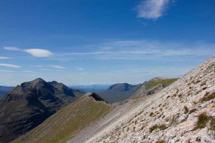
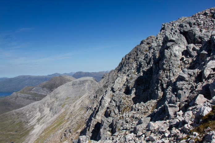
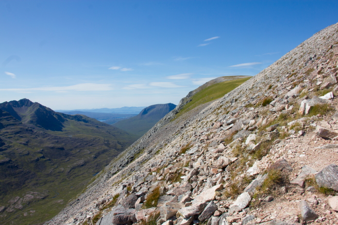
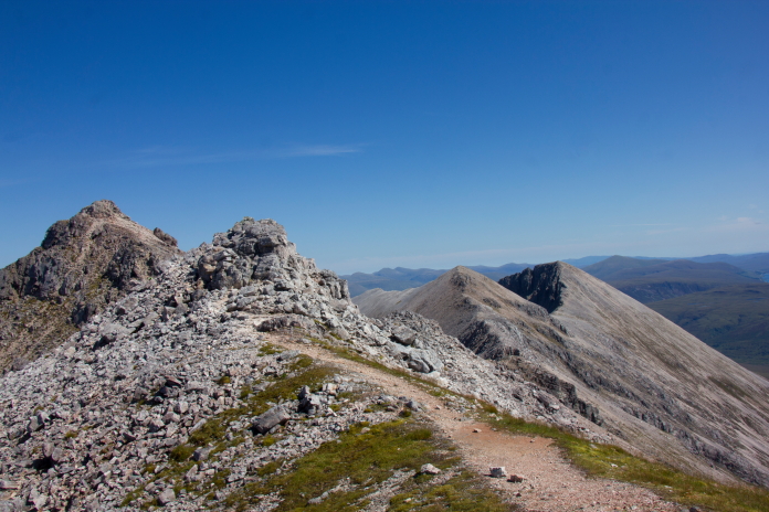 above and next 13 photos:-One spectacular view after another as we
made our way along the ridges towards Coinneach Mhor.
above and next 13 photos:-One spectacular view after another as we
made our way along the ridges towards Coinneach Mhor.
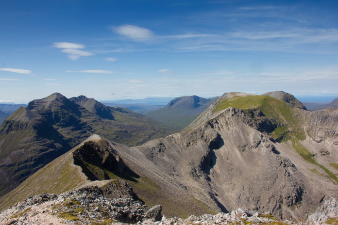
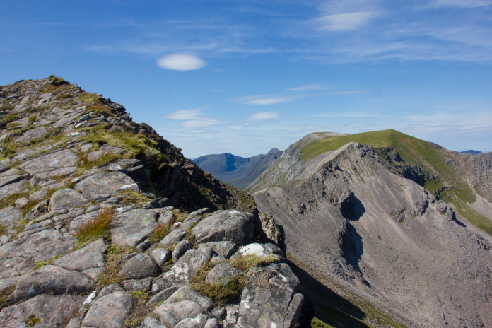
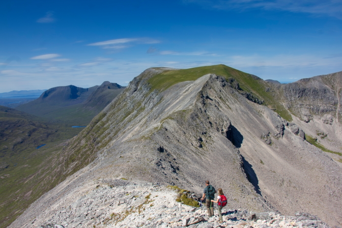
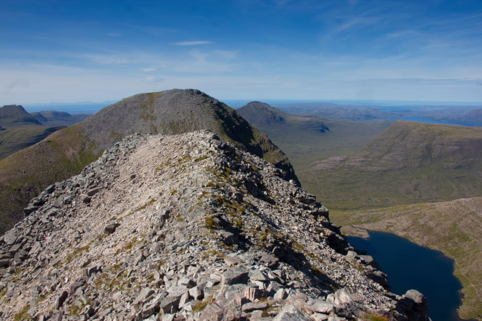
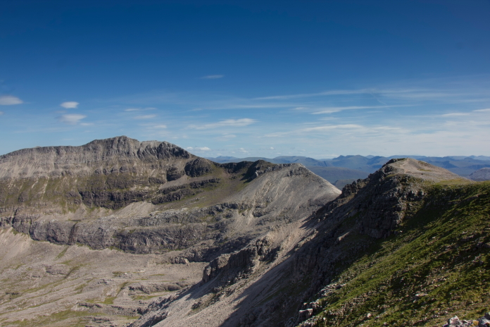
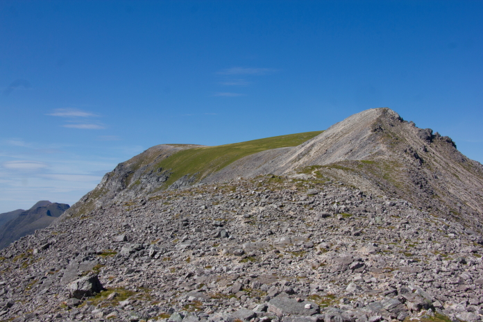 One last peak to negotiate then we were on the grassy summit
plateau of Coinneach Mhor.
One last peak to negotiate then we were on the grassy summit
plateau of Coinneach Mhor.
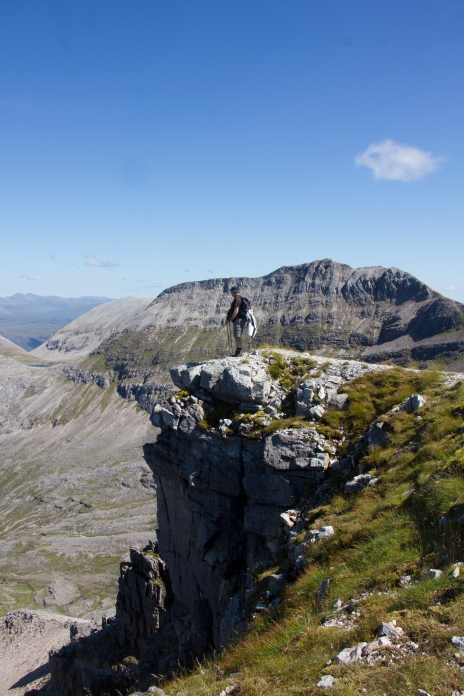
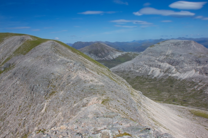
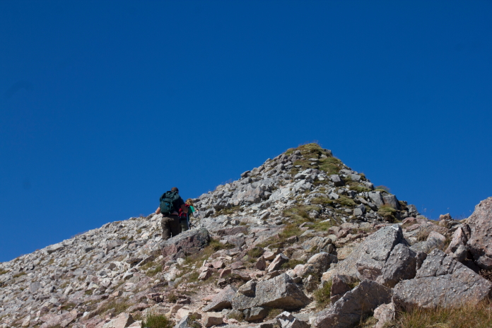 above and below:-negotiating the unnamed peak at the eastern end
of Coinneach Mhor.
above and below:-negotiating the unnamed peak at the eastern end
of Coinneach Mhor.
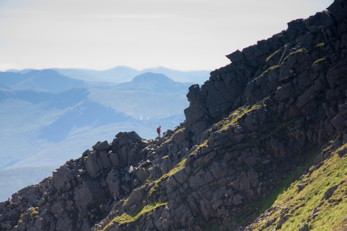
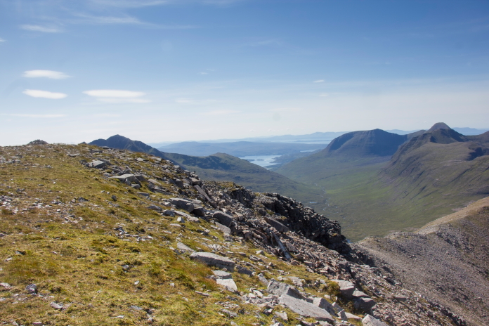
Me, enjoying yet another spectacular view. As we reached the eastern end of the Coinneach Mhor summit plateau we were passed yet again by the group who had followed us up Choire an Laoigh, their objective of the day had been to visit every peak on the Beinn Eighe range, so just after passing us here they went off to Ruadh-stac Mhor.
These three covered the ground a lot quicker than us.
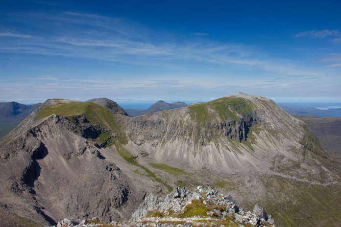
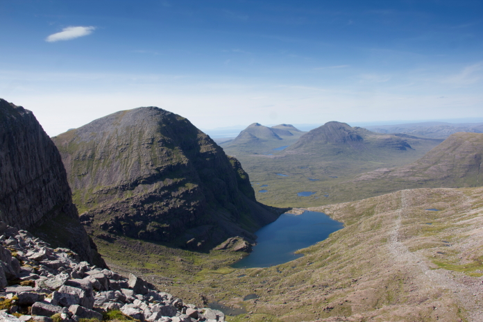
 above and below:-View east from both ends of Coinneach Mhor.
Arriving at the crashsite of Avro Lancaster TX264.
 above and below:-The area where the Lancaster collided with the
Mountain.
above and below:-The area where the Lancaster collided with the
Mountain.
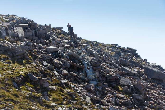
Stuart and Chloe having a look at the wreckage. More wreckage photos.
At the very top of fuselage gully.
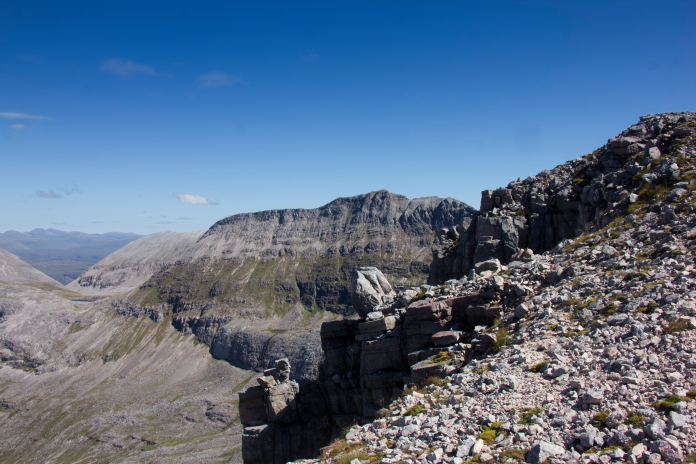
 Above and below:-Yet more fantastic views from the top of the
Triple Buttress.
Above and below:-Yet more fantastic views from the top of the
Triple Buttress.
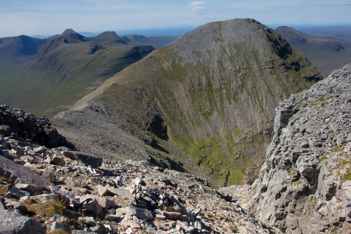
 The summit Plateau of Coinneach Mhor.
View back across to Spidean Choire an Clach.
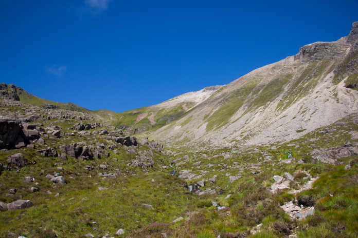
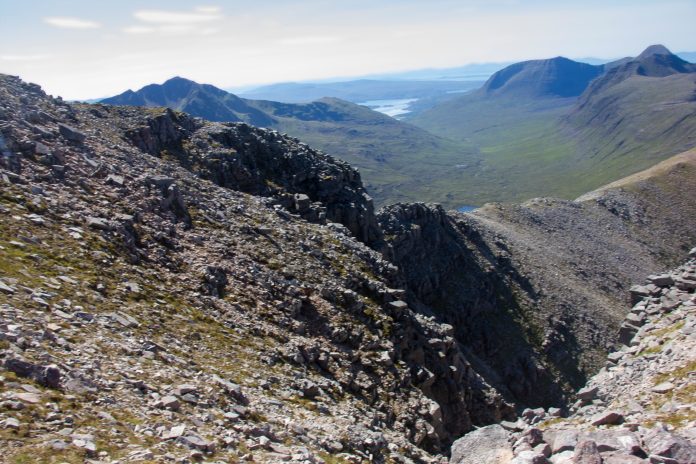
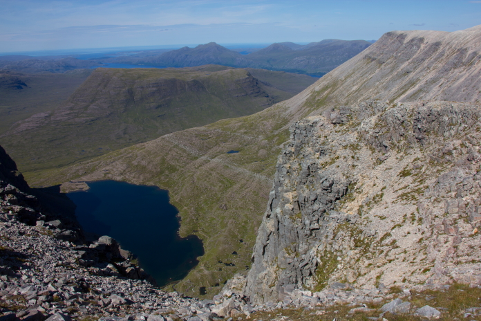
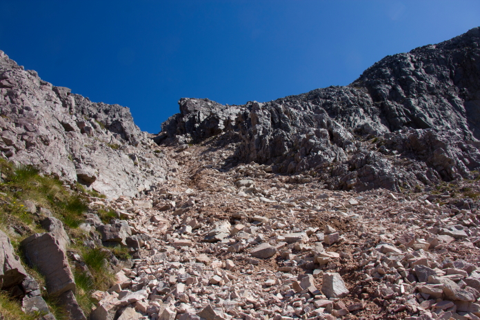
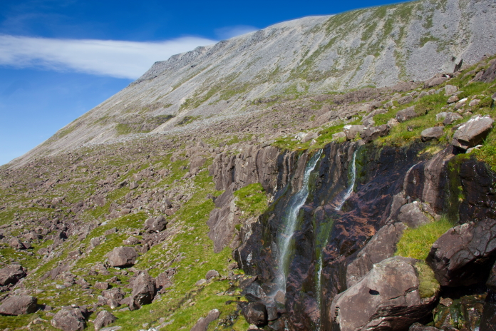
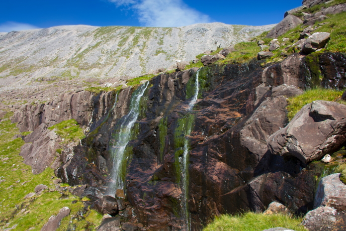
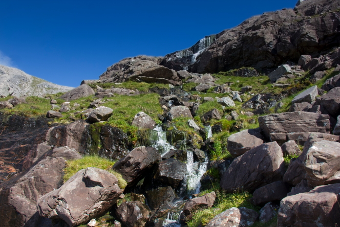
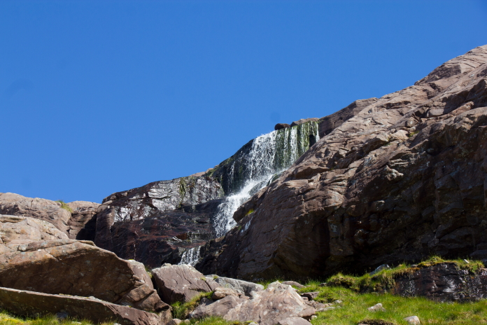
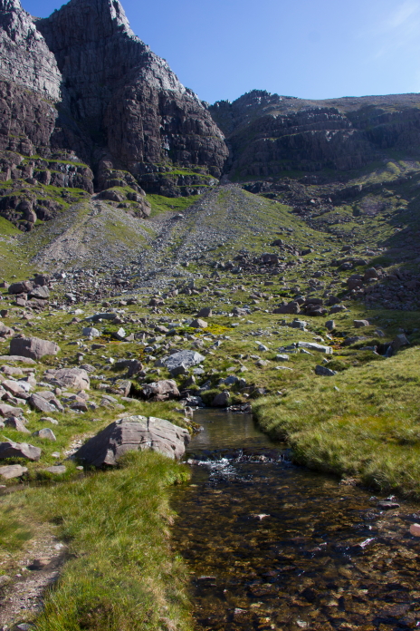
View north to Ruadh-Stac Mor from the top of the Red Chute. The Red Chute is a bit knarly, it is steep and full of loose gravel and unstable rocks but we decided it was the easiest option for our descent. Once at the bottom of the Red Chute it was pleasant walking down a few terraces to reach Loch Choire Mhic Fhearchair with the odd waterfall here and there as a distraction.
 above and next 7 photos:-Descending into Choire Mhic Fhearchair
via the Red Chute.
above and next 7 photos:-Descending into Choire Mhic Fhearchair
via the Red Chute.
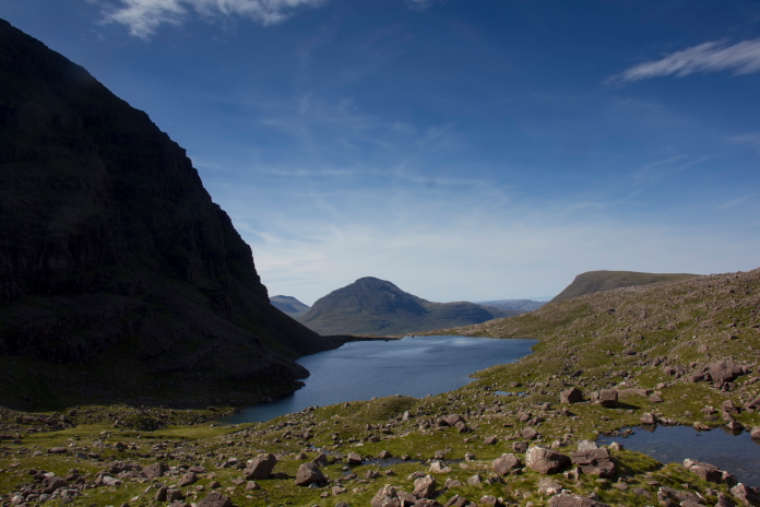
Loch Choire Mhic Fhearchair.
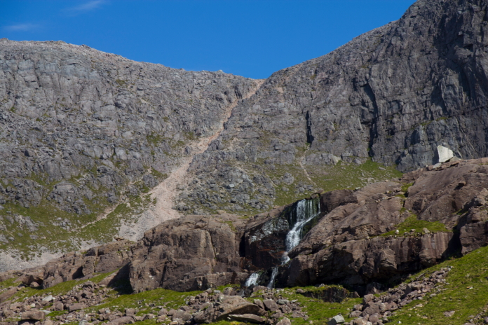
The Red Chute, it was a lot worse coming down that than I remembered.

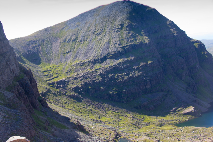
One of the Lancaster RR Merlins Engines.
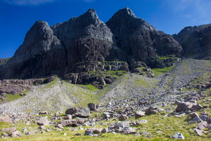
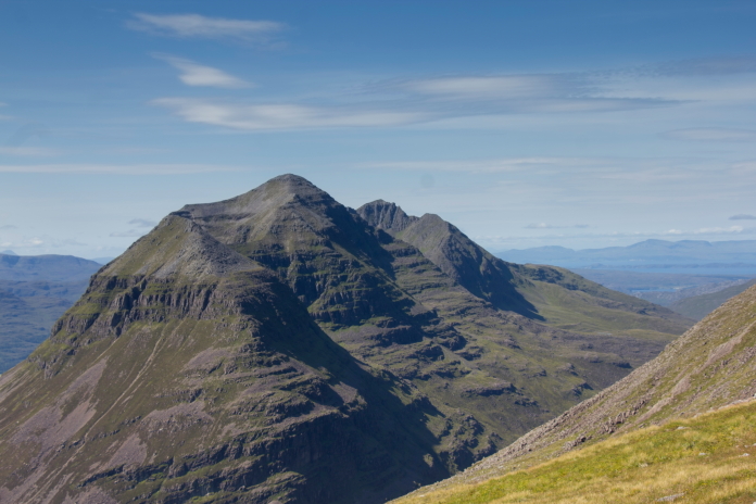
The Triple Buttress, the Lancaster crashed on the other side of the right Buttress.
There's hundreds of pieces of Lancaster wreckage scattered in these boulders.
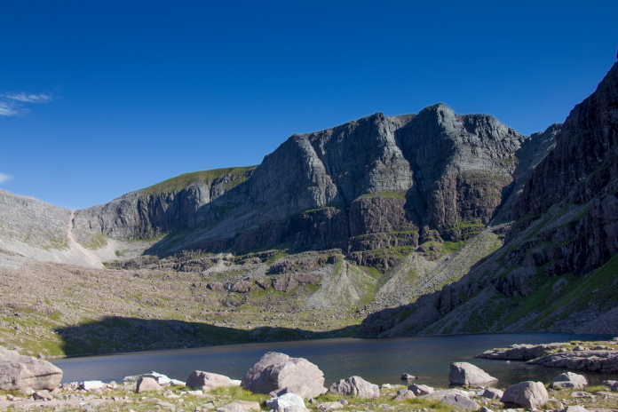
Standard photo of the Triple Buttress taken from the outflow of Loch Choire Mhic Fhearchair. Once we'd endured the Red Chute the only thing left to tackle was the long trudge around the back of Sail Mhor and down Coire Dhub Mor along the well constructed tourist path that Stuart dubbed "The path that just keeps on giving".
On the path that keeps on giving!.
 *--Second day with pronouncable names.